Another 3 night camping trip to the Jemez, setting up the R-Pod in the Jemez Falls Campground. This is truly a great time of year to go camping and hiking in the Jemez Mountains. We’re fortunate that we can go during the week (weekends can be crowded); there are many good campsites to choose from whether with camper or tent camping. Days are warm, nights cool; we enjoyed 80s daytime, around 50 at night. This year the monsoon season seems to be lasting longer so we did have some rain in the afternoon and evening.
The Drive In
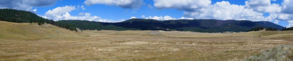
For our first day’s hiking we returned to Valles Caldera National Preserve – destination: the end of the road in northwest corner and a hike into the upper section of San Antonio Cañon. After getting our pass/permit at the Visitors Center, we drove the 17 miles through this beautiful scenery – the 4 mile view across Valle Grande, the mountains all around, the drive through Valle Jaramillo and into the wide open Valle de San Antonio. This itself is worth our visit every time we go. A gate blocks further travel onto a two-track, where we parked to begin the hike.
The Hike
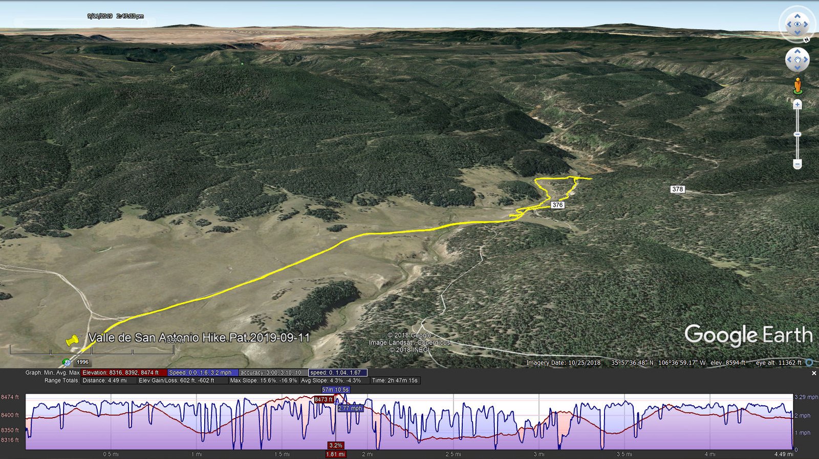
Valle de San Antonio Hike.Pat.2019-09-11
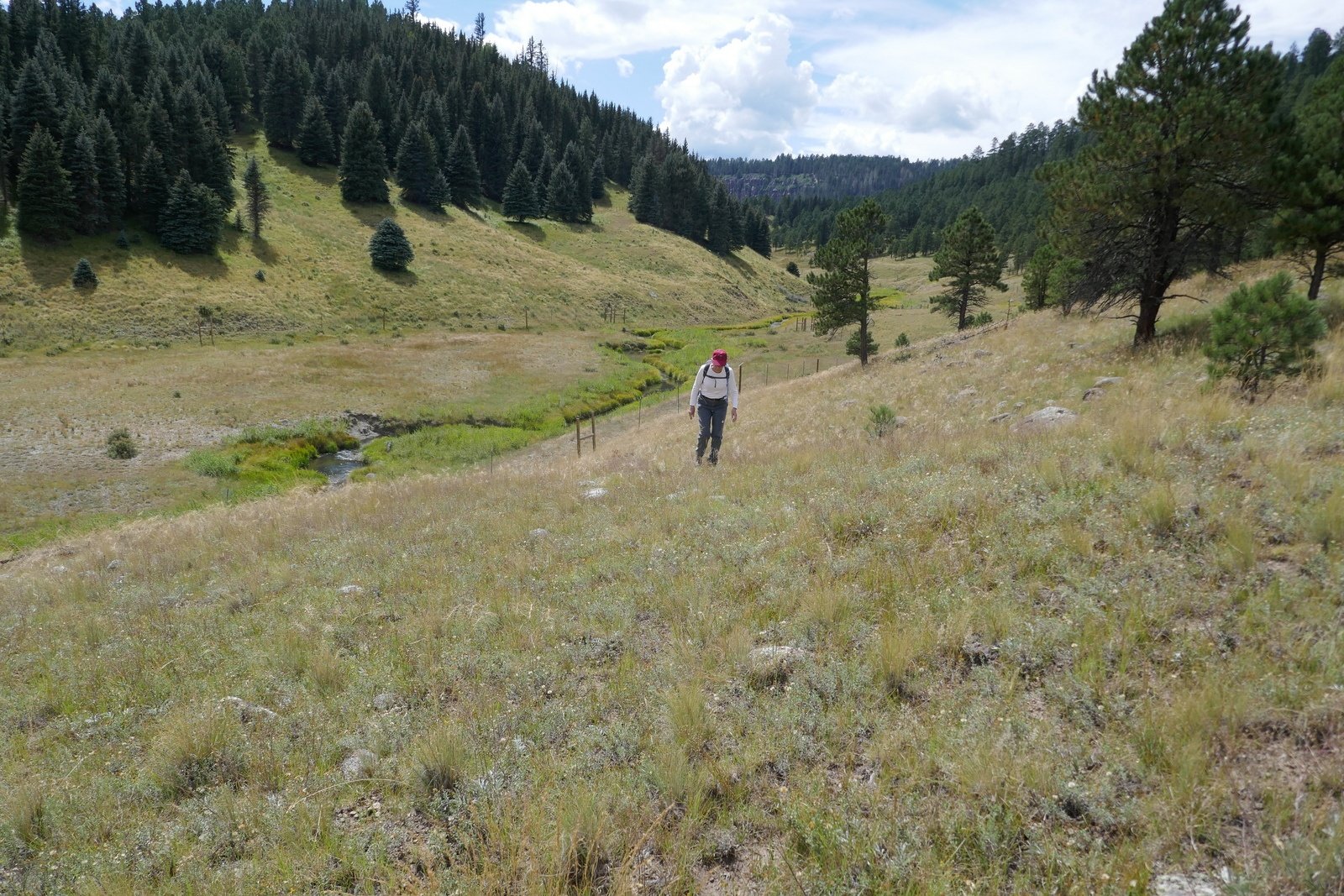
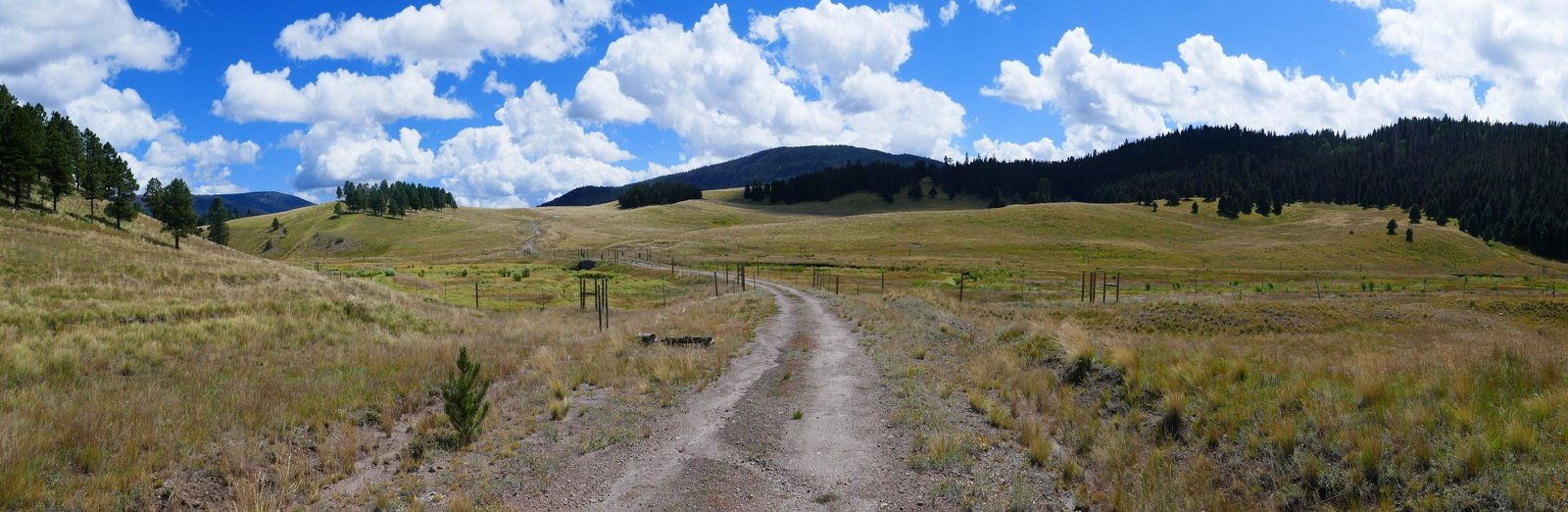 The beginning of the hike is on an old two-track. Topping a couple ridges, we enjoyed views of San Antonio Creek to our right, and looking ahead we could see the cliffs that form the western edge of San Antonio Cañon.
 A mile on we crossed the Creek on the berm over a large culvert and continued on the two track with a great view of the Creek and the Cañon ahead of us. The two-track continued on the western slope of this upper end of the Cañon, and from maps we could see that it is identified as FR 376 which continues all the way to NM 4 (‘tho it may be not passable, and I recall there is a closed gate at NM 4).
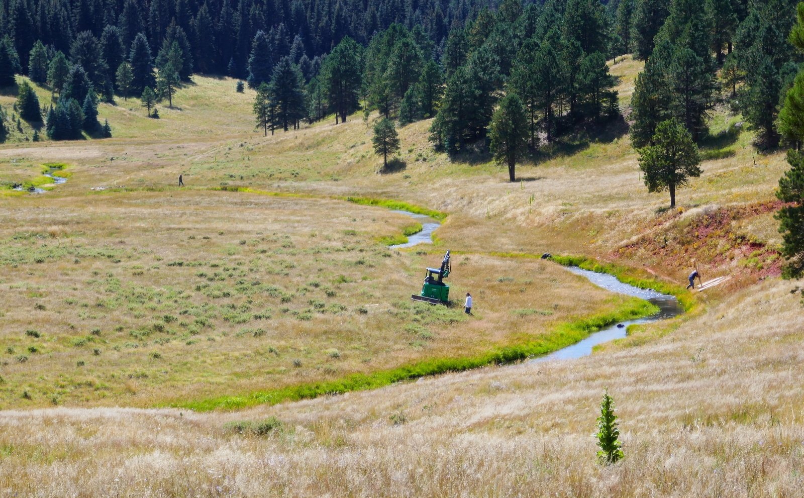
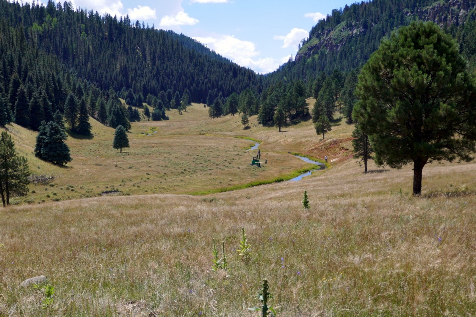
Two miles on we encountered folks with a tracked machine down along the river, and a most pleasant young woman driving a fork lift loaded with 10-12 foot long poles. She took time from her work to answer questions, and explained that she was a “wetlands restoration engineer”.
- Our first question: what is the purpose of the 10′ tall fences around sections of the river? She explained that they are “exclosures”, to keep elk and other grazing animals from the marsh and grass land along the stream, thus giving the native plants protection so they may recover. She went on to say that they are planting willow and cottonwood trees (protected further with ‘chicken fence’ around the young plants), with the goal of restoring the wetlands to their natural state.
- Next, we asked – what is the “construction” work they are performing? She explained that they are building “beaver dam analogues” (BDAs) with the goal of attracting beaver back to the creek. These BDAs are constructed by driving the poles in the creek bottom, across the creek, then weaving willow boughs through the poles to create a dam. This will give the beaver a head start on -their- dam, and over time they will make it their home. We saw more than half a dozen such BDAs along this 1 mile stretch of San Antonio Creek.

A BDA – beaver dam analogue.
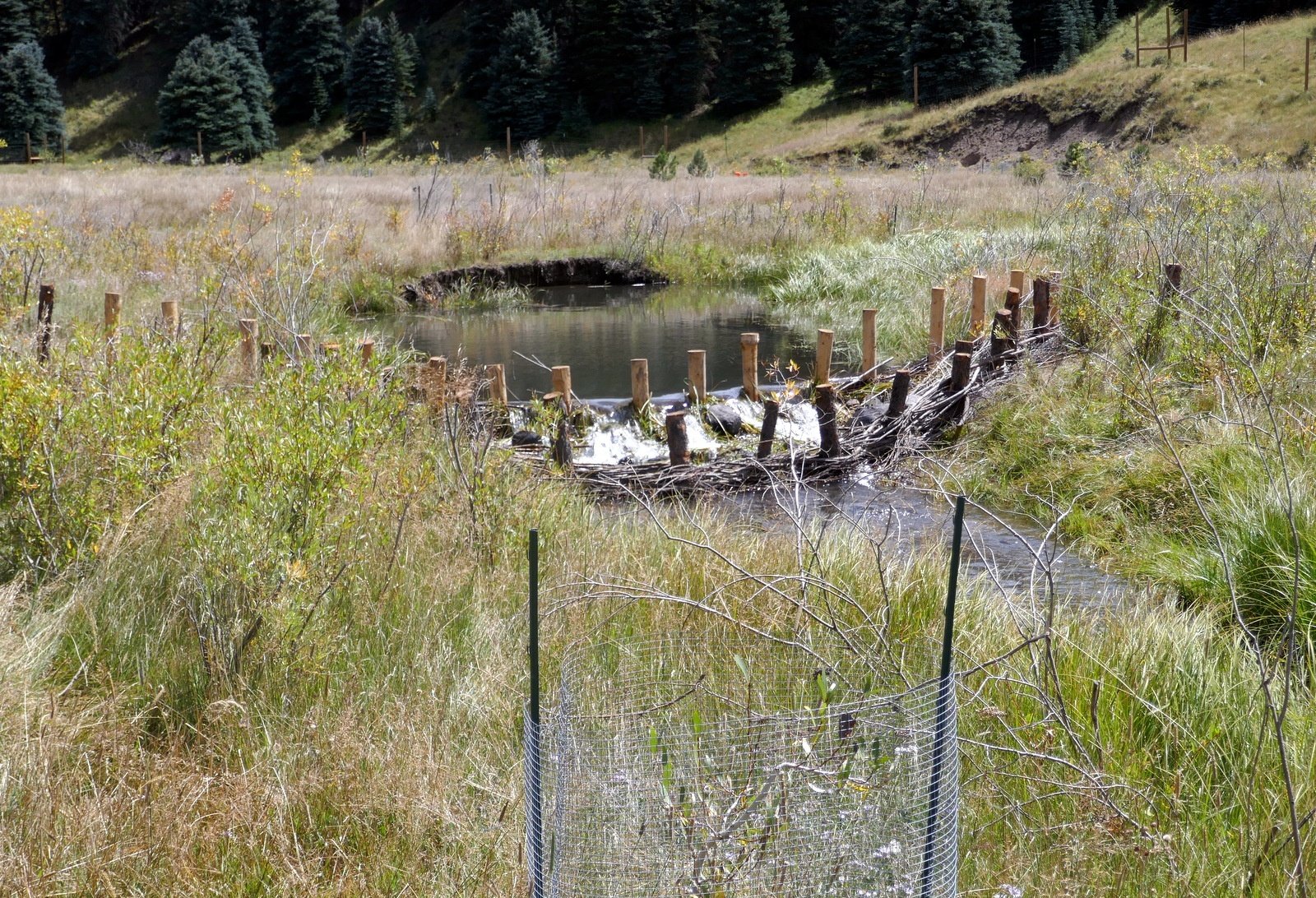
From here we descended down to creekside and entered a couple of the exclosures where we enjoyed the ambience of the running water, lush marsh grass, and recently planted willow saplings. And .. having been alerted to the fact, we saw a -real- beaver dam further upstream. This valley will look quite different in coming years.
Returning to the two-track from a nice walk along the creek, to return to the truck.
Finding it a bit challenging to walk ‘off trail’, we returned to the two-track and headed back to the truck; it was getting late and one must return to the Visitor’s Center by 5:30 (17 miles, at least a half hour). We drove part way where we stopped at the turnoff to Obsidian Valley for lunch, then checked in at the Visitor’s Center and to returned to Jemez Falls Campground for the night.
Footnote: When we encountered the restoration crew, we noticed that access to the creek was afforded by a two-track descending from the western side of the cañon. Reviewing maps and previous hikes, I realized that it descends from FR 144 and was used by Jay and me on a hike back in 2017. (Further note: from here, it is only a 2 mile hike downstream to the San Antonio Hot Springs.)
Statistics
Total Distance: 4.49 miles
Elevation: start 8,390 ft, maximum 8,474 ft, minimum 8,316 ft
Gross gain: 158 ft. Aggregate ascending 602 ft, descending 602 ft
Maximum slope: 16% ascending, 17% descending, 04.3% average
Duration: 2:47
| GPS Track Files for Download | |
223 Downloads | |
|---|---|
291 Downloads | |
314 Downloads | |
308 Downloads | |
I urge you to explore our hiking tracks with Google Earth. With the virtual 3-dimensional presentation, achieved by panning and tilting the view, you can get a much better idea of the hikes and terrain than you can get from the 2-dimensional screenshot above. For assistance: Using Google Earth Track Files.
References and Resources
National Park Service:
Valles Caldera (Home Page)
Fishing
New Mexico Nomad: Valles Caldera (the best overview/description that I’ve found)
Wikipedia: Valles Caldera
Facebook: Valles Caldera National Preserve (for up-to-date information)
AllTrails: Explore San Antonio Canyon (interactive map, start of hike near the center)
National Geographic: Valles Caldera National Preserve – Fly Fishing V
isit Los Alamos: Valles Caldera National Preserve
And check other posts for Valles Caldera