It’s been another year since the last post of our morning walks; here’s the version for 2020.
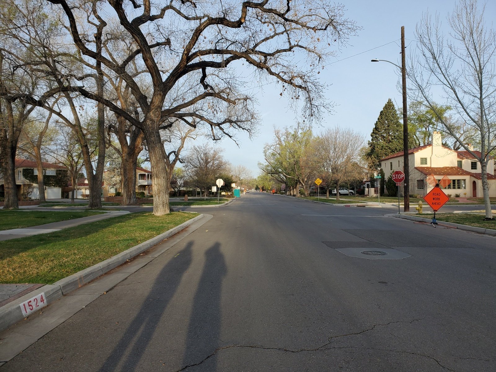 Even in this time of “social distancing” due to Covid-19, it’s important for us to get outside. Fortunately we can walk from home to Open Spaces to help keep us healthy, body and spirit. So, it’s up early to get out while the sun is still in its “sunrise phase”. We call ahead for our morning drinks from Java Joe’s, pick them up at the door to honor the health precautions. Then it’s down Park Avenue, past the Country Club and to Tingley Beach (there is virtually -no- traffic on the street these days).
The Hike
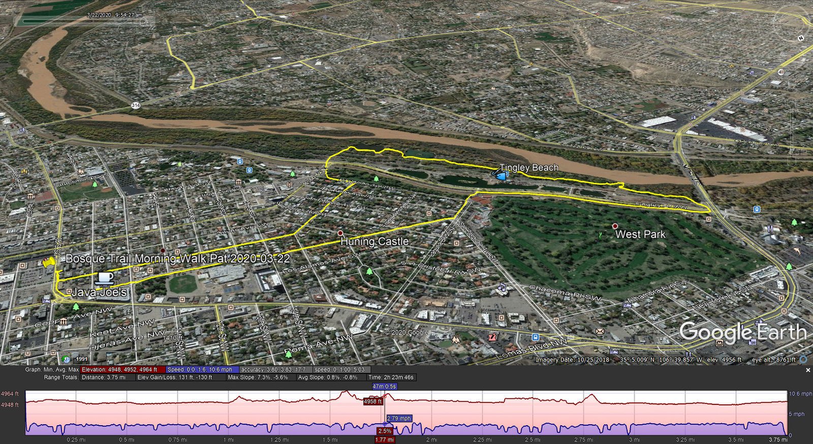
Bosque Trail Morning Walk.Pat.2020-03-22
Crossing the drain alongside Tingley Dr, we discover that a barrier has been placed across the entrance to Tingley Beach (we had discovered two days ago that gates into the Beach on the other side, along the Paseo del Bosque Trail, and into the parking lots had been closed and locked). With the Beach closed, we continued on the roadway alongside the Drain to Central Avenue. We saw numerous pairs of mallard ducks and Canada geese and even a muskrat. 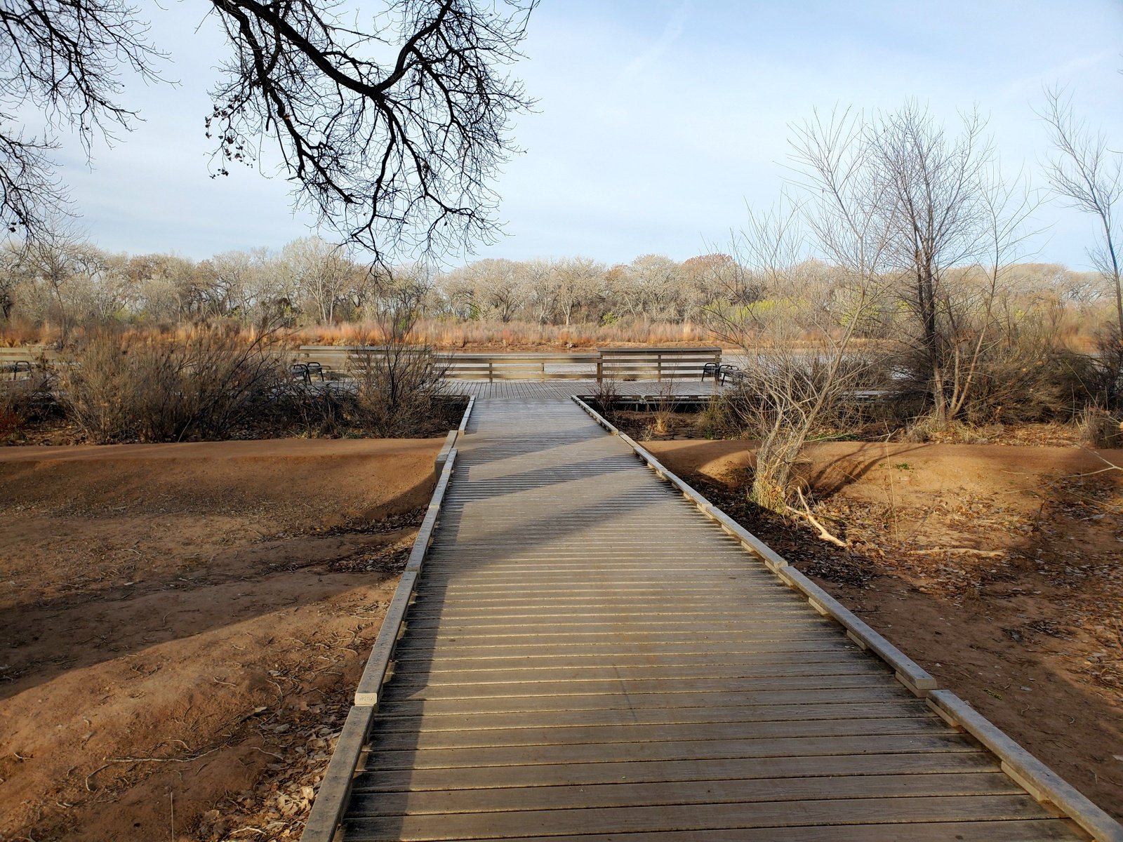
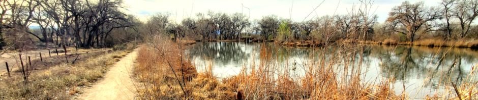
Walking a short distance from the drain along Central Avenue, we entered the Bosque trails. We made our usual stop at the pier overlooking the Rio Grande to enjoy the open skies view, check the level of the River, and do some stretching of our leg muscles. Back on the trail, we stop by the two ponds that are havens for wildlife: many kinds of waterfowl and, in the previous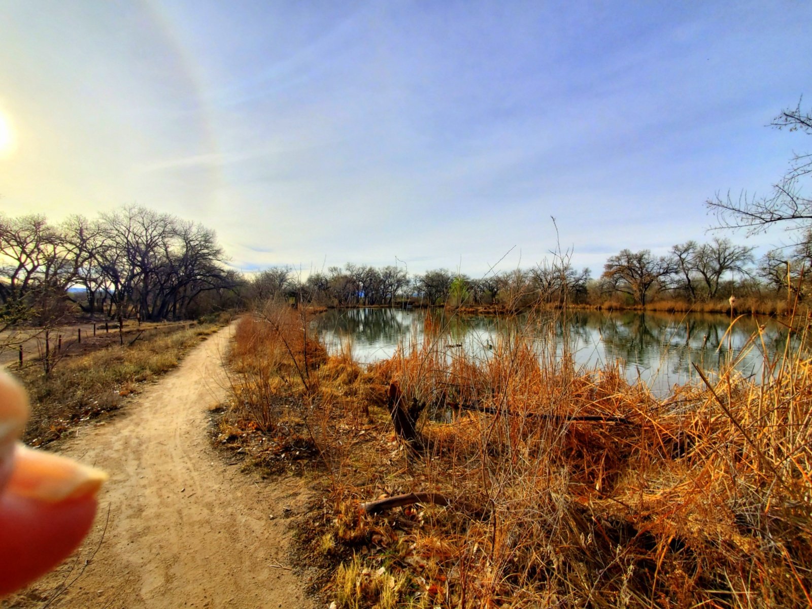 two days, a pair of golden eagles in trees on the far side of the 2nd pond.
From the ponds it’s back across the Bosque Bike Trail, the drain, and into the residential neighborhood. We walk across the end of Kit Carson Park and onto Reynolds Avenue to return home. At the corner of Kit C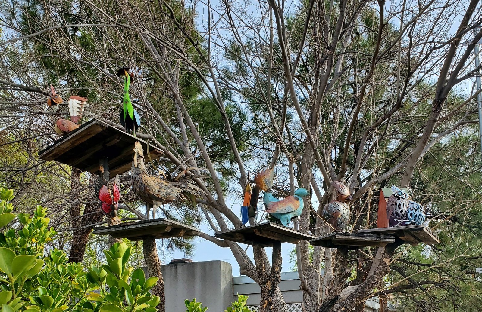 arson and Raynolds, we admire some more ‘wildlife’, a sculpture of a group if interesting, if imaginary animals. Then it’s on to Gold Avenue and home. Almost 4 miles – fresh air, time with Mother Nature, and keeping up the fitness for hiking – there are so many amazing places we plan on visiting here in New Mexico.
Statistics
Total Distance: 3.75 miles
Elevation: start 4,951 ft, maximum 4,964 ft, minimum 4,948 ft
Gross gain: 16 ft. Aggregate ascending 131 ft, descending 130 ft
Maximum slope: 7% ascending, 6% descending, 0.8% average
Duration: 2:24
| GPS Track Files for Download | |
178 Downloads | |
|---|---|
172 Downloads | |
I urge you to explore our hiking tracks with Google Earth. With the virtual 3-dimensional presentation, achieved by panning and tilting the view, you can get a much better idea of the hikes and terrain than you can get from the 2-dimensional screenshot above. For assistance: Using Google Earth Track Files.


