
Strip Mine Hike.Jay.2014-01-19
One of our earliest hikes, before I started the BLOG. This one was among many on the trails near Placitas.
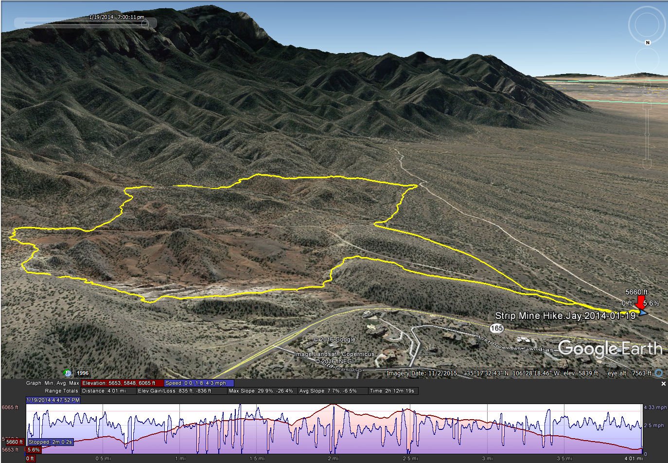
Statistics
Total Distance: 4.01 miles
Elevation: 5,848 start, 6,065 maximum, 5,653 minimum
Gross gain: 214 ft. Aggregate ascending 835 ft, descending: 836 ft
Maximum slope: 30% ascending, 26% descending, 8% average
Duration: 2:12
| GPS Track Files for Download | |
194 Downloads | |
|---|---|
149 Downloads | |