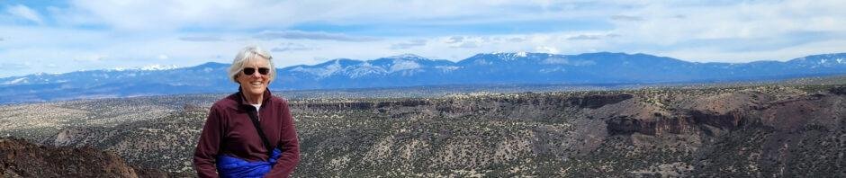
This was a get-out-of-town day, and our first and probably only visit to see the snow in the Jemez this year, and in particular in Valles Caldera.
The Drive In
We made the full loop around NM 4: Bernalillo, San Ysidro, Jemez Pueblo and a stop at Walatowa (they are set up to serve drinks and soon sandwiches), La Cueva, Valles Caldera, White Rock, Pojoaque (and tacos at El Parasol), then home via Santa Fe. ‘Tis a 200 mile drive, but it was wonderful to return to NM 4 and the Jemez River valley after many months.
NM 4 was clear the whole way. We first encountered snow as we neared La Cueava, nearing 7,500 feet elevation. Both campgrounds (Redondo and Jemez Falls) were closed. The road into the Visitors Center at Valles Caldera was also mostly clear of snow. But the drifts on both sides were 4 feet high (and a fellow we talked reported that was 2 feet less than a week ago). And the Valle itself was white from rim to rim (and with no grass showing, it seems that the elk went to lower elevations).
As for the hike, we stopped at the White Rock Visitors Center to pick up brochures. From there signs directed us to the White Rock Overlook and to the Blue Dot Trailhead.
The Hike
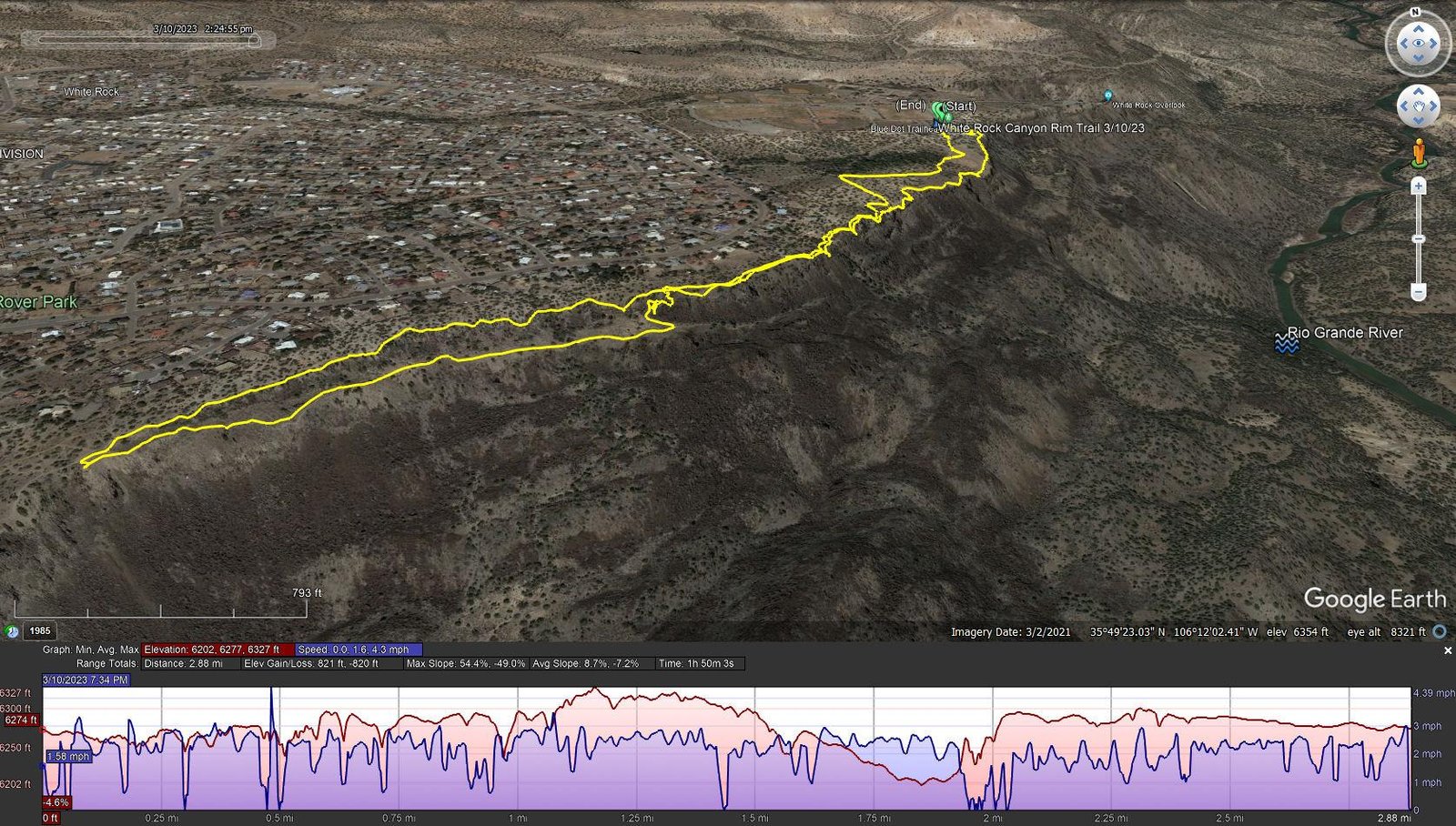
White Rock Canyon Rim Trail.Pat.2023-03-10
Notes about the Google Earth screenshot: the graph at the bottom shows elevation of the track (pink area) and speed (the blue line).
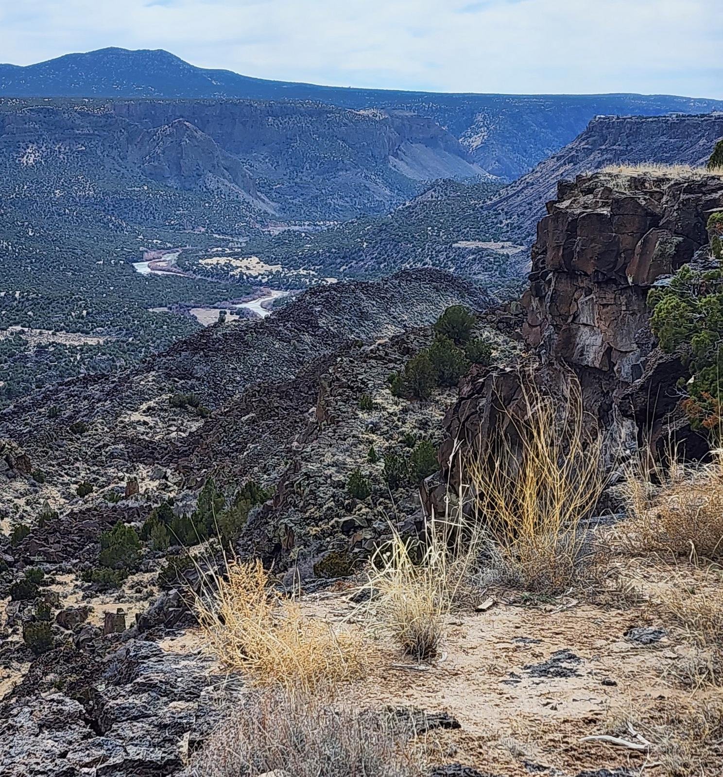 This trail is billed as an easy out-and-back hike, and that it is. At times the trail is but a few steps from the sheer cliff into the Rio Grande canyon, so the views down to the river and up the other side of the canyon are stunning. The trail is well used so it is smooth with a few areas of rocky surface.
Near the end of the designated trail, we decided to turned back. On the way out I had noticed a wide, grassy ledge a few feet below the rim trail. There appeared to be a trail along that ledge – that’s curious I thought. I had also noticed a half mile back a side trail going down off of the rim trail towards the canyon. And one more clue: GAIA GPS (on which I nowadays track our hikes) showed a trail that appeared to exist on that ledge – we decided to take it.
 The ledge is 30-60 feet wide, with, yes, a nice well-used trail. It descended gradually as we headed north, and we kept an eye out for a path of some kind back up onto the rim – the cliff to our left was vertical, 20 feet tall when we started, increasing to more that 50 feet. A half mile along, I referred to GAIA and noticed a ‘narrow line’ trail going towards the cliff, and on the ground signs of a trail that corresponded to the map.
Approaching the cliff, we were looking at a cleft filled with tumbled rock. After some hesitation, Pat volunteered to check it out. And up she went. I followed – the climb went smoothly, from one rock to the next, occasionally maintaining balance with hands on nearby rocks. It was surprisingly easy. NOTE: We Would Not Recommend making this loop from the Rim Trail to the ledge in the opposite direction – descending in the rock-strewn crevice would be difficult (for me, dangerous).
Highlight
The views are spectacular: looking down at the Rio Grande nearly 1000 feet below, the sheer walls 1.25 miles across the canyon, and in the distance the Sangre de Cristo mountains and Santa Fe Ski Basin 33 miles to the east. Oh, and we could see Cañada Ancha, the wash where we did the Diablo Canyon Hike; it beckons us to do that one again. (As you may notice, the photos are a bit washed out – the sky and air were hazy that day. On a day of clear air the views would be more amazing.)
Statistics
Total Distance: 2.88 miles
Elevation: start 6,274 ft, maximum 6,327 ft, minimum 6,202 ft
Gross gain: 125 ft. Aggregate ascending 821 ft, descending 820 ft
Maximum slope: 54% ascending, 49% descending, 7.8% average
Duration: 1:50
| GPS Track Files for Download | |
163 Downloads | |
|---|---|
179 Downloads | |
If you haven’t explored these hiking tracks with Google Earth, I urge you to try it. With the virtual 3-dimensional presentation, achieved by panning and tilting the view, you can get a much better idea of the hikes and terrain than you can get from the screenshot above. For some ideas, check out Using Google Earth Track Files.
Related Posts
Diablo Canyon Hike – 12/23/2017
References and Resources
Los Alamos: White Rock Canyon Rim
White Rock Canyon Trailheads (pdf)
AllTrails: White Rock Canyon Rim Trail
MTB Project: White Rock Canyon Rim Trail
GAIS GPS: White Rock Canyon Overlook via White Rock Canyon Rim Trail
ondafringe: BlueDot/RedDot Trails~White Rock Canyon


