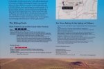
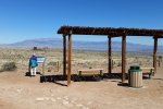
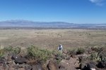
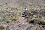
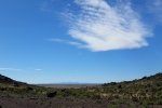
Looking for a place not too far, for an afternoon walk/hike, we chose the Volcanoes, part of the Petroglyph National Monument and Albuquerque’s Open Space Lands. ‘Tis only 15 miles or so from home, and has nice trails around the Volcanoes with stupendous views across Albuquerque and the Rio Grande valley to the Sandia and Manzano mountains. And one can even see north to the Jemez and northeast to the Sangre de Cristo mountains. We’re told New Mexico has most of the dozen or so types of volcanoes on our Mother Earth. These cones are prominent on the west mesa, the western horizon seen from throughout the city.
The Hike
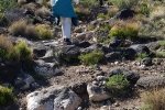
The trail is well traveled, sandy in some places, sections with small rocks (1″-3″ ), and a few stretches that are quite rocky (4″-7″ rocks). There are stretches with elevation gain as one can see from the altitude profile in the GoogleEarth image above. Overall this trail is not strenuous; the steepest and rockiest section is on the northern cone (furthest away in the GE image above).
Statistics
Total Distance: 3.42 miles
Elevation: start 5,792 ft, maximum 5,945 ft, minimum 5,792 ft
Gross gain: 153 ft. Aggregate ascending 422 ft, descending 422 ft
Maximum slope: 31% ascending, 13% descending, 4% average
Duration: 1:36
| GPS Track Files for Download | |
176 Downloads |
|
|---|---|
148 Downloads |
|
I urge you to explore our hiking tracks with Google Earth. With the virtual 3-dimensional presentation, achieved by panning and tilting the view, you can get a much better idea of the hikes and terrain than you can get from the 2-dimensional screenshot above. For assistance: Using Google Earth Track Files.
References
Albuquerque Open Space: Volcanoes
National Park Service, Petroglyph National Monument:
The Volcanoes
New Mexico Museum of Natural History & Science:
Albuquerque Basin Volcanic Field
New Mexico Buerau of Geology & Mineral Resources:
Petroglyph National Monument
ASCHG: Los Volcanos


