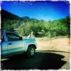
Having only limited time on this Sunday, we chose a trail close to Placitas and not too great in length. We had hike Agua Sarca back in 2014, remembering it as relatively easy but little more.
The Hike

Googl Earth screenshot of our hike on the Agua Sarca trail, 9/18/2016. I choose this view to show these canyons on the north end of the Sandia Mountains. The peak in the upper right is North Sandia, elevation 10,460 ft.
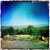
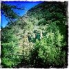
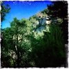
It was an easy hike, no really steep areas, with only a couple of stretches of rocky trail surface. Not shaded as much as around on the east slope of the Sandias, but the juniper, pinon, and occasional ponderosa make it pleasant on warm days.

Compare this hike, Agua Sarca (yellow) with our hike North Crest-Del Orno (orange). Placemarks identify where we thought we saw the cliffside, and where we actually encountered it on the North Crest-Del Orno hike.
The ridge to the east of the trail is quite impressive, and for a while we thought that it is the section of the ‘Sandia rind’ along which we hiked two years ago, the North Crest to Ojo del Orno hike. A section of the North Crest a narrow trail with cliff going nearly straight up on our left, and straight down on our right, both for hundreds of feet. So throughout this hike we were trying to find that section on the cliff above. At some point, we came to the conclusion that it was on this cliff, but the one beyond, the northern section which we could see round the end of the adjacent ridge; I even believed I could pick out the section of that cliff where the trail traversed. How wrong we were; see the screen shot below.
Statistics
Total Distance: 2.52 miles
Elevation: 6,367 start, 7,075 maximum, 6,367 minimum
Gross gain: 708 ft. Aggregate ascending 931 ft, descending: 924ft
Maximum slope: 52% ascending, 48% descending, 12% average
Duration: 2:55
| GPS Track Files for Download | |
110 Downloads |
|
|---|---|
71 Downloads |
|
Last Updated on February 28, 2022 by George Young

