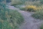
We walk almost daily on the Paseo del Bosque Trail along the Rio Grande, quite close to home. Typically ’tis an out-and-back walk from 2 to as many as 5 miles. For a variation, we planned a point-to-point walk from the Bio Park to a very nice place for breakfast, Los Poblanos Historic Inn & Organic Farm.
Is this a “hike” or a “walk”? Hikes commonly involve carrying a pack with extra water, lunch, and other gear and with a plan to have a mid-hike break for lunch. We don’t carry a pack for Walks. There was a time when distance influenced the category, but these days we take “walks” in the Bosque for which the distance is as much as we typically go for “hikes”. I suppose since a meal (breakfast) was included in this outing and it was long as our typical hike, I’m dubbing it a “hike”.
The Drive In
We began by parking our Subaru near Los Poblanos where there is ready access to an offshoot of the Bosque Trail, 3/10ths or a mile off of Rio Grande Blvd NW on on Dietz Farm Rd NW (just south of Montaño). We then returned with the Tacoma to the parking area for a trailhead just off of Rio Grande Blvd, adjacent to the Biopark.
The Hike
Notes about the Google Earth screenshot: the graph at the bottom shows elevation of the track (pink area) and speed (the blue line).
The Bosque Trail is so very pleasant in the early morning hour with the low angle of the sun highlighting the river, cottonwoods, and .. the New Mexico blue sky. We’ve walked the trail so many times, in sections on our morning walks, that it was a pleasure to go point-to-point, get our 5+ miles without having to retrace our steps. Oh, and Los Poblanos is a great place to have breakfast, this day sitting outdoors
Statistics
Total Distance: 5.23 miles
Elevation: start 4,961 ft, maximum 4,985 ft, minimum 4,955 ft
Gross gain: 30 ft. Aggregate ascending 233 ft, descending 218 ft
Maximum slope: 7% ascending, 10% descending, .8% average
Duration: 1:54
| GPS Track Files for Download | |
144 Downloads |
|
|---|---|
160 Downloads |
|
If you haven’t explored these hiking tracks with Google Earth, I urge you to try it. With the virtual 3-dimensional presentation, achieved by panning and tilting the view, you can get a much better idea of the hikes and terrain than you can get from the screenshot above. For some ideas, check out Using Google Earth Track Files.
Related Posts
Posts for Bosque Trail
References and Resources
City of Albuquerque Parks & Recreation: Paseo del Bosque Trail
AllTrails: Paseo del Bosque Trail


