Category Archives: Sierra Blanca

In the vicinity of the Sierra Blanca Mountains, NM.

Three Rivers Trail #44 Hike – 04/24/2021

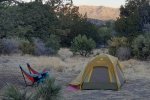
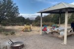
This hike took place during a 2-night camping trip with the primary purpose – to visit the Three Rivers Petroglyph Site. After our  morning tour of the Petroglyphs and lunch in the Three Rivers Campground, we set out on the Three Rivers Trail.

The Drive In

Not much to say here; the trailhead is at the east end of the Three Rivers Campground. For the drive from Albuquerque, see my post Three Rivers Petroglyph Trail Walkabout – 04/24/2021.

The Hike

Three Rivers Trail Hike.PatJayNancy.2021-04-24

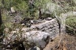
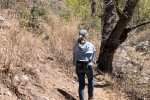
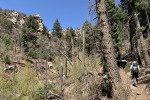
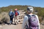
The trailhead is at the east end of the Three Rivers Campground. It starts out with a smooth dirt surface, in somewhat open space – typical juniper/piñon forest, with a few ponderosa. A few yards on the trail crosses to the north side of the streambed (no water here) and to the junction of the Three Rivers and Goat Canyon trails. Slope for the first mile or so, to the junction with the Dry Canyon Trail, the canyon is wide and open. Then the canyon narrows and there abouts we encountered water in the stream.

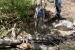
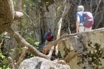
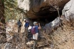
As the canyon narrowed and the trail made an “S” turn to the right, the sides of the canyon became more vertical, becoming cliffs towering above the streambed some 800 feet – awesome sights. We encountered a couple more stream crossings, easy because not a lot of water was flowing. We continued up the narrow canyon to find a “cave” and waterfall that are noted on the topo maps. Though the view of the waterfall was obscured by trees, we could see that on another day when there was a greater flow in the stream, it would be impressive.

After our mid-hike for lunch, we returned down the canyon, having enjoyed a truly great day in the mountains of New Mexico.

Postscript

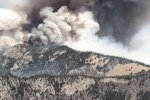
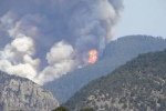
We departed the Campground mid-day Sunday. Checking news Monday, we learned that the Three Rivers Fire had started 1/2 mile from the Campground Monday morning. By Tuesday the Forest Service reported it had grown to 12,000 acres and containment was only 5%. By Wednesday, after some rain and snow in the area, control was being established. But … it -must- have burned through and around the Three Rivers Canyon, -the- area through which we enjoyed such great hike on a wonderful trail. Most Unfortunate!! It will be years (decades?) before people will have such a beautiful place to hike as we enjoyed.

Statistics

Total Distance:  4.90 miles
Elevation: start  6,423 ft, maximum  7,516 ft,  minimum 6,423 ft
Gross gain: 1,093 ft.  Aggregate ascending 1,398 ft, descending 1,397ft
Maximum slope: 34% ascending, 37% descending, 9.0% average
Duration: 3:51

GPS Track Files for Download
69 Downloads
68 Downloads
If you haven’t explored these hiking tracks with Google Earth, I urge you to try it. With the virtual 3-dimensional presentation, achieved by panning and tilting the view, you can get a much better idea of the hikes and terrain than you can get from the screenshot above. For some ideas, check out  Using Google Earth Track Files.

Related Posts

Three Rivers Petroglyph Trail Walkabout – 04/24/2021

References and Resources

USDA Forest Service: Three Rivers Trail (T44)
AllTrails: Three Rivers Trail
Ruidoso.net: Three Rivers Trailhead
Hiking Project: Three Rivers Trail (#44)
Hike Arizona: Three Rivers Trail #44, NM
Three Rivers Petroglyph Trail Walkabout – 04/24/2021

This 2-night camping trip with Jay and Nancy was planned so we could visit the Three Rivers Petroglyph Site. The Petroglyph Trail is just under a mile in length, so we chose to tour the Petroglyphs in the morning, then take a full hike after lunch. Visiting the Site in the cooler air of the morning was a good choice; later in the day it would become quite hot – there is no shade from the sun in New Mexico’s invariably clear blue skies.

The Drive In

We drove from Albuquerque the day before: I-25 to Moriarty, NM 41 to Willard, NM 42 to Corona, US 54 south to Carrizozo, then 13 miles further on US 54 to the Three Rivers Trading Post. Turn left onto Three Rivers Road, 15 miles to the campground which is tucked up against the Sierra Blanca mountains (total: 4 hours with the R-Pod, 192 miles). On the way to the campground, we passed the Petroglyph Site about 3 miles from the highway
The Walkabout

Three Rivers Petroglyph Trail Walkabout.PatJayNancy.2021-04-24


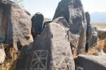
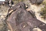
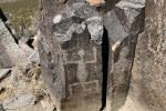
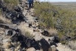
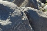
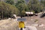
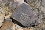
Parking next to the Visitors Center (closed these days), we started up a well-worn trail towards the ridge where there are some 21,000 petroglyphs. And only a few yards on we saw the first of them.

[Double-click on a photo to enlarge, use browsers <Back One Page to return to this page.>

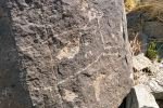
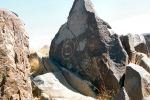
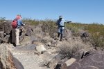
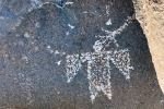
From there the trail became a bit rocky, but we soon saw more and more of the petroglyphs. In some places we climbed off-trail to get a better look closer to them.
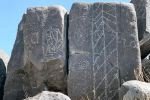
There are so many images among the petroglypy. We picked up a Visitors Guide which offered explanations for many of the images as well as a sketch of the history of the Site.
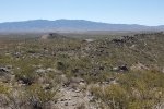
All of this while having a marvelous view across the Tularosa Basin to the San Andres Mountains 45 miles to the west.

Statistics

Total Distance:  1.16 miles
Elevation: start  4,988 ft, maximum  5,097 ft,  minimum 4,981 ft
Gross gain: 116 ft.  Aggregate ascending 201 ft, descending 205 ft
Maximum slope: 27% ascending, 22% descending, 5.8% average
Duration: 1:31

GPS Track Files for Download
54 Downloads
152 Downloads
If you haven’t explored these hiking tracks with Google Earth, I urge you to try it. With the virtual 3-dimensional presentation, achieved by panning and tilting the view, you can get a much better idea of the hikes and terrain than you can get from the screenshot above. For some ideas, check out  Using Google Earth Track Files.

Related Posts

Three Rivers Trail #44 Hike – 04/24/2021

References and Resources

BLM: Three Rivers Petroglyph Site
New Mexico True: Three Rivers Petroglyph Site
New Mexico Nomad: Three Rivers Petroglyphs
     (great for historical background)
GJHikes: Three Rivers Petroglyphs
     (great collection of photos)
AllTrails: Three Rivers Petroglyph Site Trail
USDA Forest Service: Three Rivers Campground
Campendium: Three Rivers Campground

Ski Apache Hike (& visit to Ruidoso) – 7/7/2016

Thomas came to visit from Oakland, and started with a 3-day trip to Ruidoso, NM.  The first night there, we attended a Chuckwagon Dinner and Wild West Show at the Flying J Ranch.  It was quite the entertainment, and the served a good ‘chuckwagon’ meal – ’tis a great place for families.

The Hike, #1

Track from base of Gondola Ride at Ski Apache to the top, with hike back down.
Hike 1: Track from base of Gondola Ride at Ski Apache to the top, with hike back down.
(Click on the above image for a full-size view.)

The next day we drove to Ski Apache to take the Gondola Ride up Mount Lookout.  It was quite the view to see, before we hiked back down to the resort.  We followed a service road because the ski trails were very steep – we tested a couple of them and decided – nope, we’ll stick to the road.  In the background of the GoogleEarth image above, you can see Sierra Blanca Peak a bit to the left, and beyond it to the right is the White Sands Missile Range and White Sands National Monument.

Statistics 1

NOTE:  These statistics are for the hike down
Total Distance: 2.9 miles
Elevation: 11,393 start, 11,393 maximum, 9,760 minimum
Gross gain: 1,633. Aggregate: ascending 124 ft, descending: 1,757 ft
Maximum slope: 30% ascending, 34% descending, 5.4% average
Duration: 2:11

GPS Track Files for Download
80 Downloads
73 Downloads

The Hike, #2

Track from top of Gondola Ride to peak of Mount Lookout, near Ruidoso.
Hike 2: Track from top of Gondola Ride to peak of Mount Lookout, near Ruidoso.
(Click on the image above to see a full-size view.)

While having lunch, we learned that there was a trail from the terminus for the Gondola Ride up to the top of Mount Lookout – we went back up the mountain and walked to it’s peak.

An even better view than from the upper terminus of the Gondola Ride.  (The aberration in the elevation/speed profile at the bottom of the screenshot above is a ‘hiccup’ by the GPS. And the track shows only the hike down.)

Statistics 2

These statistics are adjusted for the up & down track.
Total Distance: 0.6 miles
Elevation: 11,393 start, 11.552 maximum, 11,393 minimum
Gross gain: 159.  Aggregate  NA ft ascending,  NA ft descending
Maximum slope: NA%  ascending, NA% descending, NA% average
Duration: 0:30

GPS Track Files for Download
328 Downloads
66 Downloads

Before heading back to El Cerrito for supper and Albuquerque for the night, we enjoyed a one hour horseback ride at Grindstone Stables.  The trail led up and down through ponderosa pine forest; the horses treated us well as did the wranglers.  Another good time.