Our 3rd visit to the Cuba Badlands in the San Juan Basin, this to the Ceja Pelon the 4th badlands going west from Mesa de Cuba. Like the other recent hikes, this is the time of year to visit these Badlands, before the hot weather of summer arrives. And this is a return to Ceja Pelon, having hiked there back in 2018.
The San Juan Basin covers the northwest quarter of New Mexico and a portion of Colorado along the NM-CO border. There are -many- Badlands including the Ojito (near San Ysido), San Jose (north of Cuba), and going west Lybrook, Bisti/De-Na-Zin, Ah-Shi-Sle-Pah, and several others (see the map at American Southwest).
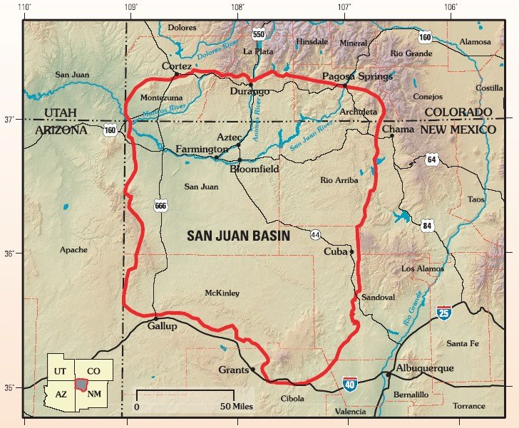
Plus these five south and west of Cuba: Mesa de Cuba, Mesa Chijuilla, Mesa Penistaja, Ceja Pelon, and Cejita Blanca Mesa.
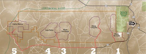
A closeup map of the first 4 of the 5 Cuba Badlands.

From Albuquerque, take US 550 to Cuba, but -at the entrance- to the town turn left onto NM 197. Continue south along the east of the very large Mesa de Cuba (one of the badlands) – the scenery as one reaches the end of Mesa de Cuba is quite interesting. Continue for 9.2 miles from US 550 to where NM 197 takes a sharp turn to the left. Midway around this turn take the road to the right (known as Valle San Ysidro); it is a well used (and graded) dirt road.
Continue for 7.2 miles from NM 197, then turn right onto another graded dirt road (not as well maintained as Valle San Ysidro, but suitable for “city vehicles”). Continue for 1.3 miles, then turn left onto a two-track. About 200 yards on, you will encounter a wash with a very steep drop from the edge. This probably requires a high clearance vehicle, and best done with four-wheel drive since even when dry that sand can be soft. From there continue on for for three or four hundred yards, tell you come across a large open area that appears to have been a wellhead. We parked there for our hike into Ceja Pelon.
The Hike
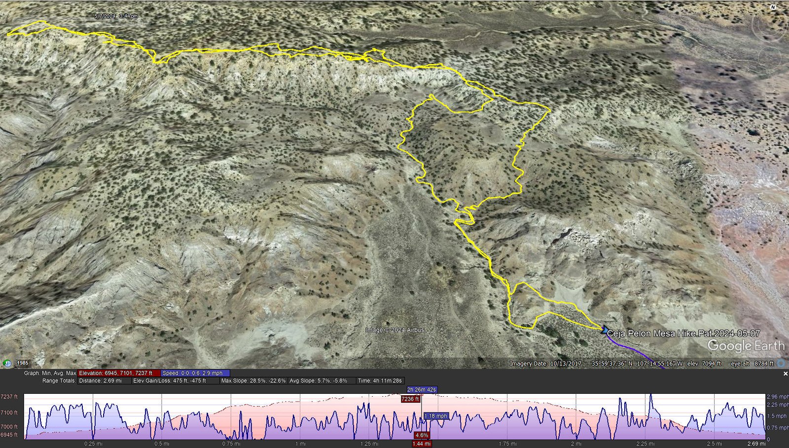
Notes about the Google Earth screenshot: the graph at the bottom shows elevation of the track (pink area) and speed (the blue line).
We began our hike by going up small canyon and then turned left to go up over a ridge into another slightly larger canyon. From there we followed that canyon for about a third of a mile, then turned to the right and worked our way up to the top of the Mesa. Along the way it was hard to take a step without trading on petrified wood from small shards to pieces maybe three or four inches in size. And occasionally we would see a section of a tree trunk, petrified.
From there we walked along the edge of the Mesa for about 6/10 of a mile. We enjoyed a great view of a field of mounds of black capped with gray materials (later, up close, the materials appeared to be some sort of crumbly clay, with near vertical faces of pockmarked surface in many patterns). We also came across rocks of almost every color, from tan to red, some yellow (some of this moss or lichen) – all very interesting. Along the ridge we did come across two petrified tree trunks, partially buried in the sand.
As on our previous visit to Ceja Pelon, on the return we found some shade under a piñon tree and shelter from the furious winds that followed us on this hike. We returned to the Tacoma by a different route, one that did not have such a steep slope to descend.
Statistics
Total Distance: 2.69 miles
Elevation: start 6,945 ft, maximum 7,237 ft, minimum 6,945 ft
Gross gain: 292 ft. Aggregate ascending 475 ft, descending 475 ft
Maximum slope: 29% ascending, 23% descending, 5.8% average
Duration: 4:11, Average Speed: 0.6 mph
| GPS Track Files for Download | |
114 Downloads | |
|---|---|
126 Downloads | |
123 Downloads | |
112 Downloads | |
If you haven’t explored these hiking tracks with Google Earth, I urge you to try it. With the virtual 3-dimensional presentation, achieved by panning and tilting the view, you can get a much better idea of the hikes and terrain than you can get from the screenshot above. For some ideas, check out Using Google Earth Track Files.
Related Posts
References and Resources
New Mexico Magazine: Badlands Walkabout
Directory of the 5 badlands near Cuba, NM
PhotoTrek New Mexico: San Juan Basin Badlands
The American Southwest:
San Juan Basin Badlands
Map of the San Juan Basin Badlands
Ceja Pelón Mesa
AllTrails: Caja Pelón
Living Wonderously: Enchanted Excursion
Two Swiss Hikers: Ceja Pelón Mesa
Jim Caffrey Images Photo Blog: The Other Badlands
Arthouse Photography: New Mexico Badlands: Ceja Pelón in color
Photos
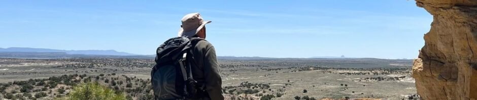
Here are a few photos that Pat took during this hike; there are many more great photos on the References and Resources list above.


