The 5th hike during our visit to Oaxaca. Pat was to spend the day with José in Teotitlán del Valle, learning about dyeing and weaving. José had also arranged for me to meet up with Alvert for a hike to the top of Cerro Danush, a mountain with special significance to his pueblo, Macuilxóchitl de Artigas Carranza.
The Drive In
José met us at Buganbilias again with Albert to drive us. After a stop at Pan Am, the nearby coffee shop, we headed out into the Tlacolula Valley. After a really good breakfast at Restaurante La Palapa de Raúl, we proceeded to José’s studio on the road from the highway to Teotitlán. Alvert from Macuilxóchitl picked me up to return to his village for the hike.
The Hike
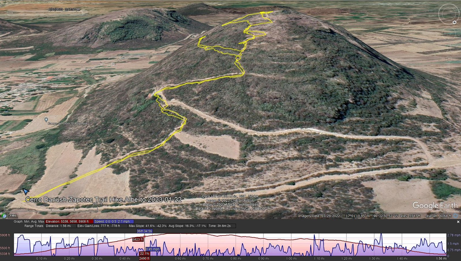
Notes about the Google Earth screenshot: the graph at the bottom shows elevation of the track (pink area) and speed (the blue line).
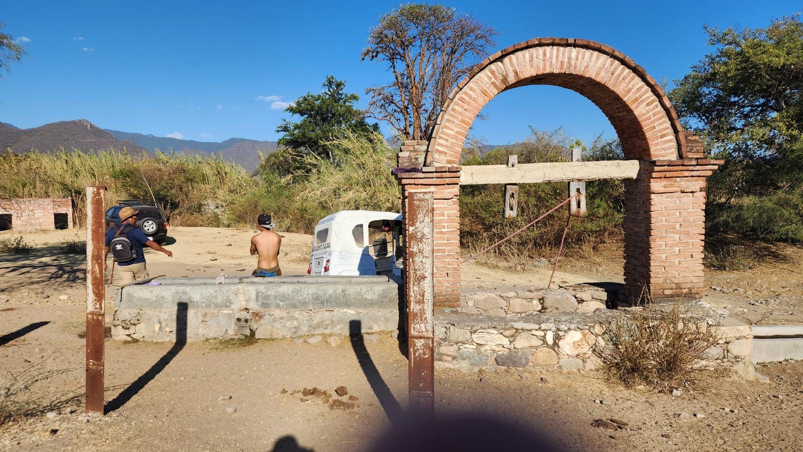
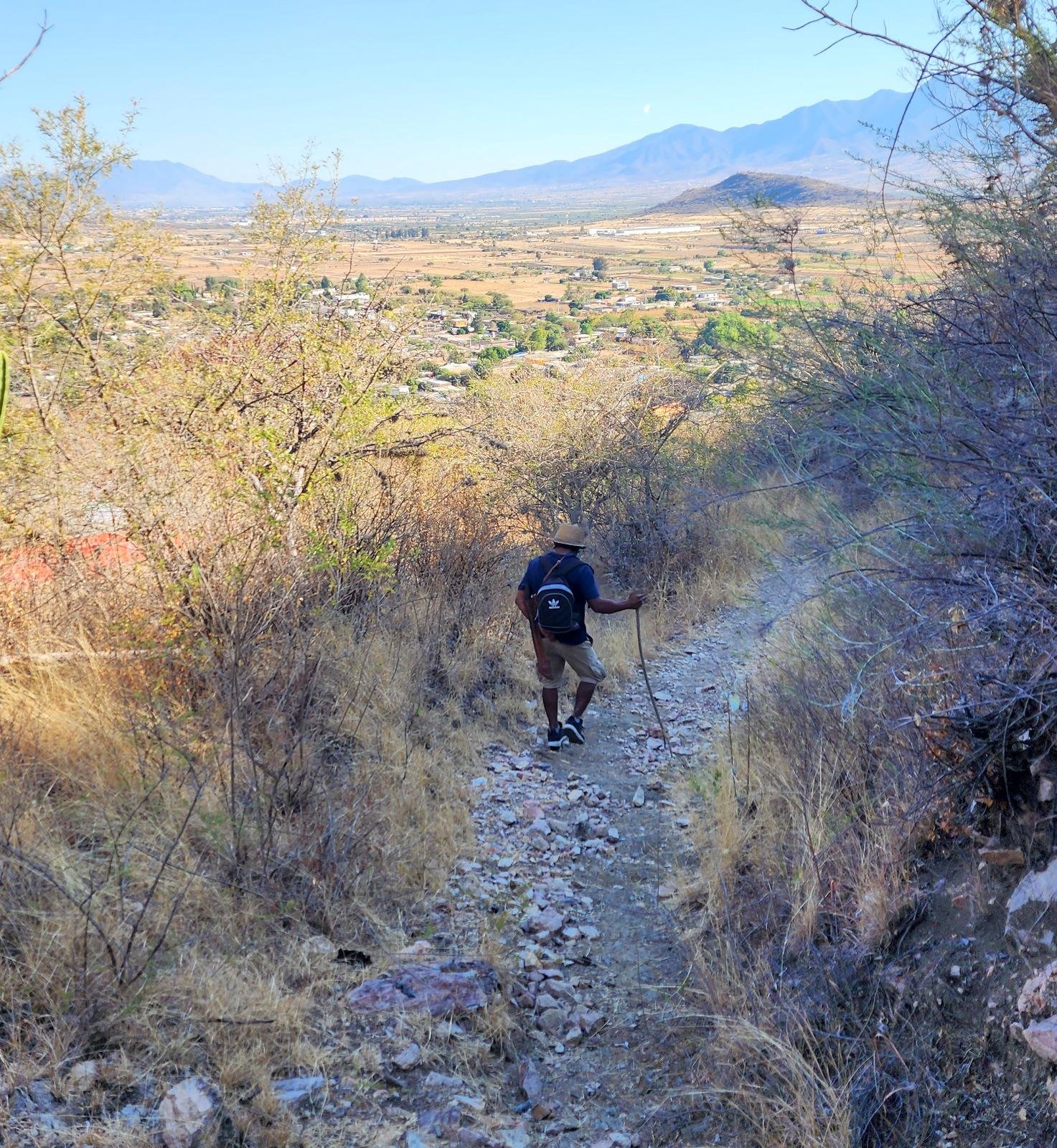
The hike began at the edge of Macuilxóchitl, next to a spring-fed watering tank used to feed cattle (and a place to wash the mototaxi for local drivers). We crossed a plowed field and started up the trail, a very steep, rocky trail with sections of outcroppings that (almost) required hand bracing. 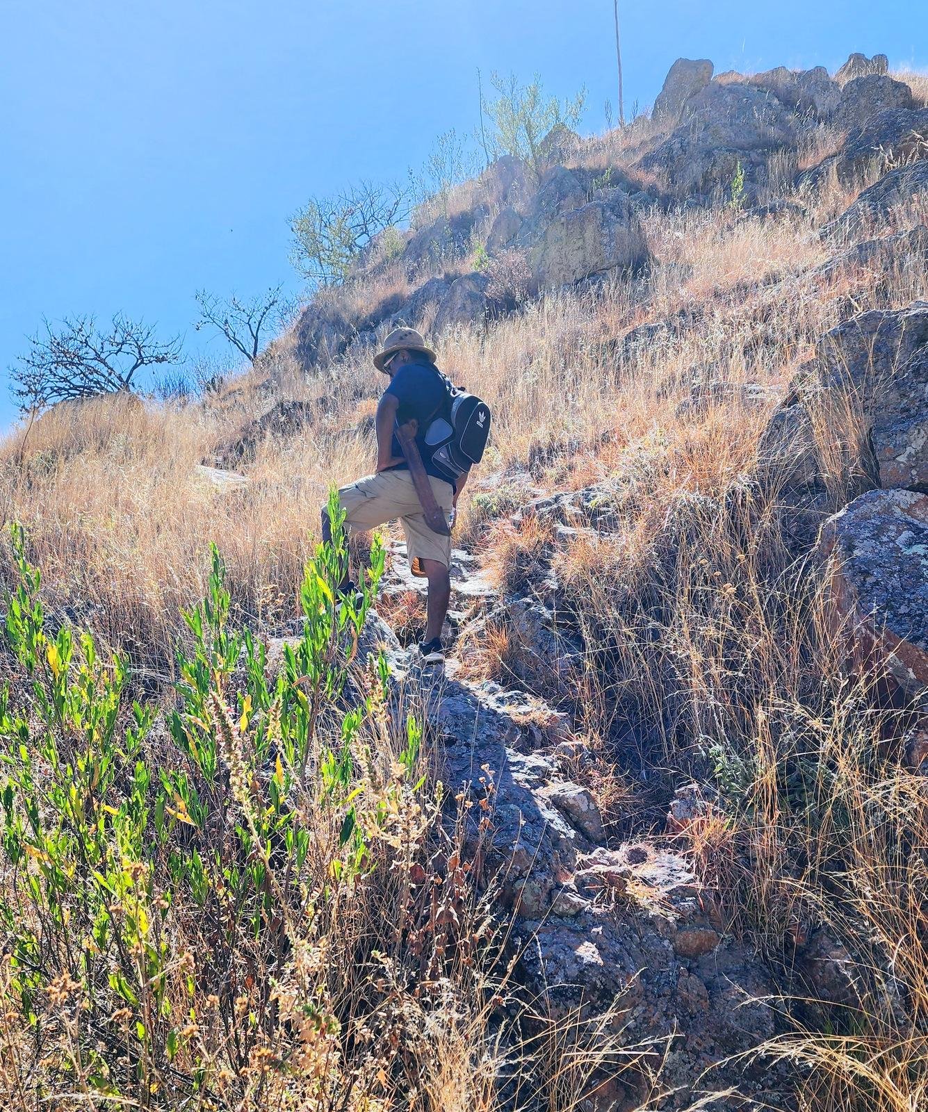 (It was so steep that I began to be concerned about safety on the way back down.) After about 200 feet of gain, we proceeded on a dirt/gravel road for another 100 feet or so, then .. we started climbing again in earnest on a trail like that on which we started.
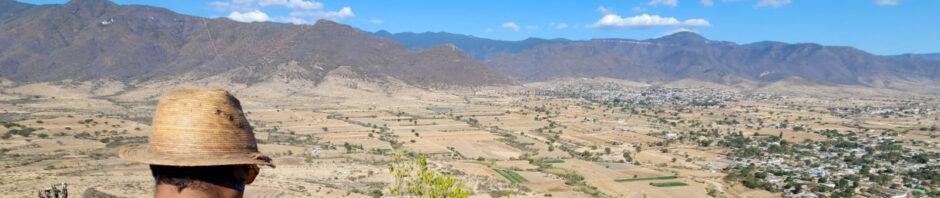
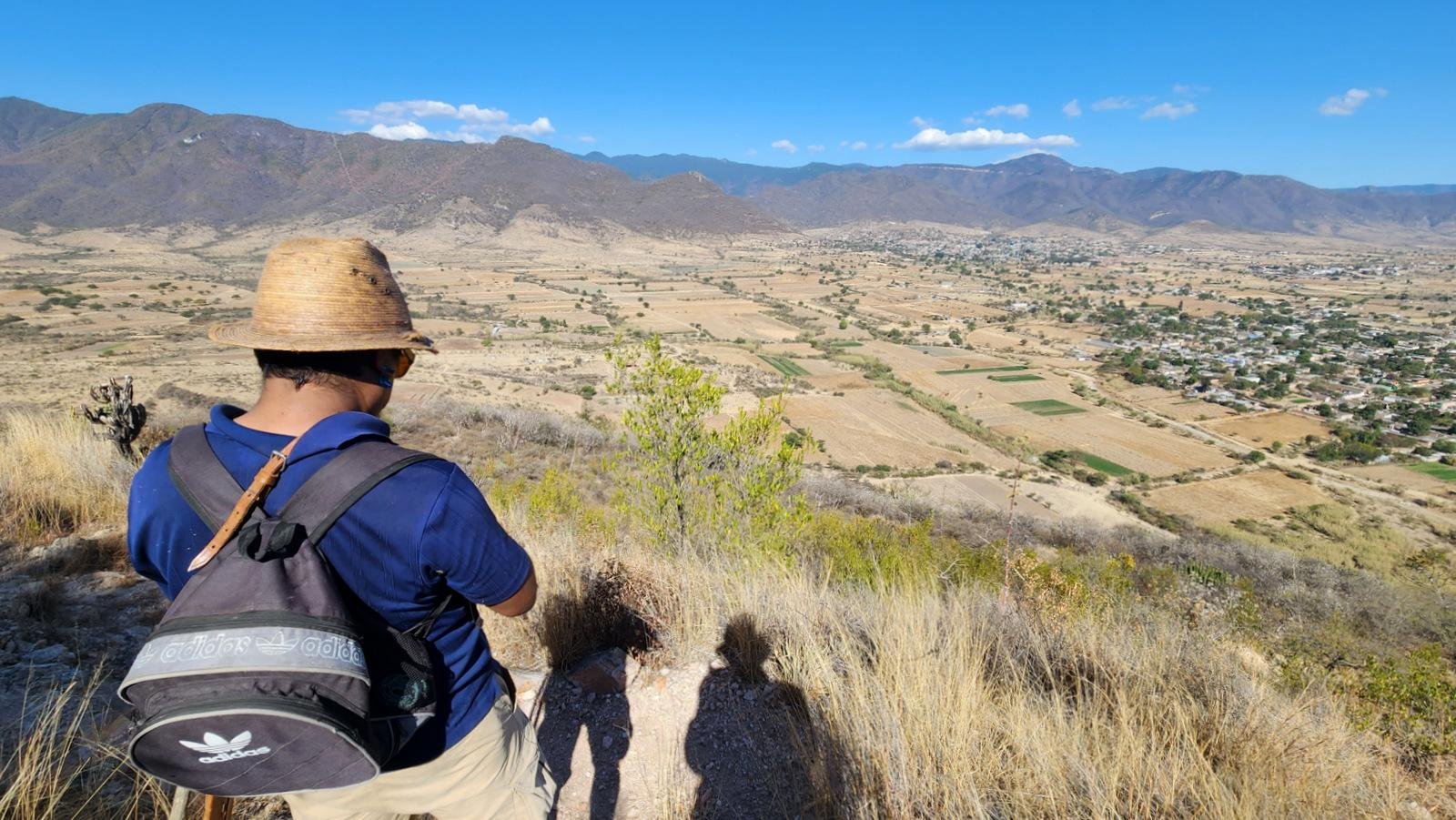 Thus we continued to the peak of Danush, where 1) the views up, down, and across the valley were spectacular, and 2) there was a modern day altar. After a few minutes admiring the scenery, we started back down, ‘tho not on the trail we came up on. Alvert paused, loosed his machete, and cut a stiff pole. He saw my reaction and handed it to me, clearly understanding that it would be important for safely descending the steep, often rocky trail, and cut another one for himself.
Alvert then guided us to an open area where he said it was cleared by the Zapotecs as a place from which they had unobstructed views of the skies, for celestial observations. From there, we headed into the bush – no trail so we were bush whacking until we encountered a very steep rocky decline. Judged to be too steep, Alvert led us, bush whacking, from there back to the main trail.
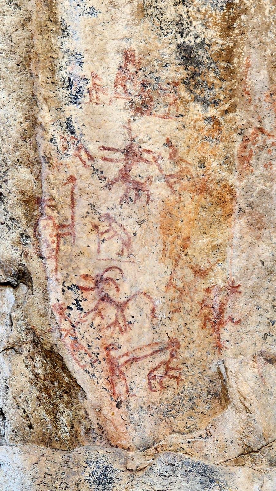
Zapotec Rock Paintings on Cerro Danush.
We descended down the trail for some 200 yards with switchbacks, then turned onto a narrow side trail. Continuing for again some 200 yards, we came to a 20′ tall rock face where Alvert pointed out the rock paintings attributed to the Zapotec culture who inhabited the area around 750 C.E.
 We returned to the main trail and down hill to the watering tank where we had started. Then it was back to Macuilxóchitl where Alvert introduced me to Armando Mendoza, president of the Asociacion Civil Guiebelagayo that promotes and supports the heritage of Macuilxóchitl. We had an enjoyable conversation – my limited Spanish and his limited English – but Alvert helped each of us. There was a moment of levity when, after Alvert explained that we had hiked to the top of Danush, he told Armando and others who had joined us that I would turn 80 years old in a couple of days. They seemed to be surprised.
Highlight
The highlight of this hike was enjoying time with Alvert, learning from each other our languages while we hiked up a trail on ‘his’ mountain. I found it interesting to realiise that I was treading on a trail of the Zapotec’s from centuries ago, and Alvert showing to me features that are so closely linked to the history of Macuilxóchitl. Thank you, Alvert!
Statistics
Total Distance: 1.31 miles
Elevation: start 5,367 ft, maximum 5,962 ft, minimum 5,367 ft
Gross gain: 595 ft. Aggregate ascending 777 ft, descending 778 ft
Maximum slope: 42% ascending, 42% descending, 16.8% average
Duration: 3:08
| GPS Track Files for Download | |
237 Downloads | |
|---|---|
224 Downloads | |
If you haven’t explored these hiking tracks with Google Earth, I urge you to try it. With the virtual 3-dimensional presentation, achieved by panning and tilting the view, you can get a much better idea of the hikes and terrain than you can get from the screenshot above. For some ideas, check out Using Google Earth Track Files.
Related Posts
Other Hikes around Oaxaca.
References and Resources
FAMSI 2008: Ronald Faulseit: Cerro Danush: An Exploration of the Late Class Transition in the Tlacolula Valley, Oaxaca (pdf)
SoaMaps: “El Calvario” Cerro Danush (read the comments)


I love reading you hiking posts. You have the most interesting hikes.
Thanks, Vince. That was for me a special experience.
I think I’ve said this before – you introduced me to the “exploration” dimension of hiking when I went with you to Cabezon. And I thank you for that experience very often. And I – we, Pat & – will try to keep the interesting posts coming.
Cheers to you and Jan.