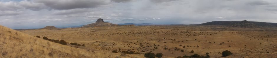
This was maybe my first visit to the Rio Puerco valley and its amazing views – the numerous volcanic necks, Cabezon being the most prominent and well known; the vista views across the valley to Mesa Chivato and Mount Taylor to the west; and … the wide open space (this video gives a truly great tour).
The Drive In
The road into the Rio Puerco valley, NM 279, is paved for a few miles off of US 550, then changes to a well maintained and traveled gravel/dirt road. Because it can seem to be trackless out in the Rio Puerco, I offer this detailed description of the route (and a link below to a GoogleEarth track):
- Travel west on US 550, 53 miles from I-25; turn left onto NM 279.
- Some 4 miles south on NM 279, you will cross the Rio Puerco itself, then through a small settlement and further along, the settlement of San Louis.
- Pavement ends at the 8.5 mile point; continue straight ahead,
- but bear left 12.3 miles from US 550.
- At 13.5 miles the road again crosses the Rio Puerco.
- In the past the road descended down a steep embankment into the bottom of the deep river bed. This was sometimes impassable due to muddy conditions or the road was simply washed out.
- I believe since then a very large culvert has been put in place improving the reliability of getting across the Rio Puerco at this point.
- Vince turned to the left 16.5 miles from US 550 which took us to the east side of Cerro de Guadalupe. Continuing straight from this point would make easy access from the west side of the Cerro.
- We continued down this gravel road for 1.5 miles (18 miles from US 550), then turned west on a two track, parking on the top of a ridge from where we began our walkabout.
The “Hike”
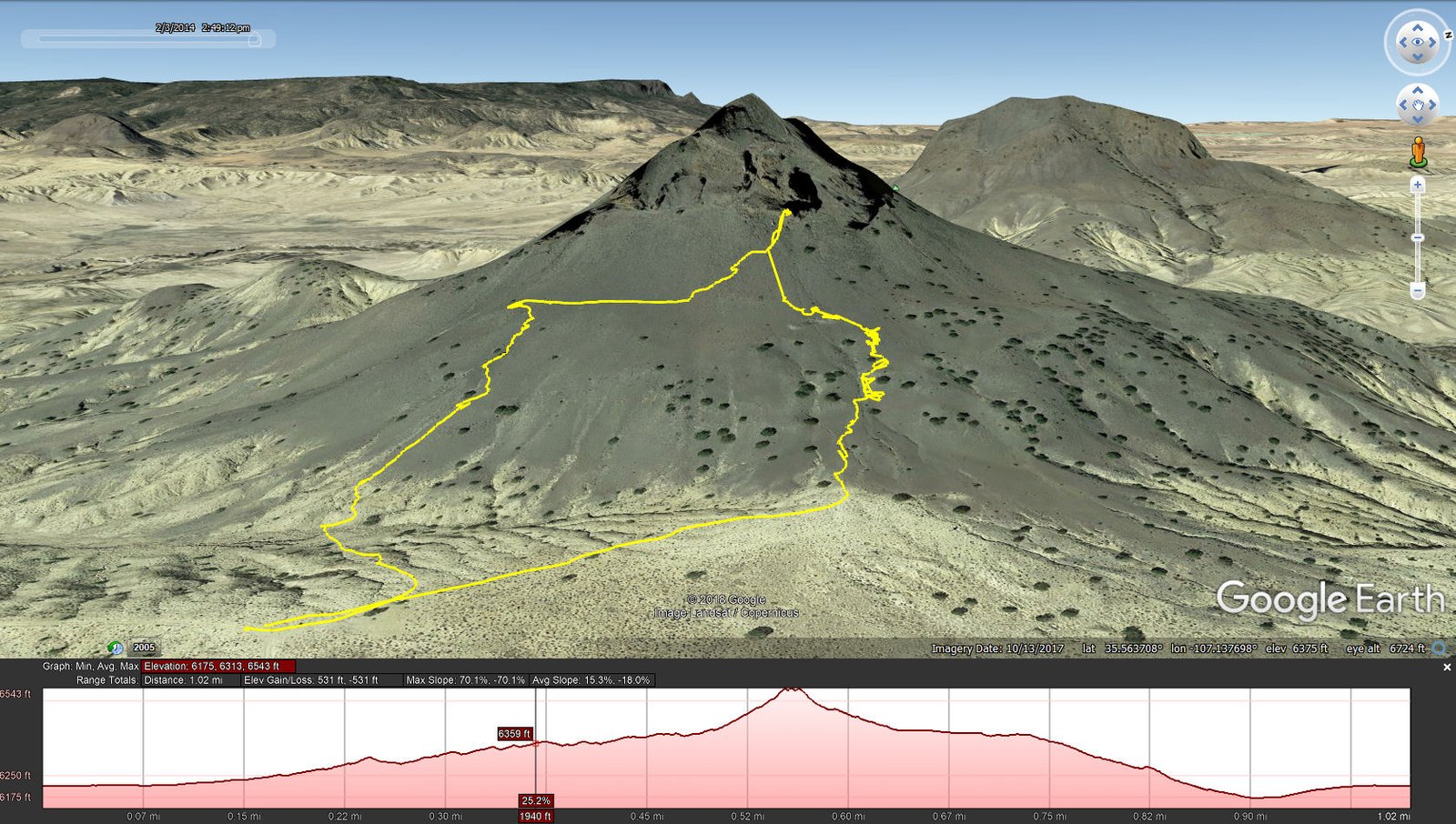
Cerro de Guadalupe Hike.Vince.2014-02-03
Vince’s objective was to look for small, clear geologic specimens (I don’t remember the name for them) that are “mined” by ants. So after leaving the car we headed towards the Cerro on the lookout for ant hills. After inspecting a couple of them, about midway up the apron of the neck we found one where, among the “tailings” of the ant hill, we found many of these specimens.
We then continued on up to apron of the neck, which is quite steep, until reaching the neck itself. Up close it is huge and sheer vertical – we were not going any further. We enjoyed a brief mid-hike break with still more wonderful views of Cabezon to the north, and Cerro Cochino and Mesa Prieta to the east. We then wandered to the southwest across the slope, then back down and to the car.
Statistics
Total Distance: 1.02 miles
Elevation: start 6,215 ft, maximum 6,543 ft, minimum 6,175 ft
Gross gain: 368 ft. Aggregate ascending 531 ft, descending 531 ft
Maximum slope: 70% ascending, 70% descending, 15% average
Duration: 2:42
| GPS Track Files for Download | |
245 Downloads | |
|---|---|
365 Downloads | |
235 Downloads | |
215 Downloads | |
I urge you to explore our hiking tracks with Google Earth. With the virtual 3-dimensional presentation, achieved by panning and tilting the view, you can get a much better idea of the hikes and terrain than you can get from the 2-dimensional screenshot above. For assistance: Using Google Earth Track Files.
References
SummitPost: Cerro de Guadalupe
New Mexico Museum of natural History & Science:
Rio Puerco/Cabezon Volcanic Necks
NM Bureau of Geology & Mineral Resources:
Cabezon Peak and the Rio Puerco Necks
Youtube: Cabezon Peak and other Volcanic Plugs of the Rio Puerco Valley
Cerro de Guadalupe is featured 20 minutes into the video


