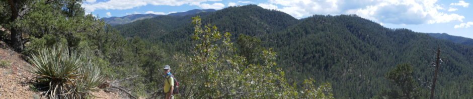
Meeting in Santa Fe these days, we’re exploring trails in the southwestern Sangre de Cristos. For this our first hike, we headed up Hyde Park Road, passing a couple of areas with cars parked alongside the road (but no trailhead evident), then stopping at the first turnout that appeared to be a trailhead. This proved to be the Chamisa Trail, #183.
The Hike
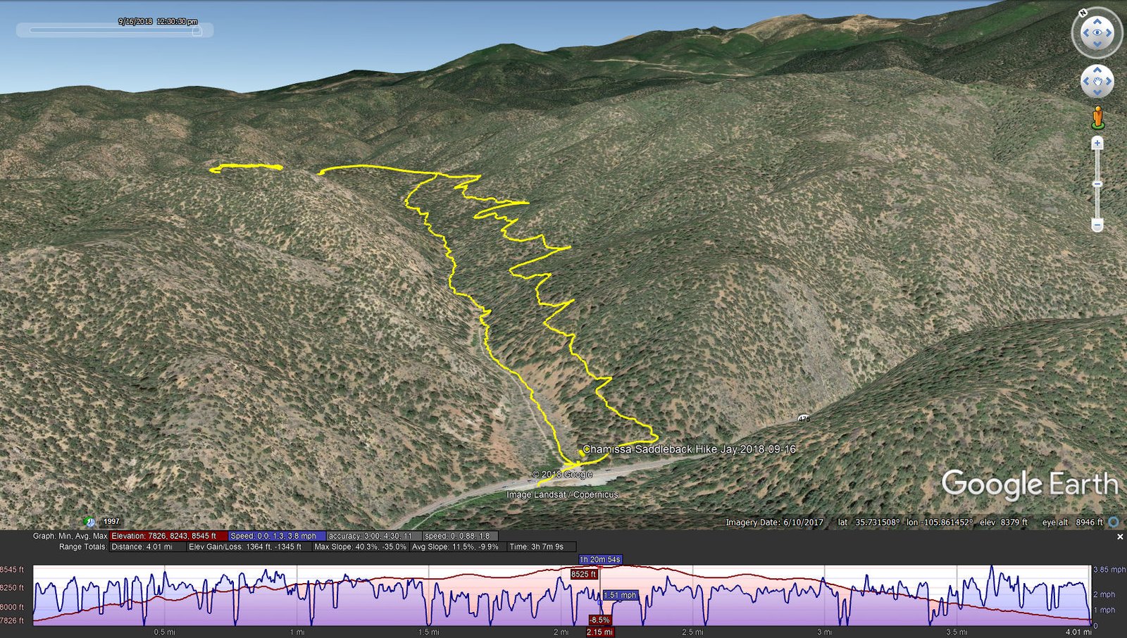
Chamisa-Saddleback Hike.Jay.2018-09-16
Just a short distance from the road we encountered a junction, where there was a sign: “Alternate Route More Difficult”. Not ready for that, we headed up to the right. Immediately we were going uphill, not steep but steady with a few switchbacks; certainly not “difficult”. Into the hike 1.5 miles, atop a ridge (the “Saddleback”?), we encountered another junction, a trail coming up the canyon from the left – we suspected that this was the other end of the “.. More Difficult” trail (confirmed later on our way down). We continued on the ridge for another 3/4 mile where, with good views from northwest to south, we took our mid-hike break. We returned to the “Saddleback” junction and decided to take the “.. More Difficult” route down through the bottom of the canyon; it was not so difficult (at least going down).
Statistics
Total Distance: 4.01 miles
Elevation: start 7,826 ft, maximum 8,545 ft, minimum 7,826 ft
Gross gain: 719 ft. Aggregate ascending 1,364 ft, descending 1,345 ft
Maximum slope: 40% ascending, 35% descending, 12% average
Duration: 3:07
| GPS Track Files for Download | |
563 Downloads | |
|---|---|
183 Downloads | |
I urge you to explore our hiking tracks with Google Earth. With the virtual 3-dimensional presentation, achieved by panning and tilting the view, you can get a much better idea of the hikes and terrain than you can get from the 2-dimensional screenshot above. For assistance: Using Google Earth Track Files.
References
USDA Forest Service: Chamisa Trail
AllTrails: Chamisa Trail
Trails.com: Chamisa Trail Loop
Santa Fe.com: Hike: the Chamisa Trail
The Hiking Project: Chamisa Trail (Lower)


