Category Archives: Santa Fe

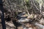
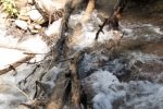
In the vicinity of Santa Fe, NM.

Spur Trail Hike – 06/17/2025

Introduction

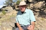
Another “back on the trail” hike, this day with my long time hiking buddy. For some weeks, he’s invited me to join him on a new trail near Santa Fe. We hit the trail a bit early, hoping it would be a bit cooler even at the higher elevation. And afterwards, as has been our habit we stopped for breakfast, this day at Pantry Dos (the best smothered breakfast burrito that I’ve eaten).

The Drive In

Getting to the Spur Trailhead is a bit convoluted. I won’t try to describe it, but use this link to GoogleMaps.

The Hike

Santa Fe, Hiking, Spur Trail
Spur Trail Hike.Jay.2025-06-17
Notes about the Google Earth screenshot: the graph at the bottom shows elevation of the track (pink area) and speed (the blue line).

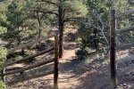
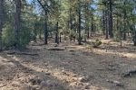
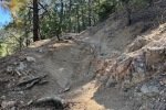
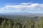
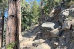
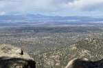
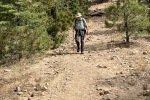
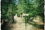
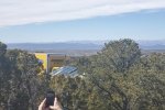
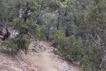
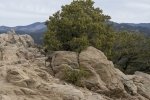
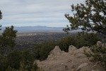
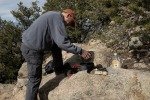
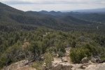
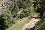
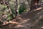
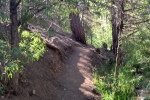
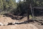
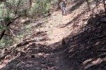
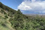
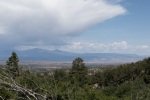
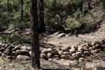
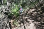
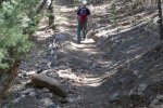
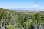
The Spur Trail is a well groomed out-and-back trail through open juniper forest (if one can call it a “forest”); we hiked the eastern portion of the trail, from Falcon Way to the Santa Fe Rail Trail and back. The trail presents a few ups-and-downs with easy slopes and only a little elevation gain overall. At the highest point one can see the mountains in every direction (except southeast): Ortiz, San Pedro, and Sandias to the southwest, Jemez to the northwest, and the Sangre de Cristo to the northeast. Oh, and some nice person has placed 4″ painted rocks marking 1 mile outbound and 2 mile return-bound – a nice touch – thanks.

Highlight

Simply being back on a hiking trail, again.

Statistics

Total Distance:   3.03 miles
Elevation: start  6,652 ft, maximum  6,847 ft,  minimum  6,741 ft
Gross gain:  106 ft.  Aggregate ascending 307 ft, descending 307 ft
Maximum slope: 13% ascending, 13% descending, 03% average
Duration: 1:31, Average Speed: 2.9 mph

GPS Track Files for Download
11 Downloads
8 Downloads
If you haven’t explored these hiking tracks with Google Earth, I urge you to try it. With the virtual 3-dimensional presentation, achieved by panning and tilting the view, you can get a much better idea of the hikes and terrain than you can get from the screenshot above. For some ideas, check out  Using Google Earth Track Files.

References and Resources

AllTrails: Spur Trail from Rancho Viejo to Santa Fe Rail Trail

Atalaya Trail Hike – 10/10/2023

Atalaya Mountain Trail has been on the list for both of us; it is a good hike this time of year (hot in summer, icy and snowy in winter).

The Drive In

The Atalaya – Upper Trailhead is uphill from St John’s College. (There is an Atalaya -Lower Trailhead.) From Old Santa Fe Trail in front of the National Park Service offices, go north on Camino Del Monte Sol, the right (east) on Camino De Cruz Blanca. Just past where it makes a hard right turn onto Wilderness Gate Road, you will find a small parking area on the left; part there. Or, retrace back on Camino De Cruz Blanca; perhaps there will be a parking space at the Dorothy Stewart Trailhead. Otherwise, ????.

The Hike

Atalaya Trail Hike.Jay.2023-10-10
Notes about the Google Earth screenshot: the graph at the bottom shows elevation of the track (pink area) and speed (the blue line).

From the parking spaces, walk down Wilderness Gate Road, turn left and pass around a gate into the residential neighborhood. From there .. this hike “gets right to it”.. continue up Camino De Cruze Blanca. A third of a mile on climb the Steep Steps onto the Atalaya Trail #170. The first few hundred yards of the trail is a nice wide sand trail, a steady but easy climb. But further on the trail gets quite steep, often with a very rocky surface – quite challenging.

Just short of a mile from parking, we encountered a sign: STEEPER ROUTE to the left, EASIER ROUTE to the right. Looking at the tracks we chose the shorter  route, the STEEPER ROUTE. And was it STEEPER, over rocks and tree roots most of the way to where the EASIER ROUTE rejoined the main trail. We planned to take the latter on the way down.

From there the trail continued to be steep with a rocky surface with only a few respites of not-so-steep-and-rocky surface until the 2 mile point in the hike. Here we attained the ridge; after a sharp turn to the left, the trail led to the peak of Atalaya Mountain (continuing to climb though not so steep).

There were great views to the north, south, and west as we climbed up the trail. But the view from near the top was the best, with Santa Fe laid out below and the Jemez Mountains in the distance. After a break for a snack lunch, we headed back down, choosing to take the EASIER ROUTE – although longer by 3/4 mile, it was a much better (EASIER) trail.

Jay here: The first time I attempted this hike was about 3 years ago. We started down at the St. Johns Campus which is the longer route for this hike. You walk up a wide arroyo before getting to where we started on this most recent hike. Naj and I made it all the way up to where the signs are for Steeper and Easier, but the trail was icy and snow covered, forcing us to turn back. Having now experienced the narrow and rocky switchbacks up near the summit, I’m glad we did not try to do this hike in icy conditions. Just to emphasize, by steeper they mean STEEP. When the hike was completed, George said he did it because he thought I could do it. To which I said, “really? I did it because I thought you could do it.” That’s hiking in New Mexico for you.

Statistics

Total Distance:   5.09 miles
Elevation: start  7,554 ft, maximum  8,992 ft,  minimum  7,553 ft
Gross gain:  1,438 ft.  Aggregate ascending  1,753 ft, descending  1,753 ft
Maximum slope: 34% ascending, 34% descending, 12.0% average
Duration: 3:55 , Average Speed: 1.3 mph

GPS Track Files for Download
364 Downloads
157 Downloads
If you haven’t explored these hiking tracks with Google Earth, I urge you to try it. With the virtual 3-dimensional presentation, achieved by panning and tilting the view, you can get a much better idea of the hikes and terrain than you can get from the screenshot above. For some ideas, check out  Using Google Earth Track Files.

Related Posts

Hikes Around Santa Fe

References and Resources

AllTrails: Atalaya Mountain Trail (starts at the Lower Trailhead)
GAIA GPS
      Atalaya Mountain Via Atalaya Trail
      Atalaya Mountain LoopVia Atalaya Trail And Dale Ball Trails
Hiking Project: Atalaya Mountain Trail (#170)
SummitPost: Atalaya Mountain
Fatmap: Atalaya Mountain Loop
Only in Your State: Atalaya Mountain Trail Is An Easy Hike …


Dale Ball Trail Hike – 04/23/2023
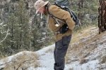
I joined Jay in Santa Fe for a quick day hike followed by a good beer at his place.

The Drive In

Drive up Hyde Park Road (NM 475) from Santa Fe to the Sierra del Norte Trailhead; there is a parking lot on the left of the road

The Hike

Dale Ball Trail Hike.Jay.2023-04-23
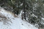
Notes about the Google Earth screenshot: the graph at the bottom shows elevation of the track (pink area) and speed (the blue line).

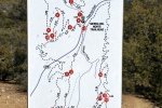
This hike was basically a clockwise loop from the Sierra del Norte Traihead: cross the road and bear left from Junction 13, then make sharp right turn towards Junction 14 where we turned left towards Junction 15. It was then 16, 22, 23, 25, 26, and 27, the southeast corner of the loop. heading west and north to 24, then 20, 18, 12, and back to 13 and the parking lot. (I just follow Jay’s lead through this maze of trails.)

Dale Ball trails are well used, involve some “ups and downs”, and have generally an easy trail surface. There are some short steep stretches and at times the trail is on a steep slope, just right for some good exercise (distance and climb & descents) and balance on those side-hill sections. But any of this web of trails in the Dale Ball make a good workout and typical New Mexico through scrubby juniper/piñon pine “forest”.

Statistics

Total Distance:   3.38 miles
Elevation: start  7,580 ft, maximum  7,777 ft,  minimum  7,486 ft
Gross gain:  291 ft.  Aggregate ascending  702 ft, descending  700 ft
Maximum slope: 21% ascending, 19% descending, 6.8% average
Duration: 1:57

GPS Track Files for Download
75 Downloads
66 Downloads
If you haven’t explored these hiking tracks with Google Earth, I urge you to try it. With the virtual 3-dimensional presentation, achieved by panning and tilting the view, you can get a much better idea of the hikes and terrain than you can get from the screenshot above. For some ideas, check out  Using Google Earth Track Files.

Related Posts

Dale Ball Trails – Dorothy Stewart Trail Extended – 11/16/2022
Dale Ball Trails Hike – 08/25/2021
Nature Conservancy-Dale Ball Trails Hike – 02/26/2021
Dale Ball Loop North Trail Hike – 05/23/2019
Hiking in the Santa Fe area

References and Resources  (** – recommended)

Santa Fe Conservation Trusts: Dale Ball Trail System
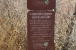
City of Santa Fe: Dale Ball Trails Map (pdf)
** Santa Fe County: Santa Fe Foothill Trails Map – 9/2018 (PDF)
AllTrails: Dale Ball Central Loop
Hiking Project: South Dale Ball Trails
Wikipedia: Dale Ball Trails
Inn on the Alameda: Eyes on the Ground: Hiking the Dale Ball Trails

Dale Ball Trails – Dorothy Stewart Trail Extended – 11/16/2022
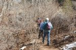
‘Tis great to go hiking with Jay again, this time on one of the Dale Ball Trails on the outskirts of Santa Fe – Dorothy Stewart Trail, with extension.

The Drive In

The trailhead is on Camino De Cruz Blanca – I’m not one to give directions for navigating around Santa Fe, Jay navigates thereabouts. So I’m going to leave you with – use your favorite driving navigation tool, and follow that.

The Hike

Dale Ball Trails – Dorothy Stewart Trail Extended.Jay.2022-11-16
Notes about the Google Earth screenshot: the graph at the bottom shows elevation of the track (pink area) and speed (the blue line).

  The Dale Ball trails are really great, used heavily by locals, afoot and sometimes on bikes. So they are well defined, easy to traverse (even tho’ the elevation gains and slope can be large in some places). There are great maps for download, and the maps are posted at the trailheads and major intersections of the trails.

The Dorothy Stewart Trail is a loop of about 1.6 miles in length. We opted to follow trails beyond the DST to get added distance. From the elevation profile above, you can see the changes in elevation in the trail. The first mile and half, down then up then down again, were easy going. Then the climb in the next mile is a bit strenuous (’tis the first challenging elevation change that I’ve seen in many weeks of waling around Albuquerque). From the top ’tis an easy downhill return to the trailhead (the last half mile or so down a gated residential street).

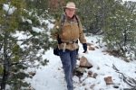
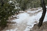
For our hike this day, we bundled up for the 30 degree temperatures (fortunately with no wind to make it -cold-). We started in sunshine but clouds soon moved in and snow flurries soon followed; that continued until we neared the finish line. For much of the trail we hiked through 1″ to 4″ of recently fallen snow – it had not melted so we saw ice in only one section. Otherwise, except for a couple of very steep sections, footing was sound with only our hiking boots.

Statistics

Total Distance:   3.55 miles
Elevation: start  7,550 ft, maximum  7,845 ft,  minimum  7,290 ft
Gross gain:  655 ft.  Aggregate ascending  929 ft, descending  929 ft
Maximum slope: 31% ascending, 27% descending, 9.0% average
Duration: 2:25

GPS Track Files for Download
48 Downloads
120 Downloads
If you haven’t explored these hiking tracks with Google Earth, I urge you to try it. With the virtual 3-dimensional presentation, achieved by panning and tilting the view, you can get a much better idea of the hikes and terrain than you can get from the screenshot above. For some ideas, check out  Using Google Earth Track Files.

Related Posts

Dale Ball Trails Hike – 08/25/2021
Nature Conservancy-Dale Ball Trails Hike – 02/26/2021
Dale Ball Loop North Trail Hike – 05/23/2019
Hiking in the Santa Fe area

References and Resources

Santa Fe Conservation Trust: Dale Ball Trails
AllTrails: Camino Cruz Blanca to Dal Ball Trails Loop
                    The north extension is Dorothy Stewart
                   Dorothy Stewart Trail
Only in Your State: … Dorothy Stewart Trail

Nature Conservancy-Dale Ball Trails Hike – 02/26/2021

For this hike we joined Jay and Nancy for a hike in their neighborhood in Santa Fe, in the Dale Ball Trails. This is their territory – one of their daily routes.

The Drive In

The trailhead for this hike is just off of Upper Canyon Road, turn left on Cerro Gordo Road, then right into the parking lot of The Nature Conservatory.

The Hike

Nature Conservancy-Dale Ball Hike.PatJayNancy.2012-02-26

The Cerro Gordo Trailhead is at the far end of the parking lot. The trail starts out in the open, on a two-track, along the south side of the Santa Fe River and the Twomile Reservoir. Some 600 yards on, the trail enters a dense thicket of small trees typical of those along a river. Another 600 yards on the trail does a 180° turn to cross the river bottom and heads west along a trail above the river bottom and lake (now mostly dry, only a small area of water).

Abreast of the lake, we turned a sharp right to proceed in a northerly direction, now on a trail among juniper and piñon trees. About 250 yards on, we found ourselves at  intersection #28 on the Dale Ball Trails map. We turned to the right, beginning a climb of some 300 feet. Like nearly all the Dale Ball Trails, it is easy to hike on (and popular for biking). After a couple of switchbacks, we reached the intersection #25 where we turned right and continued on to intersection #22 (the highest elevation on the hike). From here we turned left to make a loop back to #23 and on downhill to #25 where we continued straight ahead to #26, then #27 and along Cerro Gordo Road to the parking lot.

Statistics

Total Distance:  3.78 miles
Elevation: start  7,325 ft, maximum  7,692 ft,  minimum 7,285 ft
Gross gain: 407 ft.  Aggregate ascending 803 ft, descending 805 ft
Maximum slope: 20% ascending, 21% descending, 6,8% average
Duration: 2:57

GPS Track Files for Download
0 Downloads
84 Downloads
If you haven’t explored these hiking tracks with Google Earth, I urge you to try it. With the virtual 3-dimensional presentation, achieved by panning and tilting the view, you can get a much better idea of the hikes and terrain than you can get from the screenshot above. For some ideas, check out  Using Google Earth Track Files.

Related Posts

Dale Ball Loop North Trail Hike – 05/23/2019
Other trails around Santa Fe

References and Resources

Santa Fe Conservation Trusts: Dale Ball Trail System
City of Santa Fe: Dale Ball Trails Map (pdf)
AllTrails: Dale Ball Trails North
Broken Spoke Santa Fe: Dale Ball Trails & Foothill Trails

Dale Ball Trails Hike – 08/25/2021

I joined Jay in Santa Fe for a quick day hike in the Dale Ball Trails.

The Drive In

Head east on Hyde Park Road, turn left on Sierra Del Norte. We parked alongside the road a half mile from Hyde Park Road.

The Hike

Dale Ball Trails Hike.Jay.2021-08-25

The hike is on well used trails, smooth with occasional rocky sections. From the trailhead the trail ascends gradually for nearly a mile, from 7,555 ft to 7,830 ft. It proceeds through a juniper forest with a few piñon pines scattered among the junipers. Along the way there are signs at intersections of trails, quite helpful since there are many trails in these Dale Ball Trails.

From the top of the ridge, the trail descends back down to about 7,580 feet, where it crosses Sierra Del Norte road. Following a few yards from the road, it again ascends, this time to about 7,700 feet, then descends back to the parking, again the slopes are gradual. This makes a great short hike, close to Santa Fe, with some good views across the city.

Statistics

Total Distance:  2.23 miles
Elevation: start  7,565 ft, maximum  7,830 ft,  minimum 7,565 ft
Gross gain: 315 ft.  Aggregate ascending 508 ft, descending 507 ft
Maximum slope: 26% ascending, 25% descending, 7.8% average
Duration: 1:17

GPS Track Files for Download
211 Downloads
59 Downloads
If you haven’t explored these hiking tracks with Google Earth, I urge you to try it. With the virtual 3-dimensional presentation, achieved by panning and tilting the view, you can get a much better idea of the hikes and terrain than you can get from the screenshot above. For some ideas, check out  Using Google Earth Track Files.

Related Posts

Nature Conservancy-Dale Ball Trails Hike – 02/26/2021
Dale Ball Loop North Trail Hike – 05/23/2019
Other trails around Santa Fe

References and Resources

Santa Fe Conservation Trusts: Dale Ball Trail System
City of Santa Fe: Dale Ball Trails Map (pdf)
AllTrails: Dale Ball Trails North
Broken Spoke Santa Fe: Dale Ball Trails & Foothill Trails

Picacho Peak Trail Hike – 11/10/2019

With just a short day for hiking, we remained close to Santa Fe, and continued our exploration of the Dale Ball Trails; it is quite nice having many nice trails so close. Embarked on one new to us – the Picachco Peak trail.

The Drive In

The trail begins at the Cerro Gordo Trailhead: proceed up Upper Canyon Rd, turn left on Cerro Gordo Rd for the parking lot. Cross Upper Canyon Rd for the start of the trail.

The Hike

Picacho Peak Trail Hike.Jay.2019-11-10

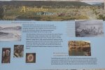
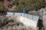
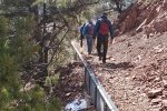
The start of the trail passes through private property so stay on it. It is a well used trail and is easy .. to follow and to tread upon.Some 700 feet into the hike the trail takes to the top of a high berm, what appears to be the downhill edge of an acequia. Along the way we encountered a sign that explained some history of this “Hydropower Ditch”. The trail then turns into an arroyo and begins the climb towards Picacho Peak. It is a reasonably steady climb, rising the 1,210 feet in 2 miles; up the arroyo, over a ridge and across another arroyo, then up a ridgeline to the peak.

The trail is in good condition throughout; only a few sections that are steeper over large rocks. A couple of places where the trail topped a ridge, the views across Santa Fe to the Jemez Mountains were great (‘tho haze restricted the scenic-ness of the views on this day). This should be a great trail for winter hiking (avoiding recent snowfall), but is quite exposed and I expect it would be hot in the summertime.

Jay here: This was my second time on this trail, but the first time all the way to the peak. It’s pronounced pea-ka-cho, by the way, and it’s really a gem for it to be so close to Santa Fe. There are many more variations to the trail within the Dale Ball system, so you can make it a more lengthy and challenging hike if you so desire. I was fine with the length just the way it was.

Statistics

Total Distance:  3.88 miles
Elevation: start  7,318 ft, maximum  8,528 ft,  minimum  7,318 ft
Gross gain:  1,210 ft.  Aggregate ascending  1,865 ft, descending  1,876 ft
Maximum slope: 62% ascending, 59% descending, 15.7% average
Duration: 3:14

GPS Track Files for Download
113 Downloads
111 Downloads
I urge you to explore our hiking tracks with Google Earth. With the virtual 3-dimensional presentation, achieved by panning and tilting the view, you can get a much better idea of the hikes and terrain than you can get from the 2-dimensional screenshot above. For assistance: Using Google Earth Track Files.

References and Resources

Santa Fe County: Foothill Trails (pdf)
AllTrails: Pichaco Peak Trail
SkyAboveUs: Great Hikes: Picacho Peak, Sante Fe, New Mexico
Inn on the Alameda: The Dale Ball Trails: Picacho Peak

Little Tesuque-Carol’s-Juan Trails Hike – 06/16/2019

Another hike near Santa Fe (thus, having a new tag: Urban for hikes easily accessible for folks living in the city). This makes a quite nice loop, with easy trail surfaces and moderate elevation changes and slopes. It begins along the Little Tesuque Creek, which on this day had a very nice flow making this first half mile or so very pleasant – the burbling stream, many grasses and flowers, and shade from the ponderosa and other trees.

The Hike

Little Tesuque-Carol’s-Juan Trails Hike.Jay.2019-06-16

About .2 mile down the canyon we encountered a Y in the trail, we “took it” – to the left, continuing on down Tesuque Creek. At the half mile point we turned right/uphill onto Carol’s Trail – no stream here and a climb up to the boundary between Dale Ball Open Spaces and the Santa Fe National Forest. From there the trail remains on the ridgetop until a quick descent into Tesuque Creek and the Winsor Trail (1.8 miles into the hike).

We chose a spot along the fast-flowing Tesuque Creek for our mid-hike break, close to the stream (flowing over rocks: noisy). A few yards up the Creek we turned onto Juan Trail to head back to the trailhead. Juan Trail proceed up (Juan?) Canyon for a mile, then climbs quickly onto a ridge.  From there it descends gently back to it’s junction with the Little Tesuque Trail/Creek; from there proceed upstream to the trailhead on Hyde Park Road.

This is one of many really great hikes near Santa Fe. Four miles, 600 ft elevation (‘tho more than 1000 feet ups/downs), two creeks offering shade. Better to go early in the day because some of the trail is on ridgetops where the sun will make it feel hot.  Enjoy.

Statistics

Total Distance:  3.94 miles
Elevation: start  7,536 ft, maximum  7,852 ft,  minimum  7,508 ft
Gross gain:  621 ft.  Aggregate ascending  1.132 ft, descending  1,134 ft
Maximum slope: 41% ascending, 33% descending, 9.3% average
Duration: 3:27

GPS Track Files for Download
97 Downloads
116 Downloads
If you haven’t explored these hiking tracks with Google Earth, I urge you to try it. With the virtual 3-dimensional presentation, achieved by panning and tilting the view, you can get a much better idea of the hikes and terrain than you can get from the screenshot above. For some ideas, check out  Using Google Earth Track Files.

References

USDA Forest Service: Juan Trail #399
Arcgis: Santa Fe County Trails (a Very Good interactive map)
Southern New Mexico Explorer: Juan Trai l(FT 399), Winsor Trail (FT 254)

Bear Wallow-Winsor-Borrega Trails Hike – 06/02/2019

Ok, so we’ve hiked this before. Not much has changed, except this time we went around the loop in the clockwise direction and we didn’t extend the hike as far up Tesuque Creek.

The Hike

Bear Wallow-Winsor-Borrega Hike.Jay.2019-06-02


Statistics

Total Distance:  4.9 miles
Elevation: start  8,887 ft, maximum  8,893 ft,  minimum  8,203 ft
Gross gain:  690 ft.  Aggregate ascending  1,566 ft, descending  1,578 ft
Maximum slope: 32% ascending, 29% descending, 9.9% average
Duration: 3:34  

GPS Track Files for Download
216 Downloads
217 Downloads
I urge you to explore our hiking tracks with Google Earth. With the virtual 3-dimensional presentation, achieved by panning and tilting the view, you can get a much better idea of the hikes and terrain than you can get from the 2-dimensional screenshot above. For assistance: Using Google Earth Track Files.

References: See earlier hike – Borrego-Winsor-Bear Wallow Hike – 7/29/2018

Rio en Medio Trail Hike – 05/26/2019

Hiking again close to Santa Fe, this time driving around through Tesuque to En Medio and the Rio en Medio Trail #163.

The Drive In

As it was for our Little Tesuque Creek hike, the trailhead is near the end of a road going up a narrow canyon with private property all along. And on a Sunday it is crowded and the limited parking was dictated that we park some distance from the trailhead.  We found a place alongside the road but out of the way of other cars about .4 miles from the trailhead.

The Hike

Rio en Medio Hike.Jay.2019-05-26

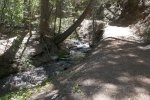
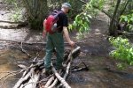
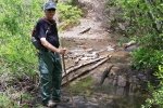
At the trailhead we found a sign providing an excellent introduction to the trail, and a warning about respecting private property. Once on the trail we were accompanied throughout by the sound of the burbling Rio en Medio. The Rio also led to a few crossings as the trail went from one side to the other; fortunately rock and logs afforded a dry fording. All along we passed through oak and other trees and shrubs which made the setting most pleasant.

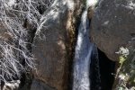
This trail is known for it’s waterfalls, two larger ones in particular. The smaller made for a nice spot to have our mid-hike break. The larger and according to other’s descriptions the more impressive required  some wading up the stream, for which we were not prepared.  So we didn’t approach it but instead climbed up the steep rocky trail to get above the falls. I was able to get a glimpse of them, enough for a camera shot from the edge of a 40′ cliff above them.

‘Tis a really  nice trail, easy trekking and quite pleasant with the stream at hand. And it would appear to have possibilities for a one-way hike over to the Borrega Trail #150 and the Aspen Cabin Trailhead (per Forest Service map).

Jay here: Interesting that there were vehicles at trailhead from Colorado, Texas and Utah. Must be the lure of the waterfalls and some widespread write-ups about this particular hike. Also significant, this hike is a good ways from Santa Fe and yet the trail comes very close to the Borrego trail that you reach from the other side of Santa Fe heading east up Hyde Park Road. You have to look at it from Google Earth or the above referenced Forest Service map to appreciate how that’s possible. With the heavy snowpack and winter rains, the water was flowing heavy and fast, unlike many preceding years of drought conditions. This would make a great Fall hike.

Statistics

Total Distance:  4.69 miles
Elevation: start  7,209 ft, maximum  7,959 ft,  minimum  7,205 ft
Gross gain:  754 ft.  Aggregate ascending  1,454 ft, descending  1,445 ft
Maximum slope: 31% ascending, 27% descending, 8.5% average
Duration: 3:24

GPS Track Files for Download
101 Downloads
303 Downloads
I urge you to explore our hiking tracks with Google Earth. With the virtual 3-dimensional presentation, achieved by panning and tilting the view, you can get a much better idea of the hikes and terrain than you can get from the 2-dimensional screenshot above. For assistance: Using Google Earth Track Files.

References

USDA Forest Service: Rio En Medio Trail #163
AllTrails:
    Lower Rio en Medio Trail   
    Rio En Medio Falls
Hiking Project: Rio en Medio
The Trails of Jeff and Charli: Lower Rio en Medio Trail – Santa Fe, NM
DougScott Art: Little Chasm Falls
OhRanger: Trail 163, Rio En Medio Trail
Inn on the Alameda: The Rio En Medio Trail