Hiking again close to Santa Fe, this time driving around through Tesuque to En Medio and the Rio en Medio Trail #163.
The Drive In
As it was for our Little Tesuque Creek hike, the trailhead is near the end of a road going up a narrow canyon with private property all along. And on a Sunday it is crowded and the limited parking was dictated that we park some distance from the trailhead. We found a place alongside the road but out of the way of other cars about .4 miles from the trailhead.
The Hike
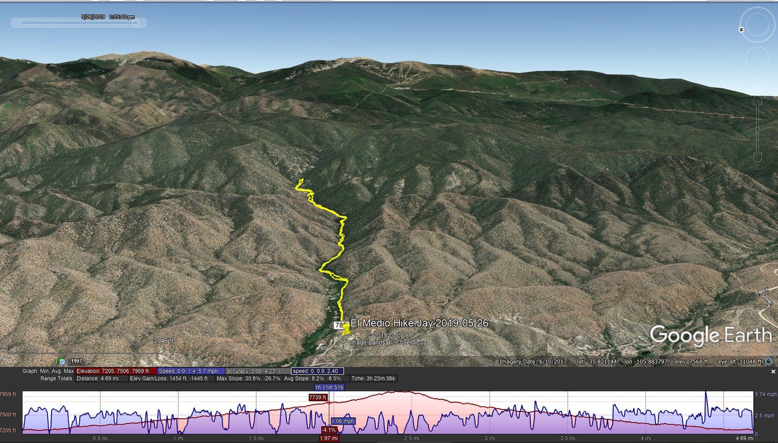
Rio en Medio Hike.Jay.2019-05-26
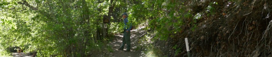
 At the trailhead we found a sign providing an excellent introduction to the trail, and a warning about respecting private property. Once on the trail we were accompanied throughout by the
 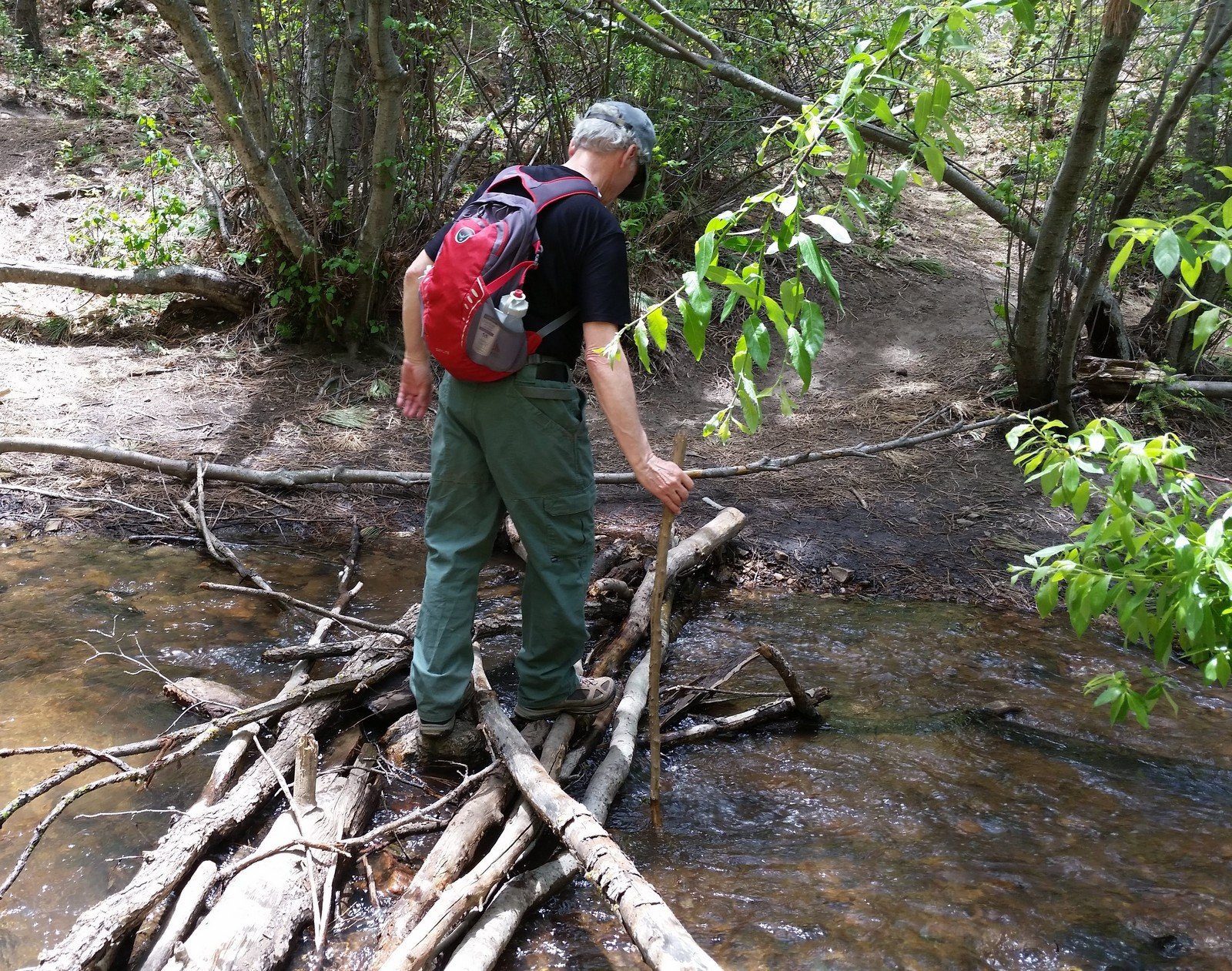 sound of the burbling Rio en Medio. The Rio also led to a few crossings as the trail went from one side to the other; fortunately rock and logs afforded a dry fording. All along we passed through oak and other trees and shrubs which made the setting most pleasant.
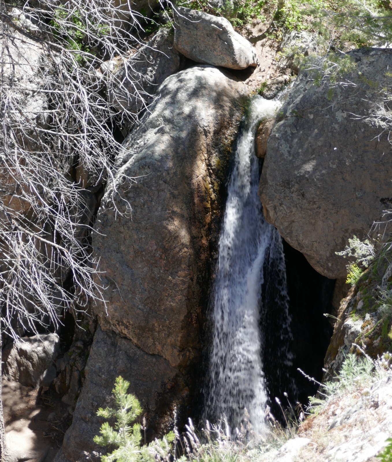
This trail is known for it’s waterfalls, two larger ones in particular. The smaller made for a nice spot to have our mid-hike break. The larger and according to other’s descriptions the more impressive required some wading up the stream, for which we were not prepared. So we didn’t approach it but instead climbed up the steep rocky trail to get above the falls. I was able to get a glimpse of them, enough for a camera shot from the edge of a 40′ cliff above them.
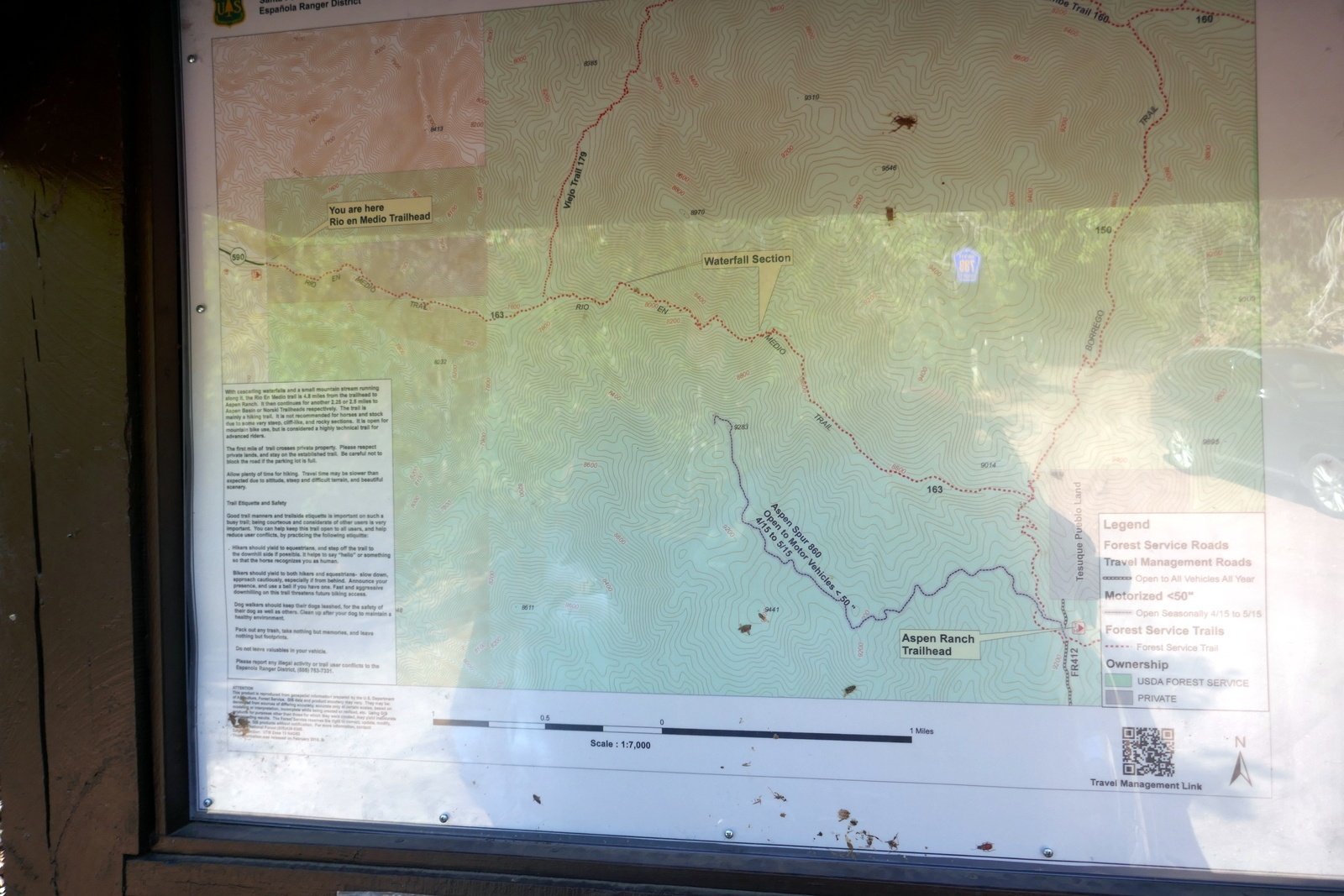
‘Tis a really nice trail, easy trekking and quite pleasant with the stream at hand. And it would appear to have possibilities for a one-way hike over to the Borrega Trail #150 and the Aspen Cabin Trailhead (per Forest Service map).
Jay here: Interesting that there were vehicles at trailhead from Colorado, Texas and Utah. Must be the lure of the waterfalls and some widespread write-ups about this particular hike. Also significant, this hike is a good ways from Santa Fe and yet the trail comes very close to the Borrego trail that you reach from the other side of Santa Fe heading east up Hyde Park Road. You have to look at it from Google Earth or the above referenced Forest Service map to appreciate how that’s possible. With the heavy snowpack and winter rains, the water was flowing heavy and fast, unlike many preceding years of drought conditions. This would make a great Fall hike.
Statistics
Total Distance: 4.69 miles
Elevation: start 7,209 ft, maximum 7,959 ft, minimum 7,205 ft
Gross gain: 754 ft. Aggregate ascending 1,454 ft, descending 1,445 ft
Maximum slope: 31% ascending, 27% descending, 8.5% average
Duration: 3:24
| GPS Track Files for Download | |
202 Downloads | |
|---|---|
421 Downloads | |
I urge you to explore our hiking tracks with Google Earth. With the virtual 3-dimensional presentation, achieved by panning and tilting the view, you can get a much better idea of the hikes and terrain than you can get from the 2-dimensional screenshot above. For assistance: Using Google Earth Track Files.
References
USDA Forest Service: Rio En Medio Trail #163
AllTrails:
Lower Rio en Medio Trail
Rio En Medio Falls
Hiking Project: Rio en Medio
The Trails of Jeff and Charli: Lower Rio en Medio Trail – Santa Fe, NM
DougScott Art: Little Chasm Falls
OhRanger: Trail 163, Rio En Medio Trail
Inn on the Alameda: The Rio En Medio Trail


