After traveling to Idaho, then around Taos, we were closer to home. The Pecos River has some great trails into the southern end of the Sangre de Cristo mountains. Having checked out a few of them (see Related Posts below), we chose to go up Cave Creek.
The Drive In
For those who are headed to this area for the first time, some description may be helpful. Take I-25 east from Santa Fe to the exit for Glorieta and Pecos-NM 50 (this is about 90 miles from Albuquerque). After crossing over I-25, turn right; in about 6 miles, turn left at the stop sign onto NM 63 through the very old village of Pecos. From here it about 20 miles to Cowles, a placename at the end of NM 63 and the entrance to Forest Service campgrounds and hiking trails. This road, paved the whole way, is relatively open at the beginning but gradually narrows and winds more as you ascend the cañon. This will take you 45 minutes or more during which you will climb from 6,900 feet at Pecos to 8,100 feet at Cowles. Along the way you will pass many pullouts and parking areas as well as 3 NM State Parks that provide access to the river for fishing. It’s a beautiful drive; take your time to enjoy it.
You will recognize that you are at Cowles when you see a bridge on your left that crosses the Pecos River – take it. A few yards on, turn right onto Panchuela Road; follow it to the end, where you will find a small ‘primitive’ camping area. The trailhead for the Cave Creek trail is just beyond a parking lot (Dockweiler trail explained below).
The Hike
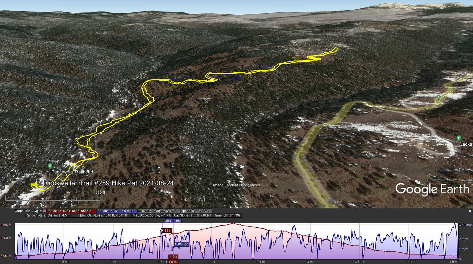
Dockweiler Trail #259 Hike.Pat.2021-08-24
We came intending to hike up the Cave Creek trail. Off to a good start, the trail is well used, easy to follow up above the creek, not much elevation gain. For part of this section of trail there is an alternate route, indicated for horses, that follows closer to the creek. At .9 miles we came upon the junction with the Dockweiler Trail; we chose to take it anticipating that in going uphill, we might get to higher and open spaces to take in more vista views.
The trail continued to be easy going, climbing steadily ‘tho not steep, with a few switchbacks, in open forest. We went out another 1.6 miles, and still had more to go it seemed before we would find vista views. This having made or usual 4-5 mile hike, we paused for our mid-hike break/snack, then headed back to parking. Once down near the river, we opted to take that ‘horse alternate’. At first is was nice to be close to the burbling creek, but soon enough the trail got squeezed next to the stream and became a lot like bushwhacking – we wished we had stayed on the main trail.
Highlight
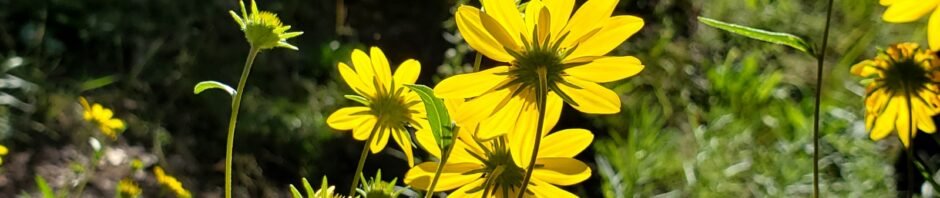
We’re repeatedly amazed at the vibrant colors of the flowers and other growing things in the New Mexico mountains. This year’s strong monsoon season brought out the flowers, their many colors, shapes, patterns, textures, etc. I’m simply unable to pass by them without capturing photos. I hope you enjoy them below.
Statistics
Total Distance: 4.5 miles
Elevation: start 8,350 ft, maximum 9,555 ft, minimum 8,334 ft
Gross gain: 1,221 ft. Aggregate ascending 1,546 ft, descending 1,546 ft
Maximum slope: 36% ascending, 42% descending, 11.2% average
Duration: 5:11
| GPS Track Files for Download | |
177 Downloads | |
|---|---|
400 Downloads | |
If you haven’t explored these hiking tracks with Google Earth, I urge you to try it. With the virtual 3-dimensional presentation, achieved by panning and tilting the view, you can get a much better idea of the hikes and terrain than you can get from the screenshot above. For some ideas, check out Using Google Earth Track Files.
Related Posts
Rio Mora Hike – 09/29/2020
Beatty’s Trail Hike – 07/02/2020
Iron Gate Campground-Monte Vista Trail Hike – 05/21/2020
Iron Gate Road HIke – 05/13/2020
Rio Mora Hike – 05/08/2020
Holy Ghost Trail Hike – 04/11/2018
References and Resources
USDA Forest Service: Cave Creek Trail #288
Dockweiler Trail #259
Panchuela Campground
AllTrails: Cave Creek Trail
Dockweiler Trail
OhRanger: Trail 259 Dockweiler Trail
Inn on the Alameda: The Pecos Wilderness and the Cave Creek Trail


