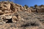
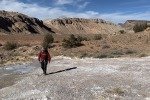
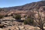
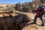
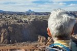
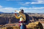
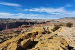
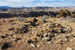
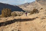
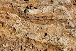
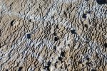
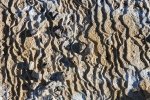
This is our first venture in the new year, returning to the Ojito Wilderness, one of our favorite areas. At the top of our list has been to explore the canyon below Dragon’s Back ridge. Looking down into the canyon from atop Dragon’s Back, there are many interesting feature, colors, and formations. So we went exploring.
The Drive In
Plan A: Our first plan was to enter through a gate just off of US 550 northwest of the north end of the canyon. The gate is on the left 4.9 miles from San Ysidro (the intersection of US 550 and NM 14). The gate hasn’t been locked and is an entrance to BLM land.
 Parking not far inside the gate (disregarding the 2-track that continues) we had anticipated that we would need to hike a half mile or so to reach the north end of Dragon’s Back from where we would enter into the canyon. However, this plan was foiled by the Rio Salado. There was some water flowing in it and we did not see a place where we could cross the water, and with the water present the wide creek bottom was very ‘mushy’. So we abandoned this plan.
Plan B: On a previous visit to the Ojito we had driven some distance on a 2-track paralleling the west side of Dragon’s Back; we hoped to be able to drive far enough to be close to that northern end of the ridge, then hike around into the canyon.

The red line is the DriveIn route from US 550 and Cabezon Road to the White Ridge Bike Trails and up the 2-track to where we began our hike (in yellow).
Note: Click on image to see full screen; [Back] on your browser to return to this page.
- We returned to US 550, went back through San Ysidro, then turned right onto Cabezon Road (2.3 miles from the junction of US 550 and NM 4 in San Ysidro). Not far from 550 there is a Y in the road – take the leg to the left (the other one goes up to the mine atop White Mesa).
- Then continued on Cabezon Road; a quarter mile beyond parking for the White Mesa Bike Trails, we turned right again, onto the 2-track towards the north end of Dragon’s Back. We parked before going round the Back, next to a shack returning to earth.
This plan worked; the 2-track is well used, easy enough for the Tacoma (‘tho a couple of spots might be difficult without the Tacoma’s high clearance).
The Hike
Notes about the Google Earth screenshot: the graph at the bottom shows elevation of the track (pink area) and speed (the blue line).
From our parking spot just off of the 2-track (near a dilapidated building) and close to the northwest corner of Dragon’s Back, we continued afoot on the 2-track to round the north end of the ridge. Along the way we looked down upon the Rio Salado – we still were unable to see a place where we could have crossed per Plan A.
 Shortly beyond where the view into the Canyon opened up, we left the 2-track and followed a well used bike trail, one of the nicest trail surfaces one can find. We followed the bike trail for close to a mile. Uncertain where the trail went from there, and wishing to stay in the Canyon below Dragon’s Ridge, we went off-trail remaining to the west of the central ridge in the Canyon. Tho off trail, it was hardly bushwhacking – rocky, gravel, in some places dirt; a few ups-and-downs across drainage coming down off of the ridge, but not difficult at all.
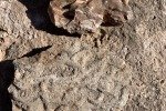
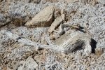
 Along the way we passed a few ‘seeps’, identified as ‘springs’ on the topo maps but little to no water flowed from them. Each such seep, whether active or dry, was marked by a large area of gypsum deposited as the water flowed downhill. In some cases, the spring was marked by a mound of gypsum deposited over time. About 1.4 miles along, we started to gain elevation up towards and ultimately
  to the top of this mid-canyon ridge. Nearing the top we found ourselves crossing a large dome of gypsum with a spring near the peak. A bit further on we discovered a large pit in the northern reach of the mound. Some 20′ across and 15′-20′ deep with a pool of water in the bottom; a strange discovery.
 From there we continued another 200 yards to the peak of this ridge. From this higher elevation we had great views further up the Canyon, to the north of Red Mesa and the Nacimiento Mountains, and to the west Dragon’s Back and beyond Cabezon on the horizon. We then headed back towards the truck, downhill on the east side of this ridge where we found -the- 2-track that we had left early on, which made an easy hike back to the truck.
Statistics
Total Distance: 3.83 miles
Elevation: start 5,567 ft, maximum 5,923 ft, minimum ft 5,636
Gross gain: 287 ft. Aggregate ascending 580 ft, descending 581 ft
Maximum slope: 29% ascending, 23% descending, 4.9% average
Duration: 3:30
| GPS Track Files for Download | |
157 Downloads |
|
|---|---|
115 Downloads |
|
116 Downloads |
|
353 Downloads |
|
If you haven’t explored these hiking tracks with Google Earth, I urge you to try it. With the virtual 3-dimensional presentation, achieved by panning and tilting the view, you can get a much better idea of the hikes and terrain than you can get from the screenshot above. For some ideas, check out Using Google Earth Track Files.
Related Posts
White Mesa Bike Trails Hike – 03/09/2017
Dragon Back,White Mesa Bike Trail – 02/16/2016
A list: Hikes in the Ojito
Google Earth tracks: Compilation of Ojito Hikes (.kml, prior to 2020)
References and Resources
BLM: White Mesa Bike Trail brochure (.pdf)
Santa Fe New Mexican: White Ridge Bike Trails … (a great article)
AllTrails: White Mesa and Dragons’ Back Trail Look
MTB Project: White Ridge Trail System – Main Loop
Travels with the Blonde Coyote: Best Hikes on Earth: The Dragon’s Back
ABQ Runner: Dragon’s Back Classic Route


