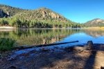
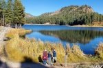
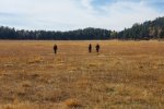
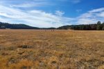
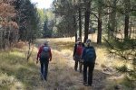
 We returned to the Jemez Mountains for 3 nights of camping and 2 days of hiking in the Valles Caldera National Preserve. After setting up camp in the Jemez Falls Campground by early afternoon on the first day, we drove over the Fenton Lake to enjoy the autumn scenery – clear water, blue sky, and gold and brown grasses and trees.
For the big hike on this trip, set for the 2nd day, we planned a point-to-point hike from the Cabin District in Valles Caldera via VC02, into El Cajete, down El Cajete Canyon, and ending at the west end of Jemez East River Slot Canyon, where the East Fork Jemez River crosses NM 4.
The Drive In
For this point-to-point hike, we planned to go from within the Valles Caldera to where the East Fork Jemez River crosses NM 4:
- First we parked a car on NM 4: drive east from the entrance to the Jemez Falls Campground for .3 miles. At the bottom of the hill, where the East Fork Jemez River crosses NM 4, park alongside the road. (In spite of the No Parking signs, there are almost always cars parked here, to collect obsidian just uphill, or to hike along the East Fork.)
- To get to the trailhead in the Cabin District, we drove further east on NM 4 to the entrance to Valles Grande National Preserve (7.2 miles), then down the road to the Entrance Station (1.9 miles on nice New Mexico Pavement). We picked up our pass for entrance into the Preserve and received the standard warning that the gate closes at 1700 – we must be out of the Preserve by then. The road to the Cabin District (1.8 miles) is a bit rough but suitable for “highway” vehicles. Turning left at the ‘T’, we parked a bit south of the Visitors Center, just shy of a cable blocking further vehicle access to VC02.
The Hike
Advanced Planning: Pat & I had hiked a large part of this route earlier this year, ‘tho in two separate hikes. We made a loop hike from the cabin district covering 1.4 miles of the initial part of this day’s plan, the upper half of the blue line above (VC09-VC0201 Trail Hike – 09/31/2021). And we made an out-and-back hike from the west end into El Cajete itself, the lower half of the blue line (El Cajete Canyon Trail Hike – 08/30/2021). For this hike, using a combination of GPS tools, I was able to delete some of each track (keeping the portion of those hikes that were in the direction for this hike), and was able to connect the GPS fixes of each track segment closest to each other (the straight line in the middle of the blue line). The result was an end-to-end track that we could use for navigation for this El Cajete Through Hike.
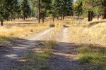
 The Hike: The hike began on a well used two-track across level ground on the edge of an open forest with a view across a valley and to South Mountain beyond. About 1.3 miles, we left the open valley behind and began a steady ‘tho gentle climb with open forest to the left, and to the right an extensive burn area with the typical downfall (more on downfall later). About 1.8 miles on, we crested the saddle between the valley of VC02 behind us and El Cajete Canyon ahead. We paused here for a mid-hike break, then began a steady descent towards a planned turn to the right that would take us over a ridge into the large open meadow – El Cajete.
After descending 1.8 miles and foreseeing more descent, and anticipating a climb up over the ridge to the right and into El Cajete, I was ready to stop going further downhill. Consulting the topo maps (USGS National Map Topo in the US Topo app), I proposed we turn to go more directly towards El Cajete. (I think) there was consensus – let’s go for it.  So we climbed 150 feet onto a ridge, where we were faced with a steep descent into a small canyon and steep ascent to cross another ridge. Hoping to find an easier crossing of this small canyon, or to follow topo lines to the top of the next ridge, we headed up hill.
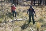
 I mentioned downfall? Downed tree trunks from a fire some years ago covered this ridge. They covered the ground, having fallen at various angles so there was no place where we could walk for even a dozen steps before having to climb over one (or 2 or 3 lying side by side). When we saw what seemed to be an open path for a few yards, we encountered trees that we didn’t see initially. And often stepping over one trunk, there was another hiding behind the first ready to trap our foot or twist an ankle. Finally .5 miles up the ridge, we were able to cross over to the 2nd ridge where we had our first view of El Cajete. It was still .3 mile distant, downhill but … more downfall the whole distance. Adding to the stress of this strenuous track over downfall , uphill and downhill, we became concerned that we might be running short of time to get back to the Caldera before the gate was closed.
After the grueling hike up hill and down hill through all that downfall , we took a well earned break for lunch at the edge of El Cajete. Then, back on trail, what a relief it was to be on open, level ground, walking through only tufts of grass. Reaching the west end of El Cajete, we picked up  the track of our earlier out-and-back hike. Back again on a decent two-track, it was a steady downhill 2.4 miles to NM 4. And we had time to spare, getting to the Entrance Station in time to fetch the vehicle at the Cabin District and leave the Caldera at 1630.
Jay here: Did someone say downfall? Or was that downhill? You could say it was an upper, but once we got going up hill, it felt like a downer. I lost count of how many trees we were stepping over/hurdling, but it was a lot. The hill was our enemy, but so was the clock. Anyhoo, we made it and can chalk this hike up to the unforgettable list. See Lessons Learned below!!
Highlight Lessons Learned
- Stick to the Plan:

In reviewing the GPS tracks, the planned track (blue) was only a couple hundred yards from our actual track (yellow), first from where we turned uphill, and again when were atop the 1st ridge. Aargh! Had we followed the plan, we would have shortened the hike by a half mile and … we would have avoided all the downfall. - Avoid Burn Areas:
 A downfall area dense with downed tree trunks requires -much more- energy than hiking, even uphill hiking. Stepping over trunks 1, 1.5, even 2 feet or more in diameter demands effort from almost every muscle in the body (including the brain – decision after decision). And larger trunks require sitting on them and swinging each leg over. I became so weary that I turned to a hiking pole to assist me in maintaining balance (the 1st time that I’ve came to depend on a pole. Because of the downed trees, this was the most strenuous hiking that any of us have done. Avoid!
Statistics
Total Distance: 7.08 miles
Elevation: start 8,744 ft, maximum 9,144 ft, minimum 7,937 ft
Gross gain: 1,207 ft. Aggregate ascending 1,273 ft, descending 2,068 ft
Maximum slope: 36% ascending, 48% descending, 7.8% average
Duration: 5:34
| GPS Track Files for Download | |
104 Downloads |
|
|---|---|
105 Downloads |
|
193 Downloads |
|
102 Downloads |
|
If you haven’t explored these hiking tracks with Google Earth, I urge you to try it. With the virtual 3-dimensional presentation, achieved by panning and tilting the view, you can get a much better idea of the hikes and terrain than you can get from the screenshot above. For some ideas, check out Using Google Earth Track Files.
Related Posts
VC09-VC0201 Trail Hike – 09/31/2021
El Cajete Canyon Trail Hile – 08/30/2021
VC02 South Mountain Hike – 05/27/2019
National Park Service – Valles Caldera National Preserve:
Hiking Valles Caldera
Moderate Hikes – El Cajete Loop, & South Mountain Trail
Prime Passages: El Cajete Three Ways
AllTrails: El Cajete
Jemez East River Slot Canyon
South Mouontain Trail (VC 02)


