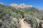
This week we chose the Embudito Trail, which Pat & I had not hiked before. The trailhead is in the Glenwood Hills neighborhood: on Montgomery Ave, go east past its intersection the Tramway Blvd, left on Glenwood Hills Dr, look for the sign to turn right onto Trailhead Rd. There is ample parking for all but the busiest days.
The Hike
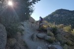
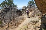
 From research, I learned one could go up the bottom of the canyon or on a trail on the slopes of Oso Ridge north of the canyon bottom. We chose the latter, the ‘high trail’, to avoid the rock falls described by others who had stayed in the canyon bottom. The trail leaves the north side of the parking lot; in about 1,000 feet turn left to take the ‘high trail’. The first 1.5 miles or so presents a steady, easy climb of 1,000 feet; this is one of the most pleasant beginnings for any of the trails on the west side of the Sandias. Beyond a mile or so we encountered some rock outcrops that required a bit of clamoring.
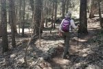
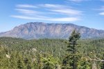
  We were on the trail early so had the shade of the mountains until the sun rose above them; because there are no trees this would be a bit warm later on a summer day. At about the 2 mile point, going above 7,000′ elevation we found ourselves in a mixed forest of juniper, piñon, and a few ponderosa pine. The shade was welcome and the trail surface changed from sand/gravel/rocks to loam/pine needles – a welcome change.
  At about the 2.25 mile point we passed the junction with the Oso Ridge trail and descended into and across Embudito Canyon where trail continued on the south slope of the Canyon. At this higher elevation and in the forest, we enjoyed pleasant, cooler temperatures and more of the very nice trail surface (interspersed with some climb-over rocks).
  At this point we debated whether to begin our return to the trailhead or … forge ahead tho’ without a definitive plan. We estimated some distances to consider options: 1) continue to the junction with Three Gun Spring ( mile further), then return, or 2) continue to the junction with Embudo (another mile further), then maybe continue to the Three Gun Spring trailhead. When we reached the Embudo junction, we decided – what the heck – let’s make it another “over the top” hike (and call brother Garth for transport back to our truck at the Embudito trailhead). So that’s what we did, our longest hike yet, with the most elevation gain.
Statistics
Total Distance: 8.63 miles
Elevation: start 6,239 ft, maximum 8,486 ft, minimum 6,239 ft
Gross gain: 2,247 ft. Aggregate ascending 3,106 ft, descending 3,020 ft
Maximum slope: 33% ascending, 26% descending, 12.4% average
Duration: 9:19
| GPS Track Files for Download | |
132 Downloads |
|
|---|---|
142 Downloads |
|
If you haven’t explored these hiking tracks with Google Earth, I urge you to try it. With the virtual 3-dimensional presentation, achieved by panning and tilting the view, you can get a much better idea of the hikes and terrain than you can get from the screenshot above. For some ideas, check out Using Google Earth Track Files.
References and Resources
USDA Forest Service: Embudito Trailhead & Embudito Trail 192
Albuquerque Parks & Recreation:
Albuquerque Open Space Foothills Trail Map (PDF)
AllTrails: Embudito Canyon Trail
Sandia Mountain Hiking Guide: Embudito Trail
ASCHG: Embudito Canyon Hike
Dog of the Desert: Embudito Trail in the Sandias
ondafringe: Day Hike: Embudito Trail to Oso Pass


