After our hike on the Three Gun Springs trail, we set our sights on preparing to do a one-way hike, Embudo Canyon to Three Gun Springs or the reverse. But first we wanted to “test ourselves” and to become familiar with Embudo, then decide which direction for our one-way hike.
We’ve hiked Embudo Canyon before, Pat & I back in 2010 and 2011; unfortunately that was before I started tracking hikes so there is no track record. And I’ve since gone with Marlin and Jay but these were back in 2014. So this was a refresher for this trail.
The Drive In
The trailhead is at the eastern terminus of Indian School Rd, a large parking lot (no fee, but no toilet as is provided in Elena Gallegos).
The Hike
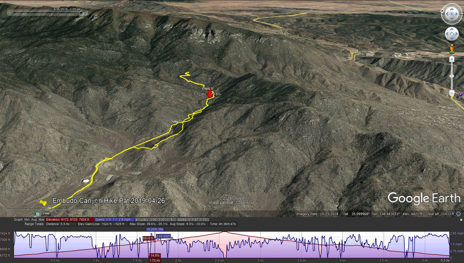
Embudo Canyon Hike.Pat.2019-04-26
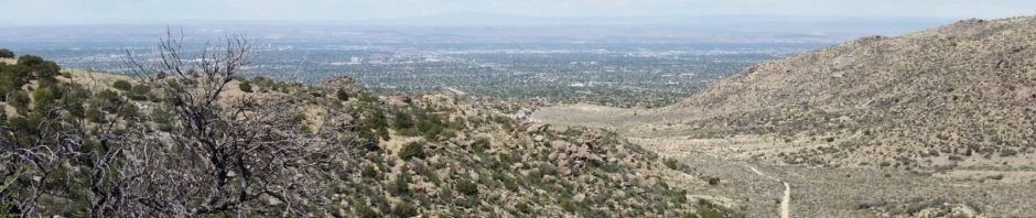
The first half mile or so is in Albuquerque’s Open Spaces, a wide sandy path up the canyon, past a huge water tank, to the top of a flood control dam – a good climb for starters and no shade. Descending down from the dam, one enters the Sandia Mountains Wilderness area and you’re -on the trail-.
Initially inside the Wilderness boundary, the canyon is wide and the trail easy going. But … about a half mile along the canyon becomes very narrow with some large rocks and rock falls it would seem blocking the way (hereafter, The Rocks). But in each case, we found a route to get over or around these “blockages”. (On the way down, we discovered a trail to bypass this section – more on that later.) From there the trail (well used and easy to follow) continues on up the canyon with beautiful view of the south end of the Sandia Mountains. The trail follows the verge of the canyon for about a half mile from the Rocks (some 300 feet elevation gain), then starts uphill towards the saddle and the junction with Three Gun Springs and Oso Pass trails.
After a couple of switch-backs on this steeper section of the trail, we stopped for our mid-hike break – PB&J sandwich, veggies, and coffee. Then headed back down the trail. Nearing the Rocks, a sign indicated a ‘Y’ in the trail, one route going down the bottom of the canyon (to the Rocks), the other heading up the south side of the canyon, identified as the “Horse Bypass”. Wishing to avoid descending through the Rocks, we chose the Bypass. Here we faced a bit of a climb, then gentle descent until .. we were looking -way- down at the trail. But, soon this Bypass took a right turn and descended to the canyon floor and the trail. From there it was all downhill, over the dam and back to parking.
Weather was beautiful, sunny with slight breeze, cool to start and at the higher elevation, warm as we finished up. But we now have a plan for the end-to-end – Embudo up, Three Gun Springs down (and then to Roots Farm Cafe in Tijeras for lunch).
Statistics
Total Distance: 5.3 miles
Elevation: start 6,172 ft, maximum 7,424 ft, minimum 6,172 ft
Gross gain: 1,252 ft. Aggregate ascending 1,524 ft, descending 1,525 ft
Maximum slope: 40% ascending, 35% descending, 9.3% average
Duration: 4:37
| GPS Track Files for Download | |
318 Downloads | |
|---|---|
139 Downloads | |
I urge you to explore our hiking tracks with Google Earth. With the virtual 3-dimensional presentation, achieved by panning and tilting the view, you can get a much better idea of the hikes and terrain than you can get from the 2-dimensional screenshot above. For assistance: Using Google Earth Track Files.
References
City of Albuquerque:
Sandia Foothills Open Space
Embudo Canyon Trailhead (pdf)
ASCHG: Numerous hikes in Embudo
AllTrails: Embudo Canyon
Hiking Project:
Embudo Canyon
Embudo Trail
ondafringe: Day Hike: Embudo Trailhead to 3 Gun Spring Trail, etc


good pictures