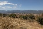
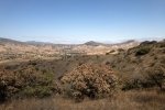
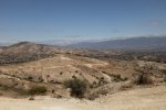
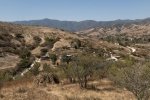
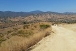
The Lending Library in Oaxaca arranges for numerous hikes throughout the year. Jay and I joined a group for a hike in the Etla Valley, northwest from Oaxaca City. They provided vans from the City for a group of about 30 people, dropped us in the village of San Andrés Ixtlahuaca. The valley is not mountainous or forested, but with hills and many pastures and fields. It being the dry season, everything was dry and tan colored (even the soil is tan in color), although along the rivers some cultivated fields had green crops.
The Hike
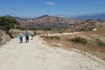
 This hike follows a dirt road for its full distance. The first mile or so passes through the outskirts of Ixtlahuaca, then starts a gentle climb up towards the ridge that separates two rivers. Along the way one will see numerous small corn plots, most all of them on a slope, in some cases a steep slope. Because of the size and the terrain, it is apparent all are tended by hand or with the assistance of oxen. Few of the fields had been harvested, the ears removed from the stalks, the stalks left standing.
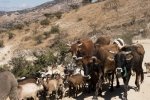
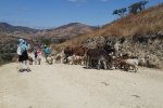
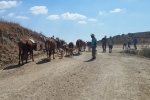
From the top of the ridge it was an easy walk down the road towards San Felipe Tejalapam. We encountered a small sheep and a few cows being herded up the road by their master and his trusty dog – this certainly added to the ambience of the experience. Approaching the end of the hike we passed among numerous cultivated fields, and crossed a small stream on the way into Tejalapam.
Boarding the vans we headed back towards Oaxaca City, tho’ taking a detour for lunch in San Sebastián Etla. The buffet at Hacienda Santa Martha presented a large spread of most any Oaxacan food one might wish for, from tacos (Oaxacan tacos) to deserts. This was well worth the detour on the way back to the City.
Jay here: This hike was a little bit like walking somewhere in Marin County, minus anything green. Could have been a bit more interesting had the path gone overland rather than a dusty road, but you take your hikes as they present themselves.
Statistics
Total Distance: 5.19 miles
Elevation: start 5,387 ft, maximum 5,905 ft, minimum 5,387 ft
Gross gain: 518 ft. Aggregate ascending 787 ft, descending 762 ft
Maximum slope: 21% ascending, 24% descending, 6.7% average
Duration: 2:36
| GPS Track Files for Download | |
217 Downloads |
|
|---|---|
169 Downloads |
|
133 Downloads |
|
110 Downloads |
|
If you haven’t explored these hiking tracks with Google Earth, I urge you to try it. With the virtual 3-dimensional presentation, achieved by panning and tilting the view, you can get a much better idea of the hikes and terrain than you can get from the screenshot above. For some ideas, check out Using Google Earth Track Files.
References
HoofingItInOaxaca: Hiking Venues for “Hoofing It In Oaxaca”
Buffet Lunch: Hacienda Santa Martha de Bárcena


