This is our 2nd hike on our trip to Idaho, and during our first day with the R-Pod set up in the Casino Creek Campground, along the Salmon River five miles east of Stanley.
The Drive In
I had done much research on hiking trails around Stanley – there were so many choices that it was hard to pick one, especially that we were new to the area. We started the day intending to hike the Fishhook Creek Trail, 4.5 miles with little elevation gain – an easy day. The trailhead is near a parking lot on the drive into the Redfish Lake Lodge (this is about 5 miles south of Stanley; 3 miles on US on Idaho 22 to the turnoff to Redfish Lake, then a couple of miles on the road towards Redfish Lodge).
The Hike
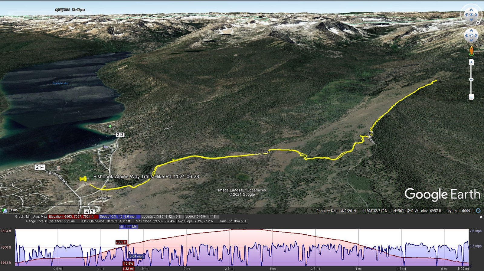
Fishhook Creek-Alpine Way Trails Hike.Pat.2021-06-28
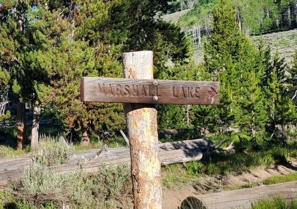 From the parking lot, we followed the signs pointing us across the Lodge Road to where we found the trailhead. The start of the hike was on a well groomed trail, almost a two-track, skirting an pretty aspen grove. The trail continued through open forest but with much dead-fall. I guess we began to think this trail would be too easy because, coming upon a trail going off to the right (and uphill), we changed our course and continued on the Alpine Way trail towards Marshall Lake. (The extensive research paid off – I had imported into USTopo on my phone/GPS most of the trails that I thought we might find interesting. Alpine Way was included so the change in plan went smoothly.)
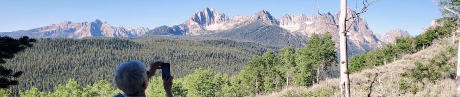
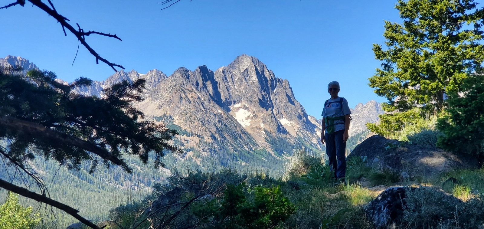 Up to that point we had gained some 150 ft elevation. But heading up Alpine Way we ascended 450 feet to the top of a ridge and continued climbing from there to our turn-around point. Along the way we had amazing views of the central portion of the Sawtooth Mountains, and could easily see how they came by that name. The trail remained well used, easy hiking.
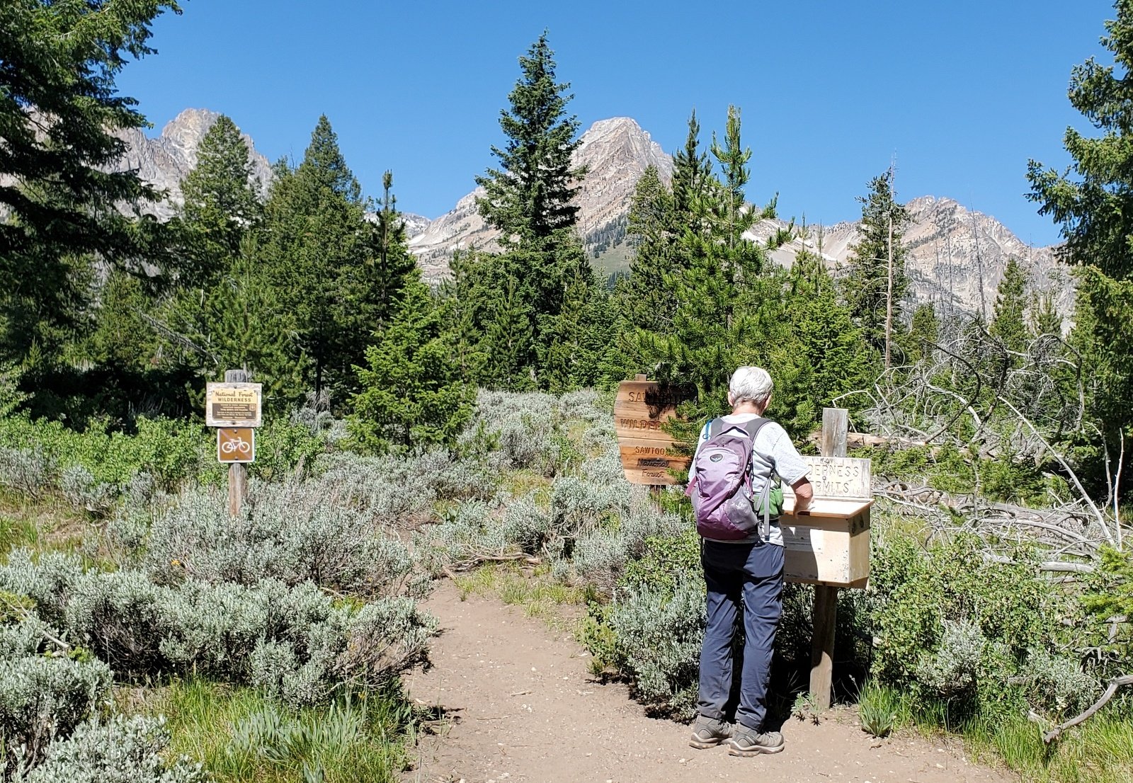 We continued on Alpine Way, at one point entering the Sawtooth Wilderness Area (and signing in). We are most comfortable when our hikes are under 6 miles, so at 2.7 miles, we paused to enjoy our traditional mid-hike break (ramen, carrots, PB&J) and returned to the trailhead.
Highlights
Our surroundings were so very green. Clearly there is sufficient sources of water to support lush growth of trees, shrubs, and … flowers. This is such a contrast to New Mexico. Some of the flowers we see in New Mexico, but there were others that were new to us. And even the trees were so healthy, and some unfamiliar to us. Check our Flower Photos below for a sampling of what we have seen.
Statistics
Total Distance: 5.29 miles
Elevation: start 6,563 ft, maximum 7,524 ft, minimum 6,563 ft
Gross gain: 961 ft. Aggregate ascending 1,076 ft, descending 1,087 ft
Maximum slope: 30% ascending, 37% descending, 7.2% average
Duration: 5:11
| GPS Track Files for Download | |
236 Downloads | |
|---|---|
453 Downloads | |
If you haven’t explored these hiking tracks with Google Earth, I urge you to try it. With the virtual 3-dimensional presentation, achieved by panning and tilting the view, you can get a much better idea of the hikes and terrain than you can get from the screenshot above. For some ideas, check out Using Google Earth Track Files.
Related Posts
References and Resources
USFS: Fishhook Creek Trail
Alpine Way Trailhead
AllTrails: Fishhook Creek Trail
Marshall Lake via Trail 186 and Alpine Way Trail
The Outbound: Hike Fishhook Creek
Hiking Project: Alpine Way Trail
Idaho Campground Review: Hiking to Marshall Lake from Redfish Trailhead
High-Powered Planet: Alpine Way Trail


