After enjoying a lay day, following our hike above 11,000′ on the Continental Divide Trail, on this Fourth of July we skipped the big parade on Pagosa Springs and headed for a popular trail nearby.
The Drive In
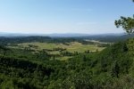
The drive out on a road that was in some places quite circuitous, we enjoyed some wonderful scenic views back across the valley. As suspected, this is a well-used trail, easy surface and terrain, but we were early in the day (and the parade was ongoing) we had the trail mostly to ourselves on the way out.
The Hike
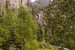
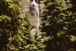
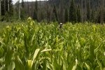
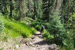
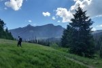
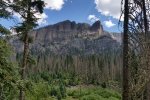
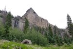
At times we were in forest, along other stretches we were in more open space; occasionally we could hear the sound of Fourmile Creek running over rocks or maybe beaver dams. From about 3/4 of a mile we caught first site of one of the two waterfalls, the one on Fourmile Creek. A 1/2 mile further on the 2nd waterfall, the one on Falls Creek, came into view. Both are reported to be 300′ high. The hike back was easy enough (after the earlier hikes), during which we watched the Rocky Mountain rain cells appear, move, and dissipate, tho’ one did find it’s way to us and sprinkled for 20 minutes or so.
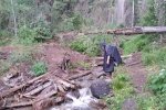
Jay here: This was our last hike in the Pogosa Springs area and a good choice for a finale. The rainbow at the 3 mile mark is impressive…perhaps 500-600 feet high. The hike begins with a lot of descents that only make you dread the return trip when your legs are weary and you have to hit all the ascents. We had some light rain on the return and I broke out the poncho. All in all, a great finish to 5 days of hiking.
Statistics
Total Distance: 6.04 miles
Elevation: start 9,156 ft, maximum 9,569 ft, minimum 8,973 ft
Gross gain: 603 ft. Aggregate ascending 1,542 ft, descending 1,541 ft
Maximum slope: 33% ascending, 37% descending, 8% average
Duration: 4:03
| GPS Track Files for Download | |
361 Downloads |
|
|---|---|
131 Downloads |
|
I urge you to explore our hiking tracks with Google Earth. With the virtual 3-dimensional presentation, achieved by panning and tilting the view, you can get a much better idea of the hikes and terrain than you can get from the 2-dimensional screenshot above. For assistance: Using Google Earth Track Files.
References
The Adventure Guide-Pagosa.com:
Hiking Trails in the San Juan National Forest – Pagosa Springs Area
Pagosa.com:
A Walk in the Woods: Hiking Trails in Pagosa Springs
Fourmile Falls Hike
Scenic Waterfalls in the Pagosa Springs Area
Hiking Fourmile Falls Trail in Pagosa Springs
SummitPost: FourmileLake Hike, Cherry Cairn Peak Attempt
UtahTrails: Fourmile Creek
The Outbound Collective:
Hike the Weminumche WIlderness to Fourmile Falls
Outdoor Recreation Information Center – Colorado:
Pagosa Springs Region Day Hiking Trails Index


