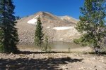
Our third hike during a 3-week trip through middle Idaho. The R-Pod was set up in the Casino Creek Campground, along the Salmon River five miles east of Stanley.
The Drive In
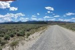
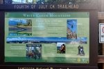
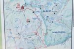
 To get to the Fourth of July Trailhead, travel 15 miles south on ID 75. Turn left onto FR 209, a gravel road in good condition. The 1st couple of miles is across open scrub-brush range, then enters into Fourth of July Cañon. Continue for 10 miles from ID 75 through the cañon and along Fourth of July Creek, a quite pleasant drive. The trailhead is just off of FR 209, to the right, with ample parking and a quite informative sign board (see photos below).
The Hike
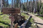
 We began our hike by signing in, then heading out on Trail 109 towards Fourth of July Lake. The trail passes through healthy forest and appears to be well used and maintained, making ambulation quite easy. And there are trail signs reaffirming we were on track.
 Elevation gain was steady for about 1.6 miles until abreast of Fourth of July Lake (from 8,749 ft to 9,370 ft). After a mostly level section along the margin of the Lake, the trail ascends another 300 feet or so to a saddle (.4 miles), where there was a small pond below some snow up on a rock slope.
  Then a descent of some 300 feet (.4 miles) to Washington Lake.
This was a great hike on a beautiful trail, with mostly healthy forests (trees, “shrubs”, and flowers). A “clean” trail, steady slope, and great views of mountains left and right. Even some left-over snow. We met only a half dozen other hikers, tho’ this must be a very popular trail for hiking and backpacking further into the White Cloud Wilderness and surrounding general forest areas.
Statistics
Total Distance: 5.8 miles
Elevation: start 8,749 ft, maximum 9,582 ft, minimum ft
Gross gain: 833 ft. Aggregate ascending 1,184 ft, descending 1,189 ft
Maximum slope: 20% ascending, 16% descending, 7.0% average
Duration: 5:25
| GPS Track Files for Download | |
125 Downloads |
|
|---|---|
112 Downloads |
|
If you haven’t explored these hiking tracks with Google Earth, I urge you to try it. With the virtual 3-dimensional presentation, achieved by panning and tilting the view, you can get a much better idea of the hikes and terrain than you can get from the screenshot above. For some ideas, check out Using Google Earth Track Files.
Related Posts
Fishhook Creek-Alpine Way Trails Hike – 06/28/2021
Lower Cedar Creek Falls Trail Hike – 06/26/2021


