Our first hike on a 3-night camping trip to southern New Mexico (where it would be warmer than our usual camping in northern New Mexico). We set up camp in the Leasburg State Park, having made reservations for a larger dry campsite with sufficient room for our Tacoma & R-Pod and Jay and Nancy’s Subaru. The site was quite clean and comfortable with a large table under a shelter and a firepit. And not far from roads to prospective hiking trails.
The Drive In
For our hike on the 1st day, we chose the trail to Geronimo’s Cave. From the Leasburg State Park campground, we drove out the entrance road (Leasburg Park Rd), turned right on Fort Selden Rd, then at the ‘T’ turned left on NM 185/N Valley Drive. NM 185 parallels the Rio Grande, so we were looking for a road or path that would give us access. Not finding a public road, we opted to park on NM 185 and walk west on a Class 6 two-track that would take us to the Rio Grande near where AllTrails marked the trail.
Note: As we approached the river, we found ourselves crossing a gravel road atop the levee above the Rio, and an obvious parking area between the levee and the river. After the hike we found a gravel road from the highway to the levee, about half a mile northwest of where we parked. This would clearly be preferable to parking on the highway. [Ed. Note: That would be Hayride Rd where it intersects with N Valley Dr]
The Hike
Notes about the Google Earth screenshot: the graph at the bottom shows elevation of the track (pink area) and speed (the blue line).
Getting the the trail proper was itself a bit challenging:
- Getting from the highway was easy enough – a seldom used two-track of soft dirt/sand, typical of alluvial material (.2 miles). Then it was up onto the levee, down the river side, and the Rio Grande.
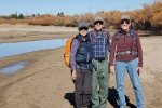
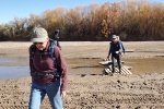
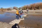
 Getting across the Rio Grande was next. Fortunately this time of year the river’s flow is minimal and – others had conveniently left shipping pallets over what little flow remained.
- We were challenged in finding a way out of the river bottom onto the hillside and the trail. A thick row of salt cedar blocked much of the bank, and where there were paths the ascent was very steep. Jay scouted upriver and downriver for a ways, but didn’t find anything better. There were signs of folks climbing up the slope, and we found a small ravine which, tho’ challenging, we used to get up and to the trail.
- Update – On our return leg, we had a trail to follow and discovered that -the trail- entrance is further upriver than we had scouted. So, check the .gps track for the return leg of our hike for the entrance to the trail.
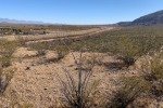
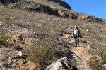
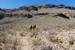
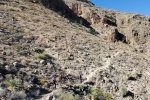
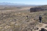
The hike is on a well-used trail, sand, gravel, and in some areas some rocks – easy hiking. The elevation rises uniformly, with a steeper portion near the river and the  last .25 mile. Like most of southern New Mexico, there are mostly no trees, only the scrubish plants typical in a desert setting.
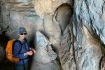
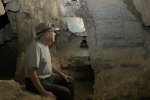
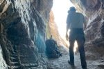
The entrance to the cave is inviting, a large opening in a rock outcropping. For the first 20-30 feet, one is in an open gallery, 10-15 feet tall and similarly wide. The floor is smooth sand. There has been some defacing (pink and blue paint or some such) on the wall in a few places. No doubt this would be a pleasant place on a hot summer day.
Highlight
F or Pat and me, exploring the cave was most interesting.
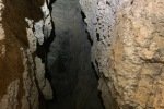
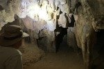
- For the first 30-40 feet, the walls were rock, with a sand floor and ample head clearance. As we went further, it was necessary to ‘skinny’ through a narrow passage, but no crawling or serious contorting.
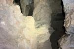
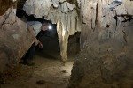
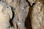
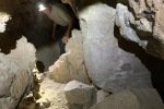
- Further on, we came upon the remains of stalactites. On the ceiling of the cave there was what appeared to be stumps from which the original formations had been broken. And there were interesting patterns on the wall left by (I suppose) evaporation of seeping water leaving the calcite or other mineral in swirls and bulges.
Jay here: Although the slog thru soft sand from the road to the trail was not a great start, this hike turned out to be a winner with a prize inside (that would be the cave). The great views of the surrounding mountains were an added bonus. Driving in on Hayride Road and following the modified trail starting point will make for a more enjoyable hike experience.
Statistics
Total Distance: 3.16 miles
Elevation: start 3,954 ft, maximum 4,466 ft, minimum 3,949 ft
Gross gain: 517 ft. Aggregate ascending 646 ft, descending 646 ft
Maximum slope: 55% ascending, 43% descending, 7.2% average
Duration: 3:10
| GPS Track Files for Download | |
170 Downloads |
|
|---|---|
140 Downloads |
|
If you haven’t explored these hiking tracks with Google Earth, I urge you to try it. With the virtual 3-dimensional presentation, achieved by panning and tilting the view, you can get a much better idea of the hikes and terrain than you can get from the screenshot above. For some ideas, check out Using Google Earth Track Files.
References and Resources
AllTrails: Geronimo’s Cave
Southern New Mexico Explorer: Organ Mountains … Geronimo’s Cave
New Mexico Nomad: Organ Mountains-Desert Peaks National Monument


