This, a day trip to Valles Caldera to enjoy some beautiful scenery, and to get out on the trail. Hidden Valley meets both of those goals exceptionally well.
The Drive In
The trail begins at a two-track to the left of the main road driving into Valles Caldera, about .6 mile from NM 4. Park alongside the road, near the two-track with a cable blocking vehicle traffic. ‘Tho it isn’t visible from the parking place, the Missing Cabin is just over the ridge at the end of the two-track.
The Hike
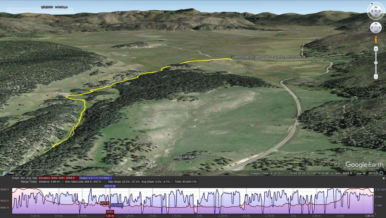
Valles Caldera-Hidden Valley Trail Hike.Pat.2023-09-26
Notes about the Google Earth screenshot: the graph at the bottom shows elevation of the track (pink area) and speed (the blue line).
This trail is ideal for an easy hike into a beautiful part of Valles Caldera. Unlike going into the back country of the Caldera, an entrance reservation and permit is not required (reservations and permits are now required to go beyond the cabin district, a procedure instituted this summer).
I could not write a better description of a hike on this trail than I wrote back on 2021: Hidden Valley Trail Hike – 10/22/2021. After you read that, then read the notes that I’m adding from this hike.
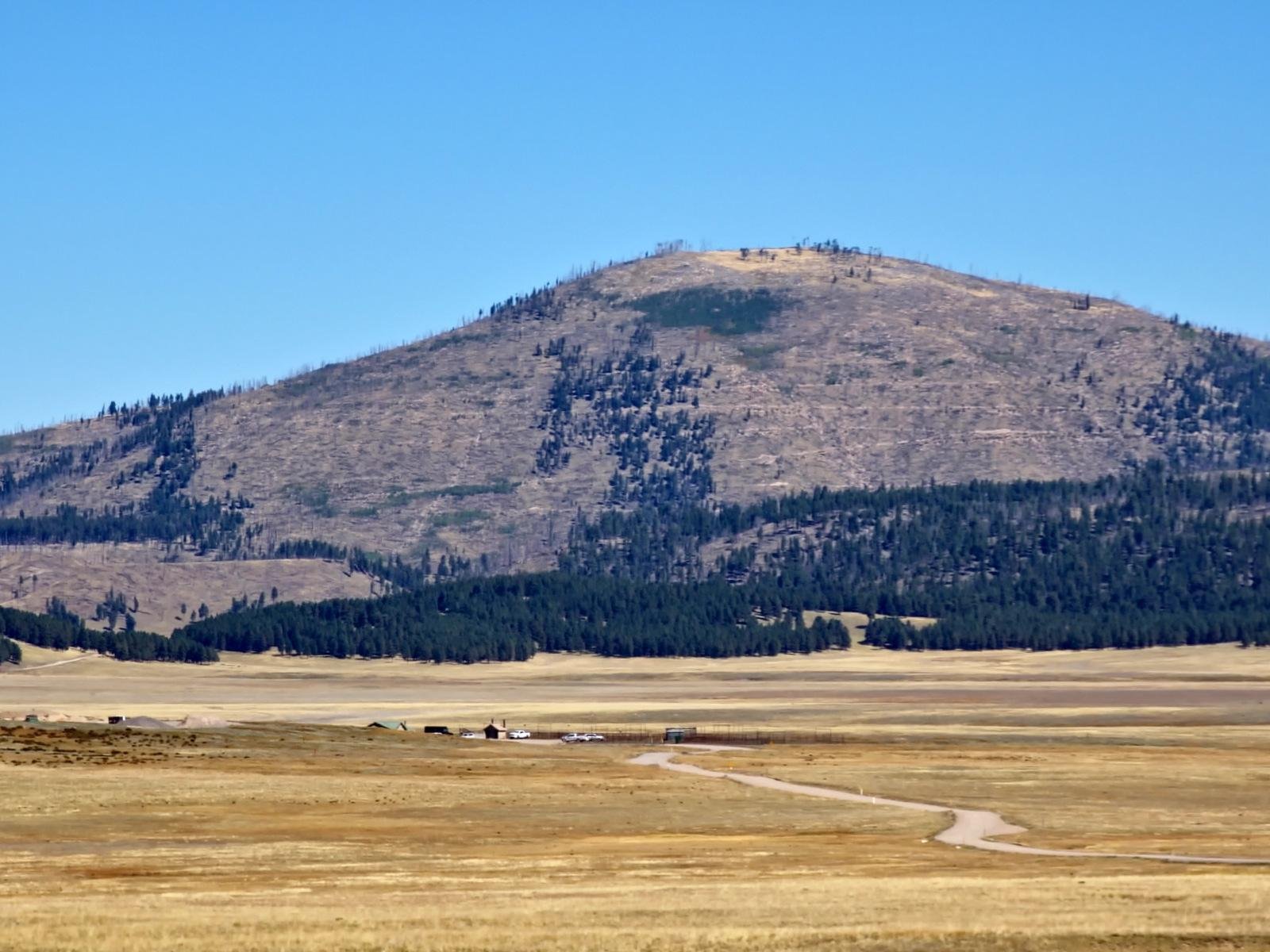 There is now way photos can do justice to the beauty of Valles Caldera The scale of the scale of the scenery is huge especially across the very wide and flat valley itself – we could see black specks in the middle Valle, a herd of elk. The colors and shapes of the Valle and the mountains in and around it , set off against a clear blue sky is beautiful.
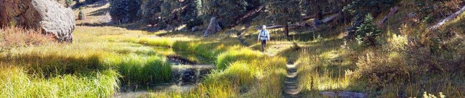
Closer in on our hike, 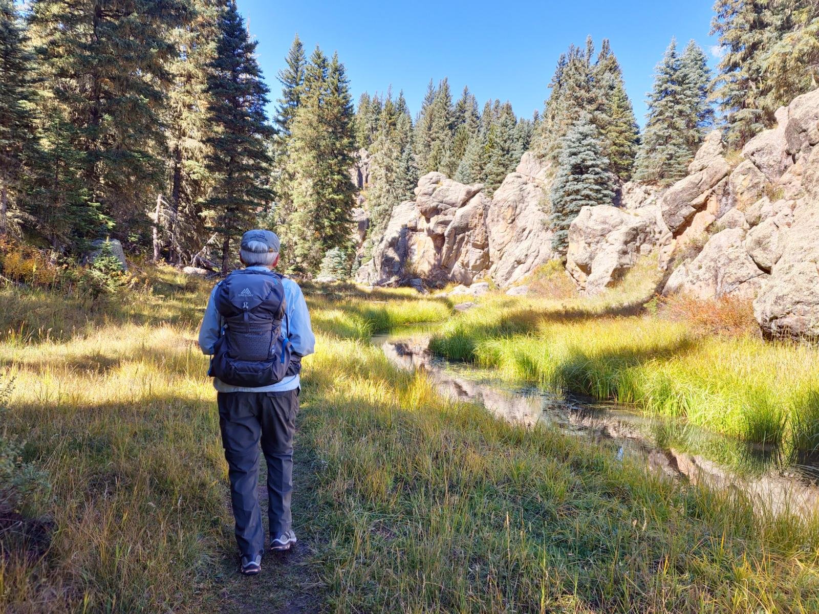 Hidden Valley itself presents such a wide range of colors, patterns, and shapes, with the grasses along the East Fork Jemez River and Douglas fir and blue spruce trees up the sides of the Valley.
From parking, we took a trail (not the gravel road) up the hill through knee high grass. Topping the hill we passed the Cabin and proceeded back down into Hidden Valley and the trail paralleling the East Fork Jemez River. The trail presents clumps of worn-down grass. Once into the Valley, it is mostly smooth ground with a few yards of rocks scattered along the way. In a couple of places the trail is right up against the River – passable at this time of year but likely inundated when there is more water in the River. There is one river crossing – a couple of boards on rocks made it easy.
Highlight
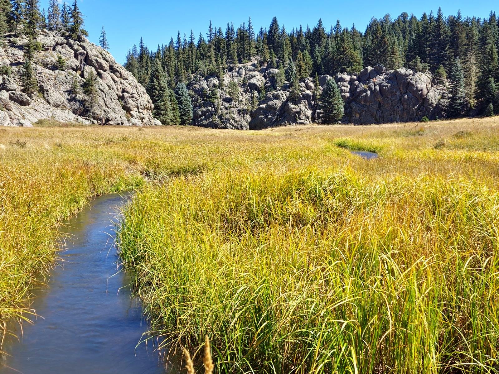 The abundant grasses along the stream create a colorful scene, ranging from green to yellow and some orange, true Autumn colors. At one point, Pat said “the scenery just follows along with us”. Then, approaching some deep grass, Pat flushed a great horned owl who flew off accompanied by a raven that had been perched in a tree above. The owl taking flight made virtually no noise.
Statistics
Total Distance: 3.86 miles
Elevation: start 8,545 ft, maximum 8,568 ft, minimum 8,464 ft
Gross gain: 104 ft. Aggregate ascending 646 ft, descending 647 ft
Maximum slope: 23% ascending, 27% descending, 4.2% average
Duration: 3:25 , Average Speed: 1.1 mph
| GPS Track Files for Download | |
42 Downloads | |
|---|---|
0 Downloads | |
If you haven’t explored these hiking tracks with Google Earth, I urge you to try it. With the virtual 3-dimensional presentation, achieved by panning and tilting the view, you can get a much better idea of the hikes and terrain than you can get from the screenshot above. For some ideas, check out Using Google Earth Track Files.
Related Posts
Other Hikes in Hidden Valley
Hikes in Valles Caldera
References and Resources
National Park Service:
Valles Caldera – A Diverse Landscape Born from an Explosive Past
Hike the Missing Cabin Trail
Hike the Hidden Valley Trail
AllTrails: Hidden Valley Trail
Prime Passages (“Beerhiker”): Hidden Valley – Hidden Valley Beer Hike
Western Regional Climate Cener: Hidden Valley, New Mexico Weather Station


