A friend at Java Joe’s recently told us about his recent visit to La Bajada, a small village at the base of La Bajada, the escarpment (thank you, Chris). This village is at the base of the road up the escarpment from Rio Abajo to Rio Alta. There is great history of this road and the surrounding mesa and basin — dating back to prehistoric times, as part of El Camino Real de Tierra Adentro and subsequent Spanish travel from Mexico to Santa Fe, explorers and others from ‘back east’ as they explored the west, and in more modern times commercial interests and construction of various routes up La Bajada (Reference: La Bajada). I have enjoyed very much reading the Related Posts below. Mindful of this long history, it was even more interesting hiking on the La Bajada tracks while enjoying the great scenery of this trail.
The Drive In
The ‘trailhead’ is just beyond the village of La Bajada. From I-25 on the way from Albuquerque to Santa Fe, just before the highway starts uphill, exit onto NM 16 towards Peña Blanca. In 3.7 miles, turn right towards La Bajada (and the signs point to Tetilla Peak Recreation Area); it soon turns from paved to gravel. After crossing the bridge over the Santa Fe River, turn right onto La Bajada Village Road (2.4 miles). Passing the village on your right, continue for 1 mile to an intersection with a road going back across the Santa Fe river (a part of the original Route 66); park here – the trail continues on the gravel road/two track ahead .
The Hike
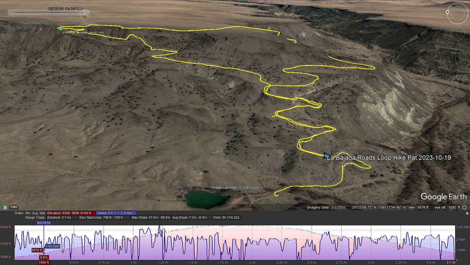
La Bajada Roads Loop Hike.Pat.2023-10-19
Notes about the Google Earth screenshot: the graph at the bottom shows elevation of the track (pink area) and speed (the blue line).
The high temperatures of summer have past (almost – we continue to have near record breaking highs), so we headed to La Bahada to explore this historic “roadway”. Reviewing land ownership maps, we were aware that the trailhead (and the road in for that matter) are on the Cochiti Pueblo. Thus we are most respectful to tread lightly. (About 3/4 mile and half way up the track enters National Forest land.)
 T
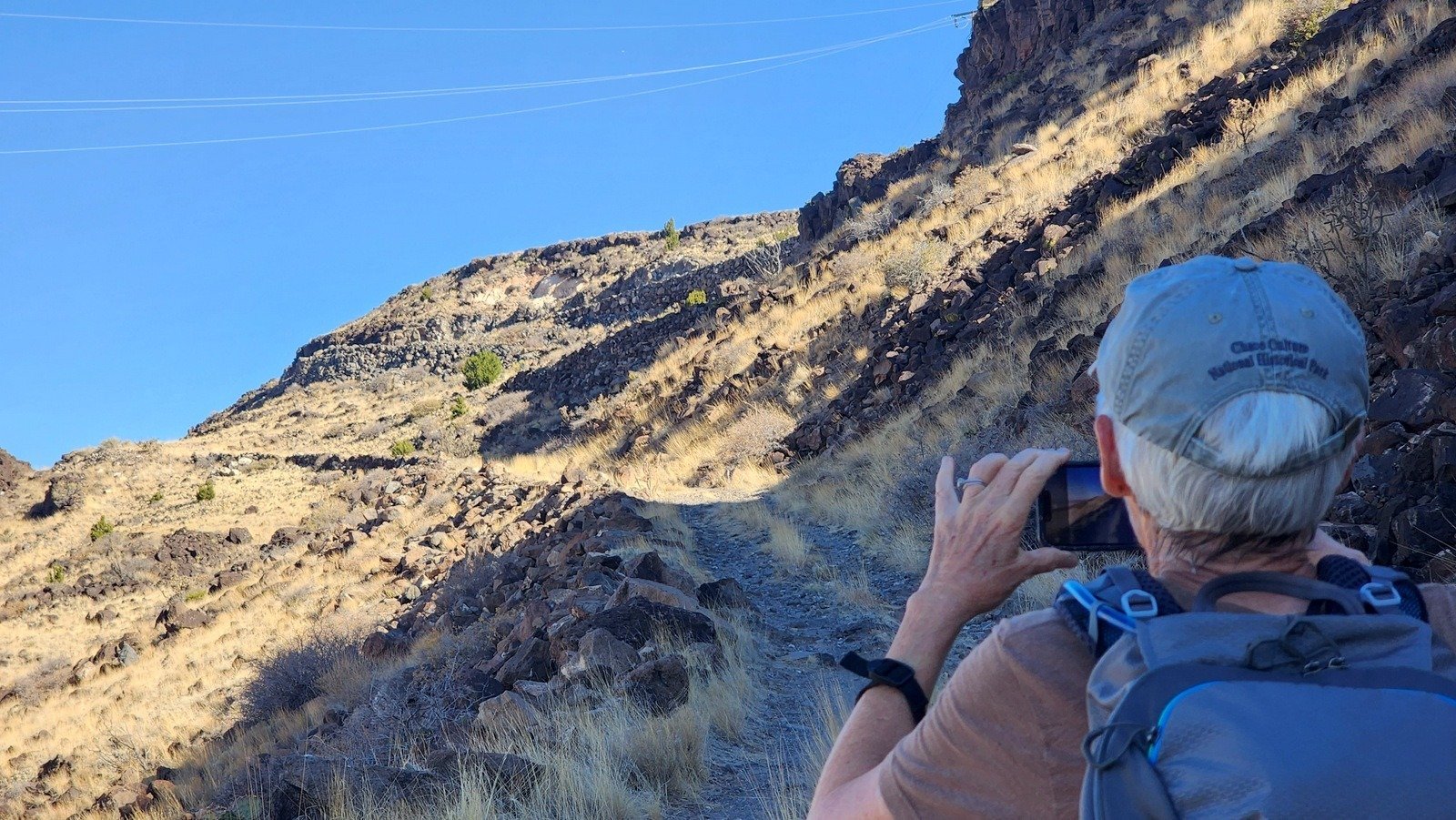
T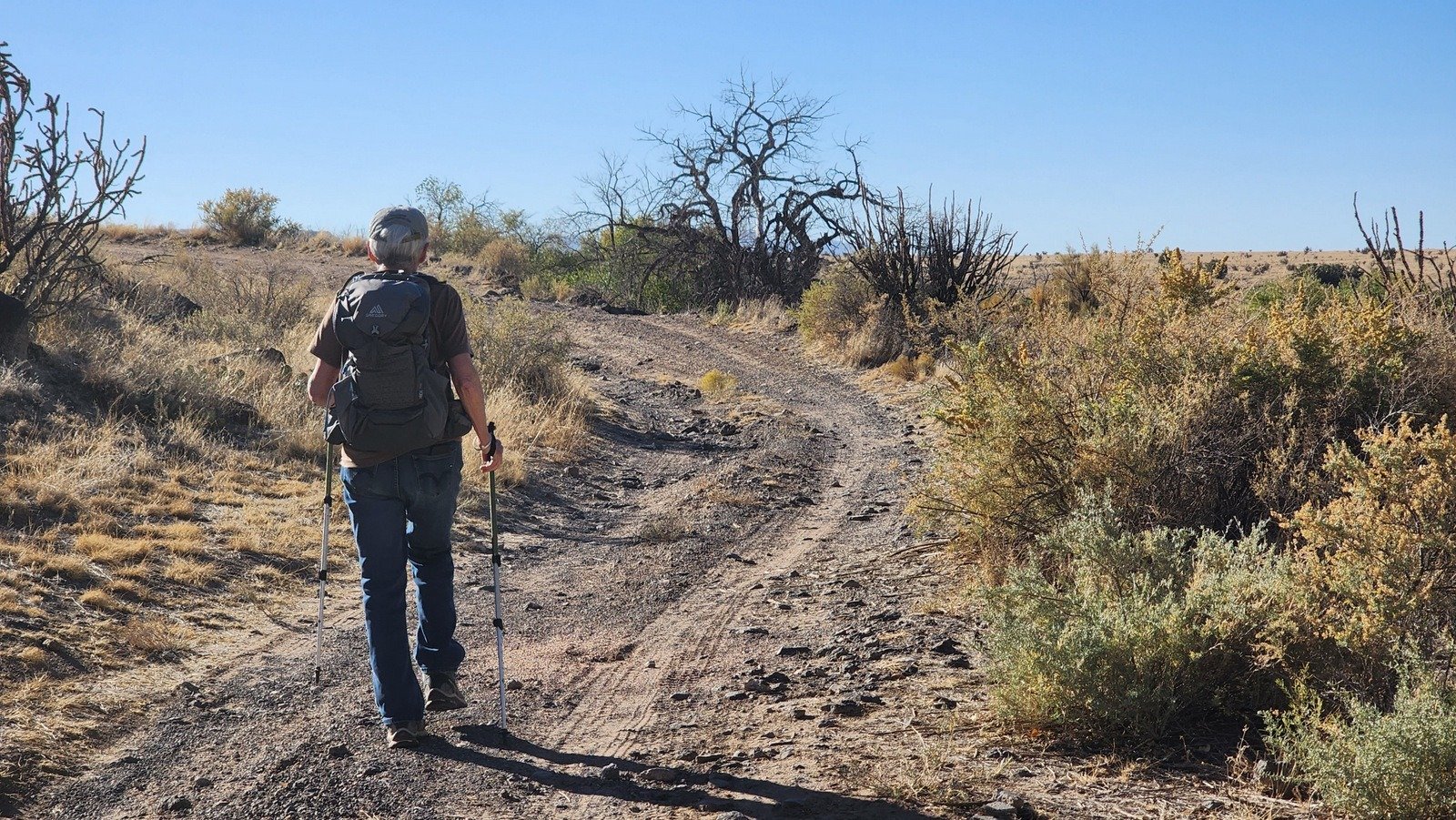 he trail -is- the old Route 66. We planned to make our hike a loop, up one of the roads, then down another; the two legs join at that 3/4 mile point. And that first 3/4 mile is the section shown on so many photos – 6 or 7 switchbacks as it ascends the first 200 feet or so. It is a fairly steady climb with gravel being the predominant road/trail surface, with some sections rocky rock covered in some sections, and
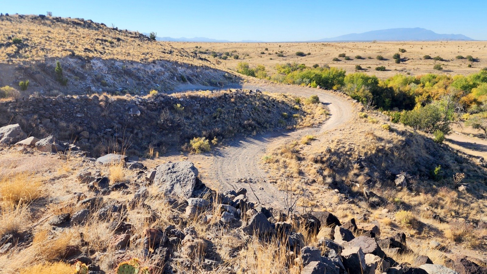
 And we enjoyed some great views on the way up – looking back at the switchbacks, and down from about 200 feet at our truck.
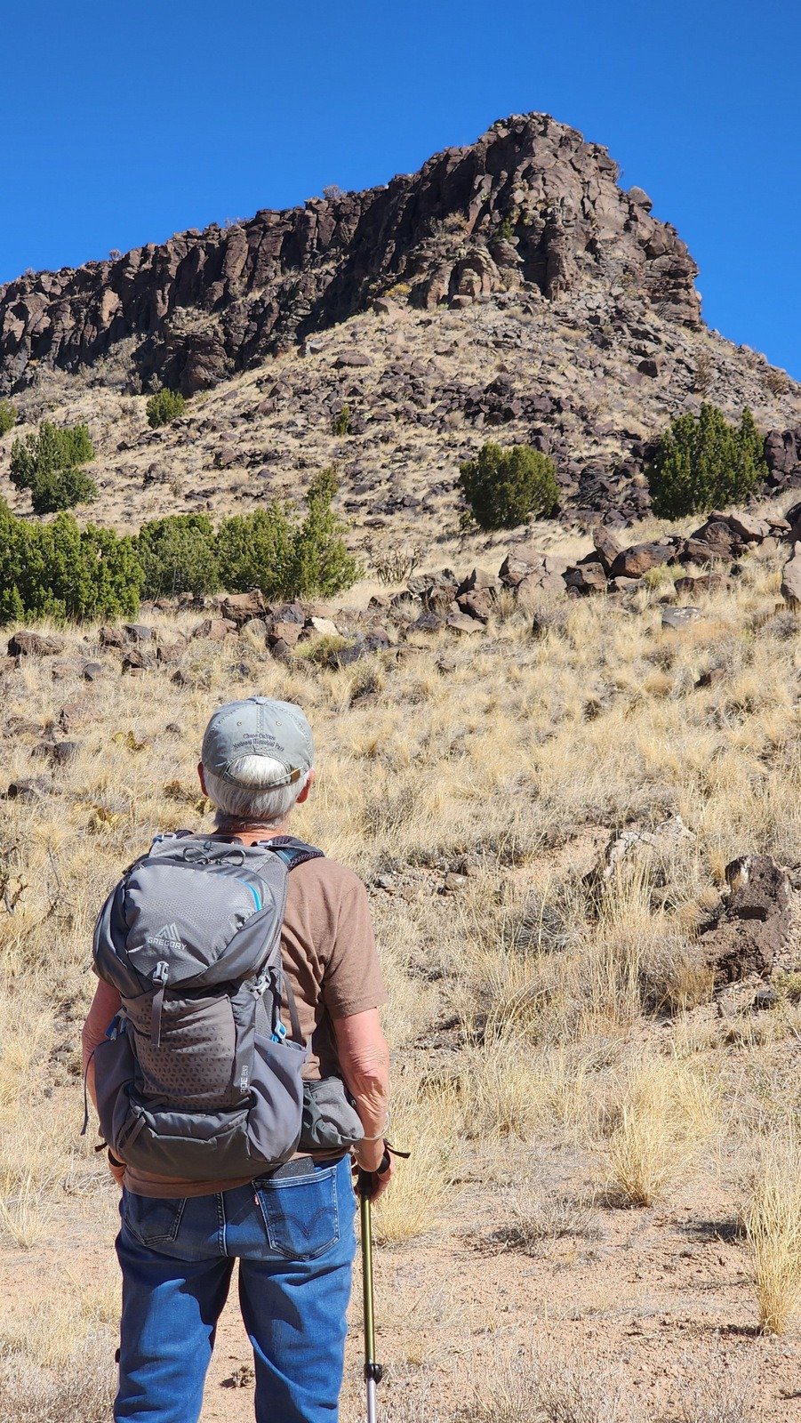
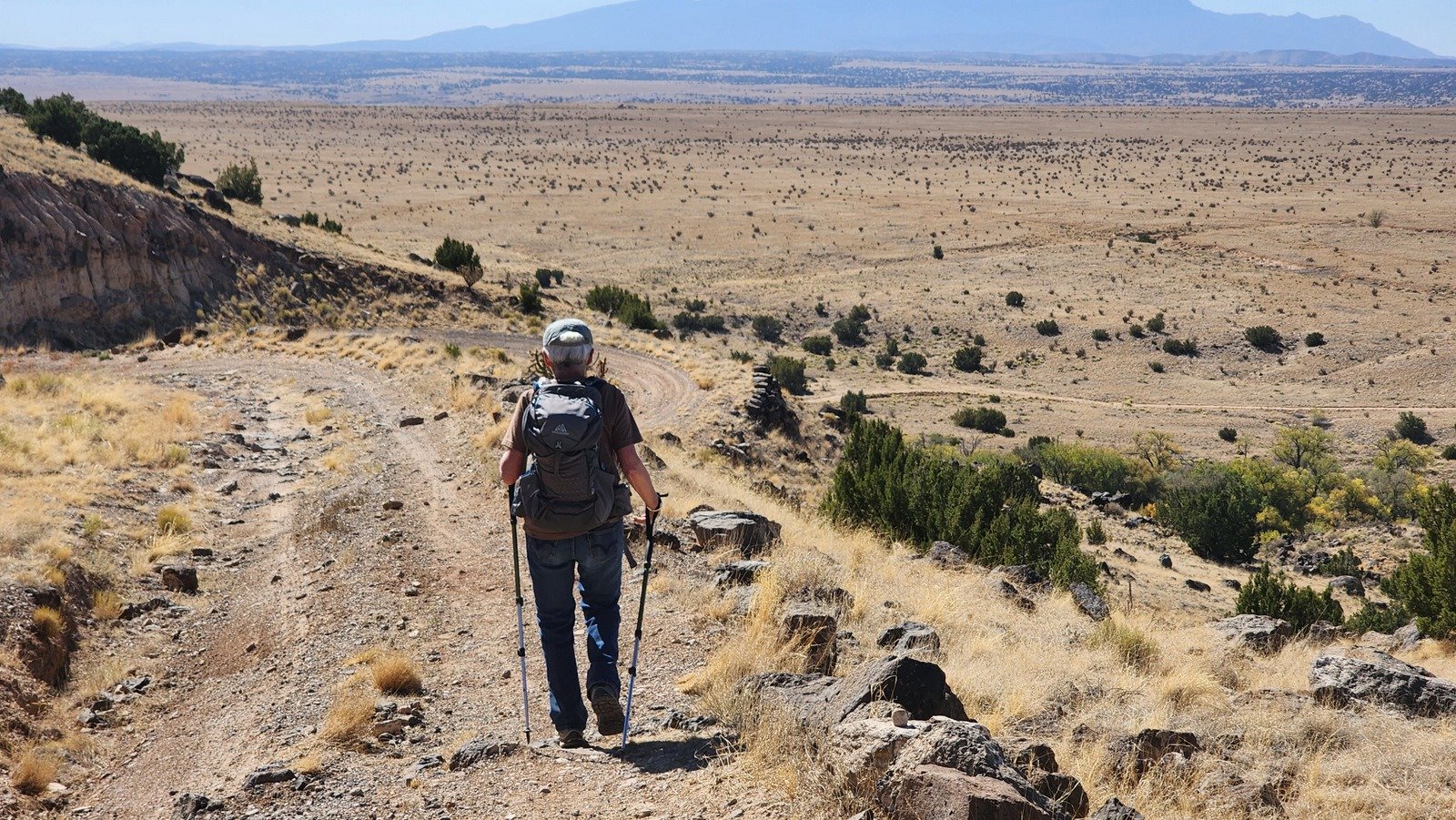
N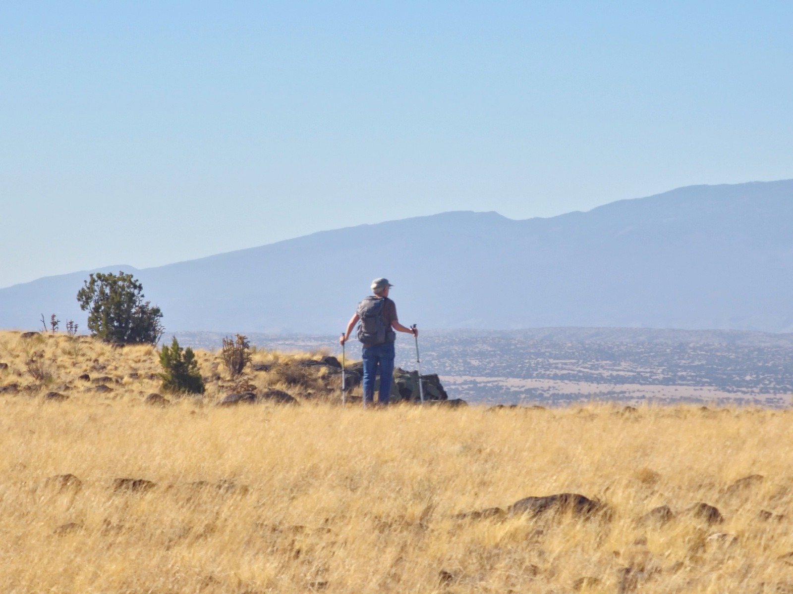 earing th
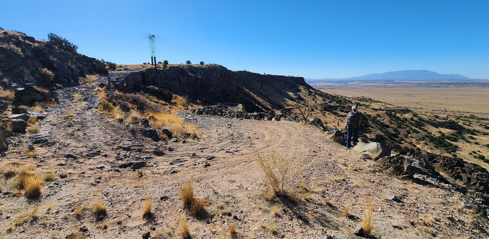 e top of the road, the view of the surrounding territory began to expand. And on top of Bajada Mesa, we had a 360° view, from the Sandias to the south, the Jemez to the northwest, and the Sangre de Cristo to the northeast.
 To make a loop, we would cut across the top of the mesa. However, we thought we might enjoy a great view if we went to the point. So we set our course to 190 degrees (with help of the GPS and GAIA) and along the west edge of the mesa. With no trail to follow, the ground was peppered with 6″, 10″, and larger lava rocks – these made the going tough. We bailed (still enjoying great views) and turned across the mesa towards the other road/two-track. We intercepted a two-track that led us to the ‘trailhead’ for the descent.
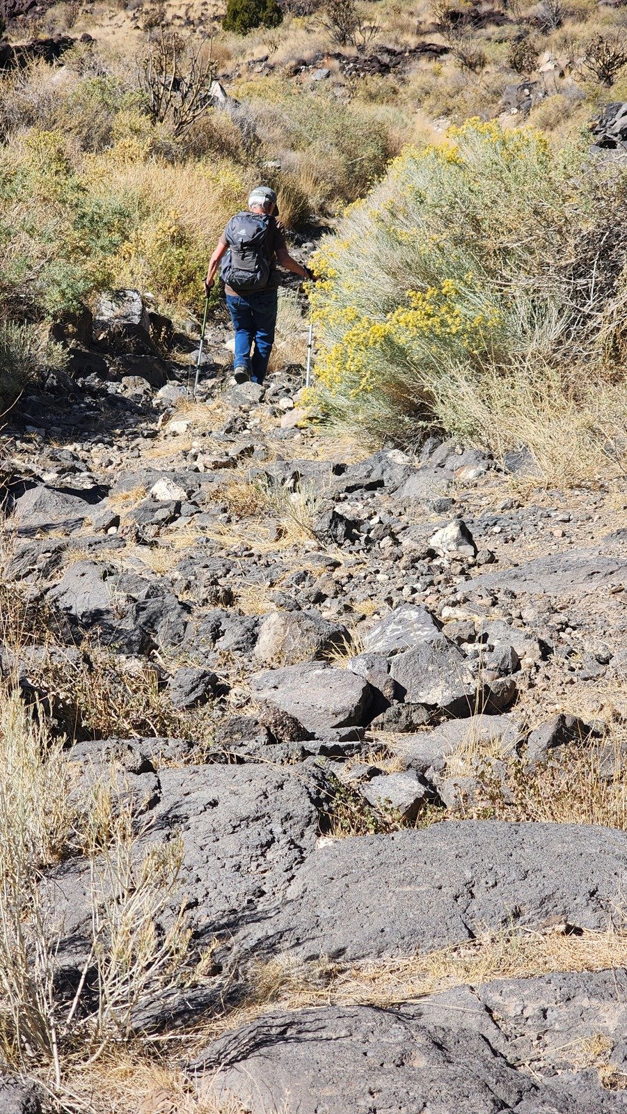
 ‘Tho not a steep descent, the first few hundred yards were -very rocky-, quite challenging – I broke out my hiking pole which I use only when descending very rocky trails. Along this side of the mesa we were looking down into the Santa Fe cañon and the River – more great scenery.
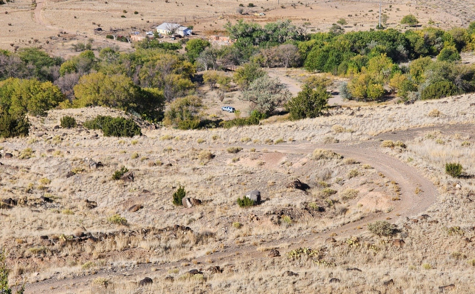
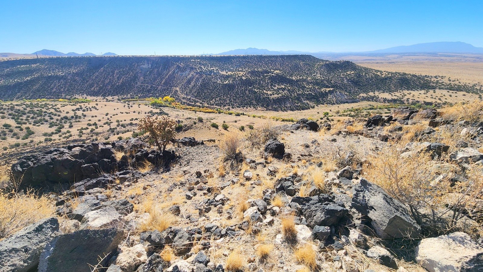
 On this tra
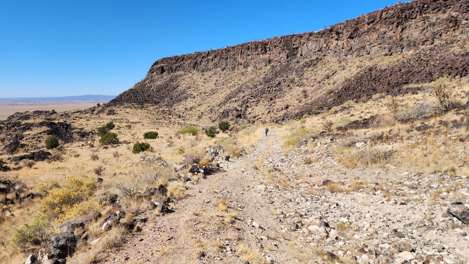 ck the scope of the La Bajada mesa was more evident, as it towered over the trail as we descended. And as we approached the junction with the up-hill track, the height of the mesa caught our attention.
 Back on the lower/common portion of the loop – another view of the one of the switchbacks and the view across this western portion of the Galisteo Basin.
Upon returning to the truck and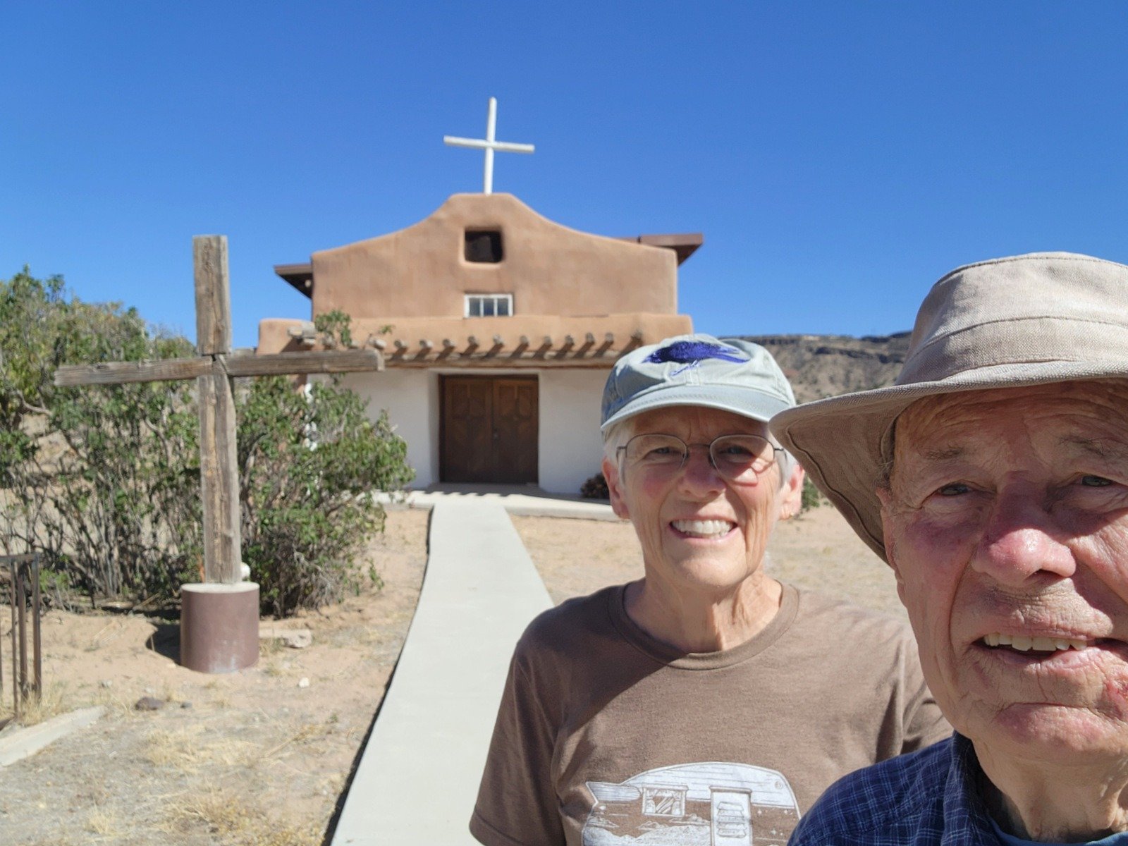 heading towards home, we drove through the village of La Bahada. Our friend Chris suggest we stop at the church and in particular see the doors that were produced many years ago by a fellow carpenter to his father. The doors are clearly a work of art and skill. Thanks, Chris, for your enthusiasm for New Mexico history and for sharing it with us.
Highlight
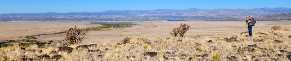
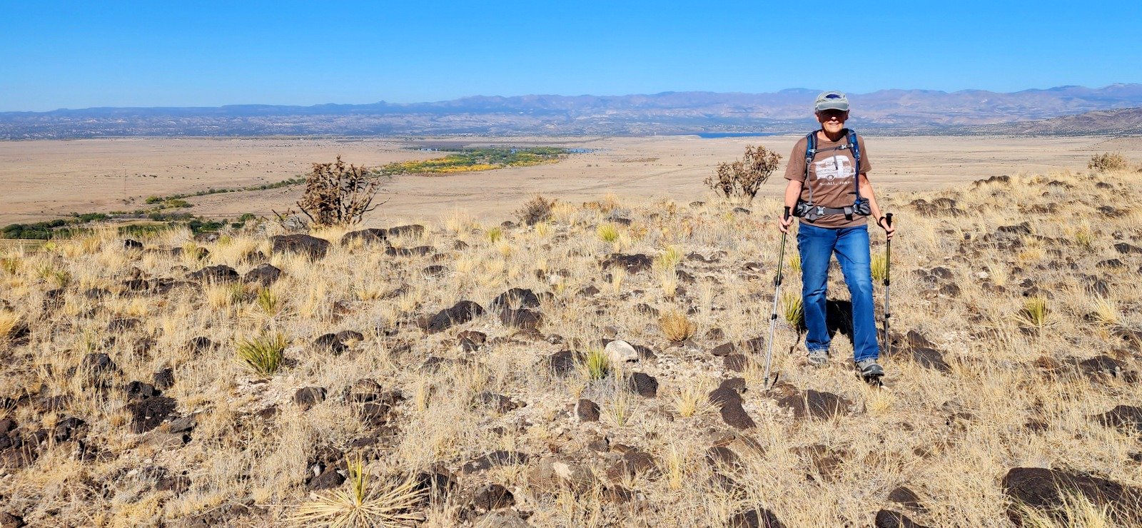
 In so many ways this hike reflects what we enjoy so much about New Mexico. All around us there is history, from the Native Americans to the modern times. Hiking puts us into wildly open spaces with views of mountains, plains, rivers, and (almost) always the vibrant blue of New Mexico skies. And this time of year there are more colors – in the distance the cottonwood trees turning their golden yellow with some trees still green, complemented by some water (Cochiti Lake over Pat’s shoulder) and the skyline of the Jemez Mountains. “Why?”
Statistics
Total Distance: 3.7 miles
Elevation: start 5,507 ft, maximum 6,104 ft, minimum 5,506 ft
Gross gain: 598 ft. Aggregate ascending 796 ft, descending 728 ft
Maximum slope: 58% ascending, 59% descending, 6.8% average
Duration: 3:17, Average Speed: 1.1 mph
| GPS Track Files for Download | |
136 Downloads | |
|---|---|
147 Downloads | |
If you haven’t explored these hiking tracks with Google Earth, I urge you to try it. With the virtual 3-dimensional presentation, achieved by panning and tilting the view, you can get a much better idea of the hikes and terrain than you can get from the screenshot above. For some ideas, check out Using Google Earth Track Files.
Related Posts
References and Resources
National Park Service: New Mexico: La Bajada Mesa
La Bajada Mesa
USDA Forest Service: La Bajada (PDF)
Library of Congress: La Bajada Historic Trails and Roads (1598, 1860s, 1909, 1926)
The Village of La Bajada, NM: About
Trip Advissor: La Bajada Hill
Route 66 Times: La Bajada Hill
The Road Wanderer: Route 66 Side Trip – Exploring La Bajada
AllTrails: La Bajada Trail
Galisteo Basin Archaeology: Galisteo Watershed
Route 66 News: An early image of La Bajada Hill
Photos


