We set out for the Jemez Mountains without a firm plan, except to have breakfast at the Highway 4 Cafe in Jemez Springs. But .. alas it was closed – for the day. Two week prior, on a Monday, we had the same encounter (the Cafe is regularly closed on Monday and Tuesday). To get something for breakfast, we shopped at the market in La Cueva – had canned tuna fish on crackers for breakfast, not satisfactory. So we decided to drive the extra distance to White Rock and breakfast at the Pig and Fig Cafe. That was a good choice, we enjoyed a really nice breakfast.
To make this long story short, having driven past Valles Caldera to White Rock, we decided to hike a trail that I have had in my sights for a few years – the Water Canyon Trail on the western boundary of the Los Alamos installation. In the past I hadn’t set it as a destination because we usually center our activities back at the Caldera and it is a bit of a drive to get here on a windy road. But since were already at White Rock, it made sense to hike it.
The Drive In
Whether coming from the east (Española) or the west (Jemez Springs) on NM 4, find your way to the intersection with NM 501, the road that goes into Los Alamos proper. Turn north on NM 501 where there are two parking places for access to the Water Canyon Trail. The first is a gravel parking area on the left (west side of NM 501) a quarter of a mile from the intersection. The second is a bit further on, nine tenths of a mile a dirt parking area again on the left, a steep area above the road. We encountered this first (coming from Los Alamos) so parked there to start our hike.
The Hike
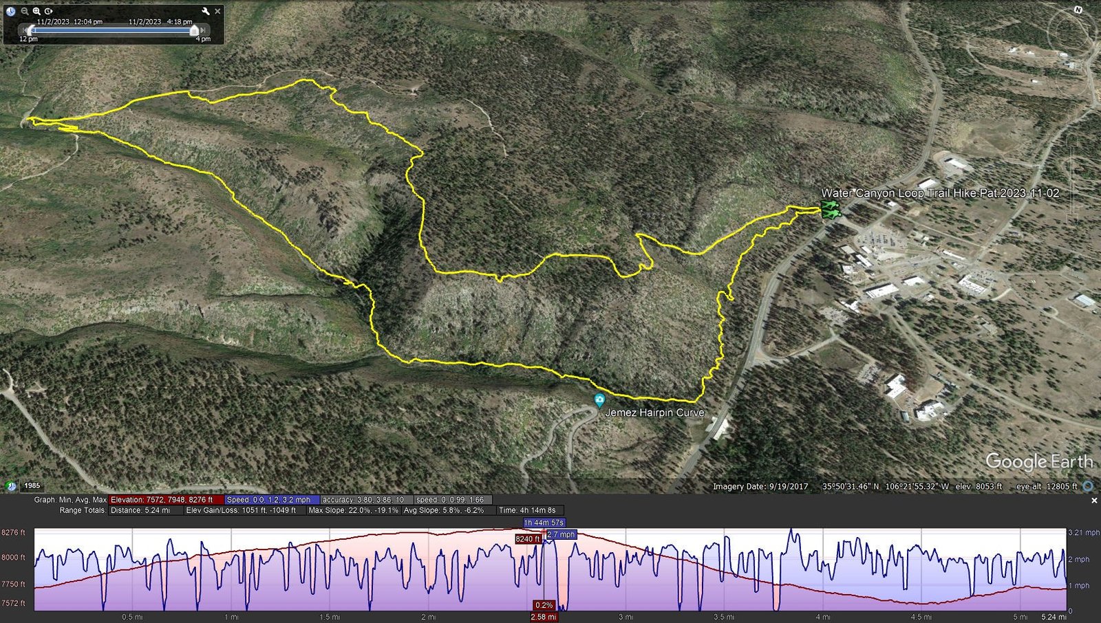
Water Canyon Loop Trail Hike.Pat.2023-11-02
Notes about the Google Earth screenshot: the graph at the bottom shows elevation of the track (pink area) and speed (the blue line).
Alighting from the Tacoma and donning our packs, we headed out on the first thing we saw that looked like a trail. It became clear that it was a 2-track that headed uphill towards the mesa top. A bit rocky it was none the less an easy climb of 300 feet or so over 3/4 of a mile. From there we continued along the edge of the mesa on a mostly smooth trail, passing through a mixed ponderosa and juniper forest with vantage points to look down into Water Canyon.
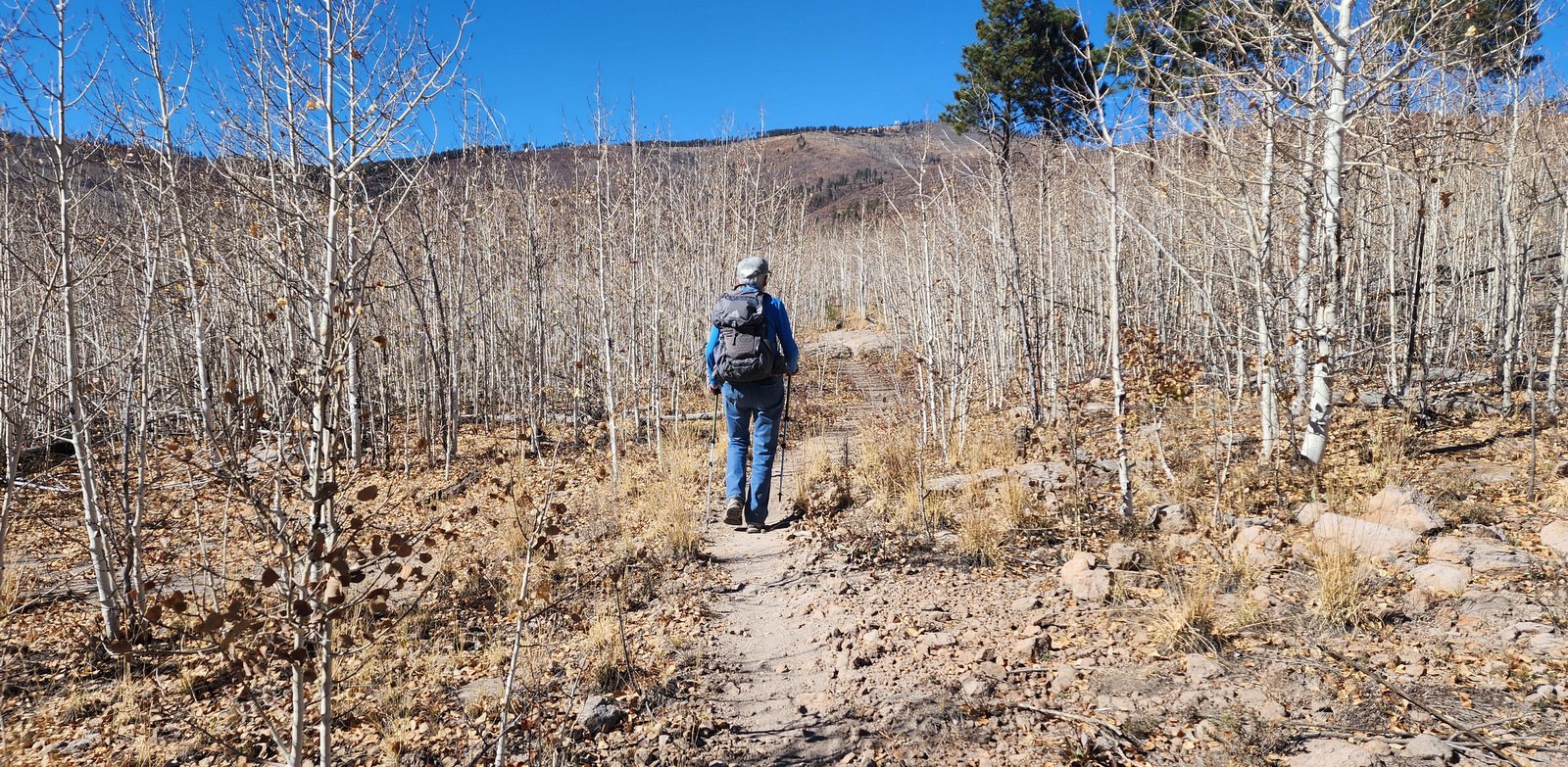
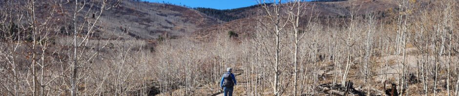
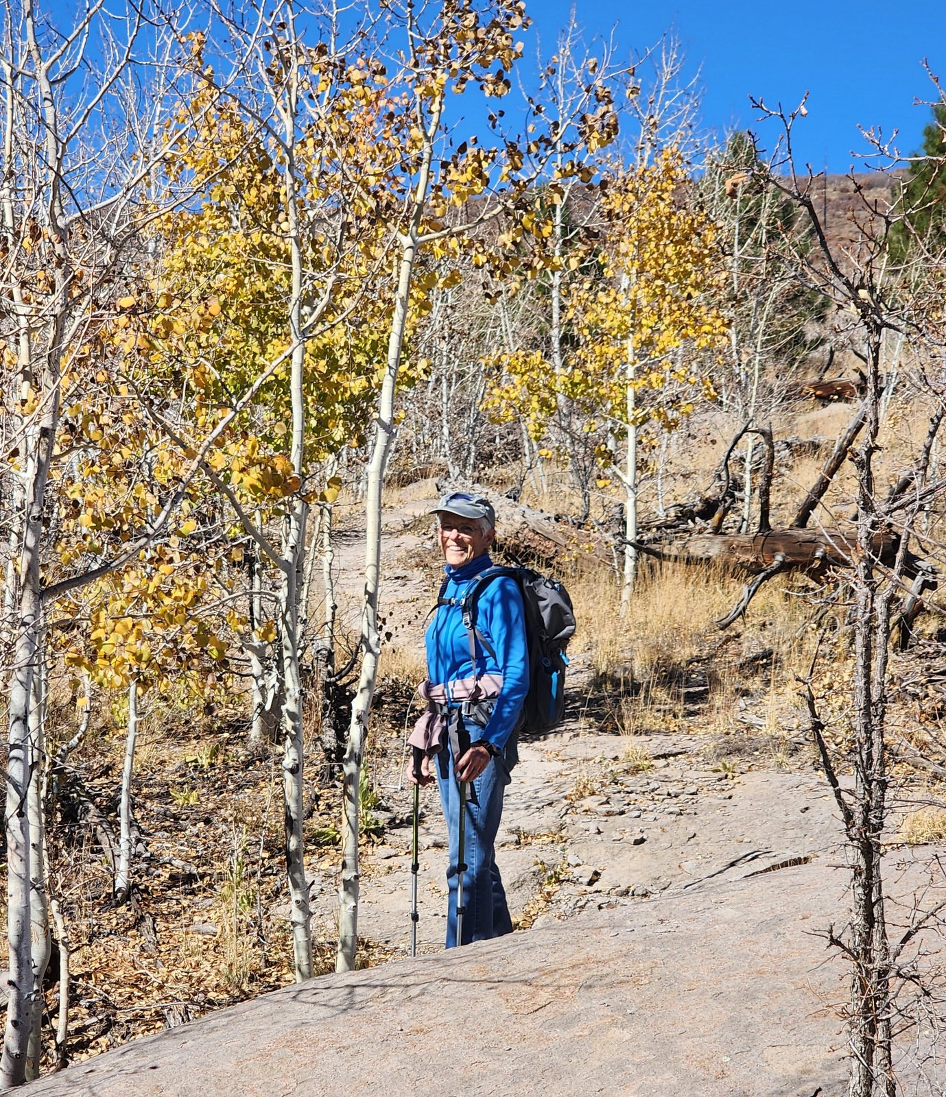 At about 1.5 miles into the hike, we found ourselves passing through thick stands of very young aspen.From a distance, the white twigs of the trees, all having the same height, looked like grass they were so dense and uniform. For the most part their leaves had fallen, ‘tho a few leaves remained; this would be an beautiful colorful hike when the aspen are leafed out, even more so when they have turned into their autumn colors.
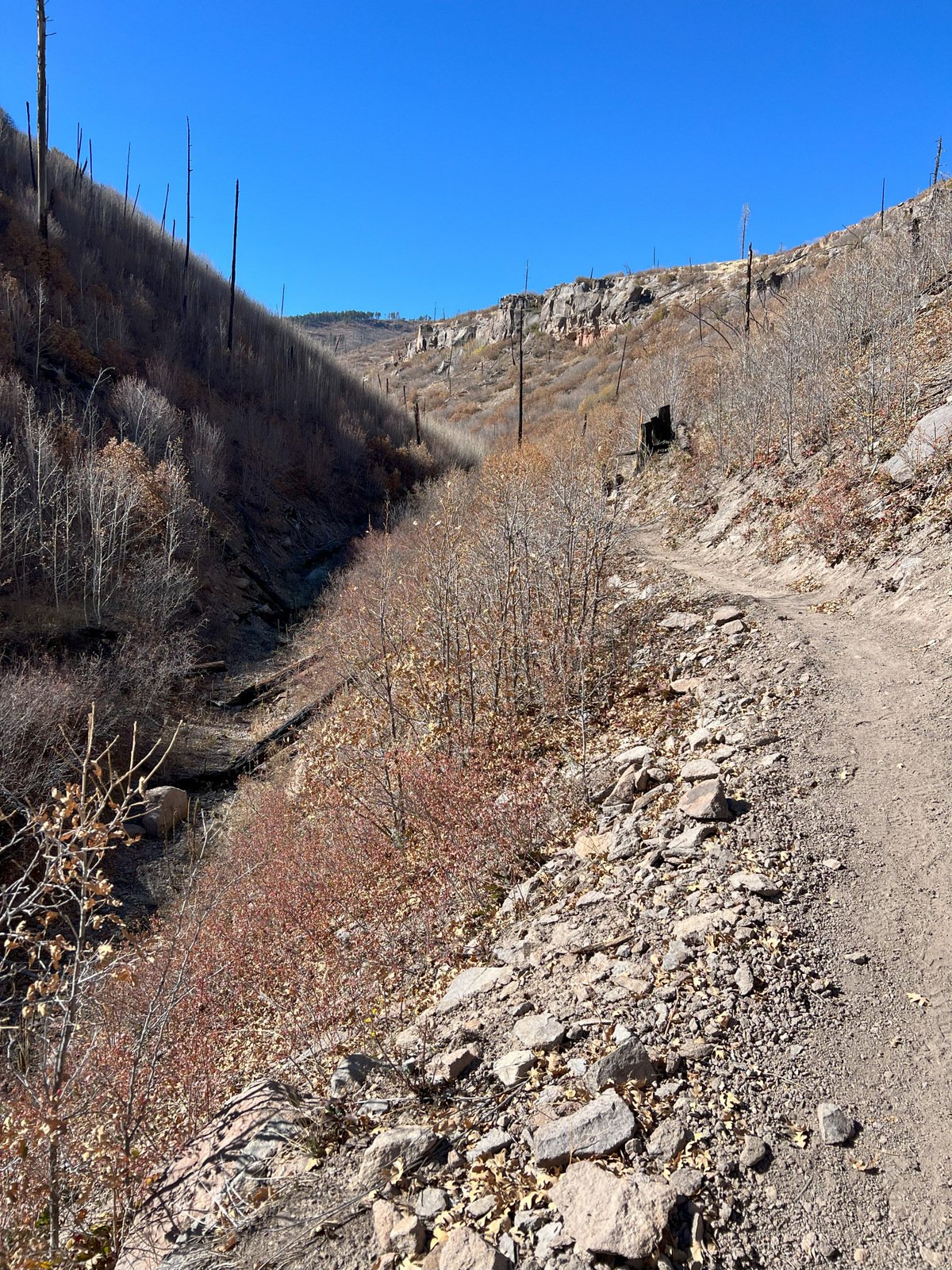 The last 4 tenths of a mile were on a well used Forest Road (American Spring Road) which took us the top of the loop at 2.6 miles. We found the trail off of the road, on the north side of the stream bed, and began our descent down Water Canyon. The canyon is narrow, but the trail-makers created an easy path above the bottom of the canyon. A bit steeper than the other half of the loop, it was an easy descent.
Upon reaching NM 105 and noting that we were at the first parking area mentioned above, we realized the truck was a half mile away … uphill (check the elevation profile on the GoogleEarth snapshot above). That last half mile was a bit of a drag, coming at the end of our hike. In the future we would choose to park at this lower area, hike up the canyon, then have the remainder of the loop downhill.
Highlight
… Checking out new territory.
Statistics
Total Distance: 5.24 miles
Elevation: start 7,714 ft, maximum 8,276 ft, minimum 7,572 ft
Gross gain: 704 ft. Aggregate ascending 1,051 ft, descending 1,049 ft
Maximum slope: 22% ascending, 19% descending, 6.0% average
Duration: 4:14 , Average Speed: 1.2 mph
| GPS Track Files for Download | |
152 Downloads | |
|---|---|
150 Downloads | |
If you haven’t explored these hiking tracks with Google Earth, I urge you to try it. With the virtual 3-dimensional presentation, achieved by panning and tilting the view, you can get a much better idea of the hikes and terrain than you can get from the screenshot above. For some ideas, check out Using Google Earth Track Files.
Related Posts
Other hikes in the area of Bandelier and White Rock.
References and Resources
AllTrails: Water Canyon Trail
Pajarito Environmental Education Center: Upper Water Canyon Trail to the Meadow
Hiking Project: Water Canyon
BeerHiker Prime Passages: Los Alamos Canyon Loop Hike