In reviewing tracks I’d collected from others, I stumbled on this hike for ASCHG. Since weather continues to be cool enough to explore further the Ojito Wilderness, we set Las Milpas as our hike for the day. Of particular interest was the presence of Pueblo Ruins here atop the mesa west of Canada las Milpas.
The Drive In
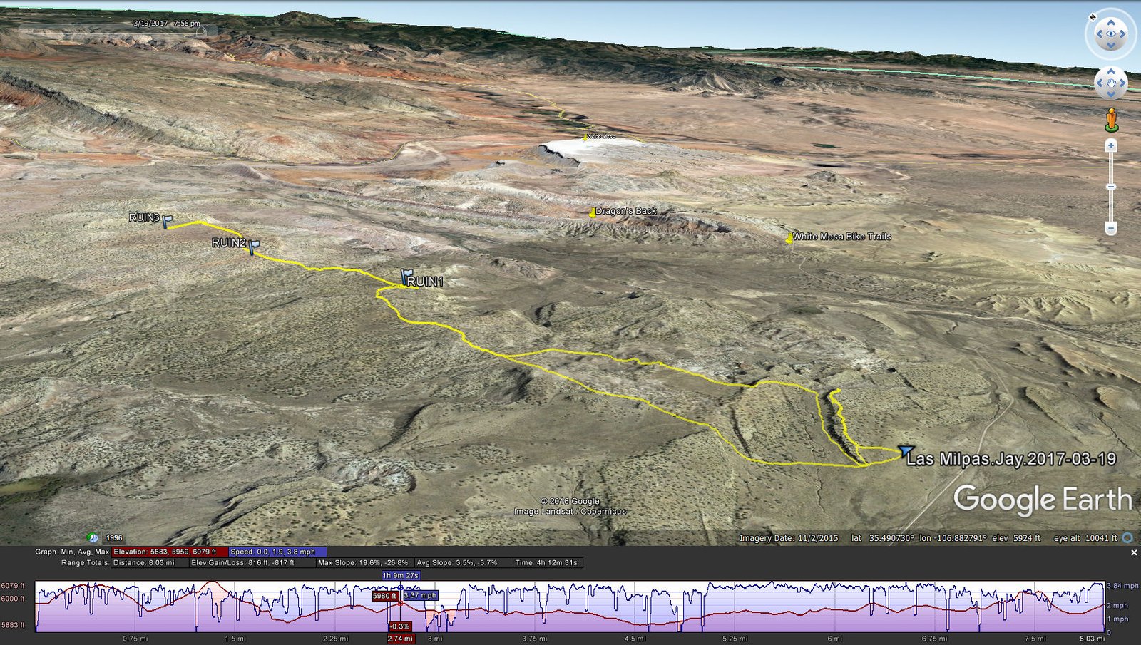
We parked at the Y of a two track a quarter of mile off of Cabezon Road, a starting place different from the ASCHG track.
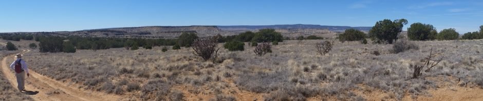
The Hike
Las Milpas Hike.Jay.2017-03-19
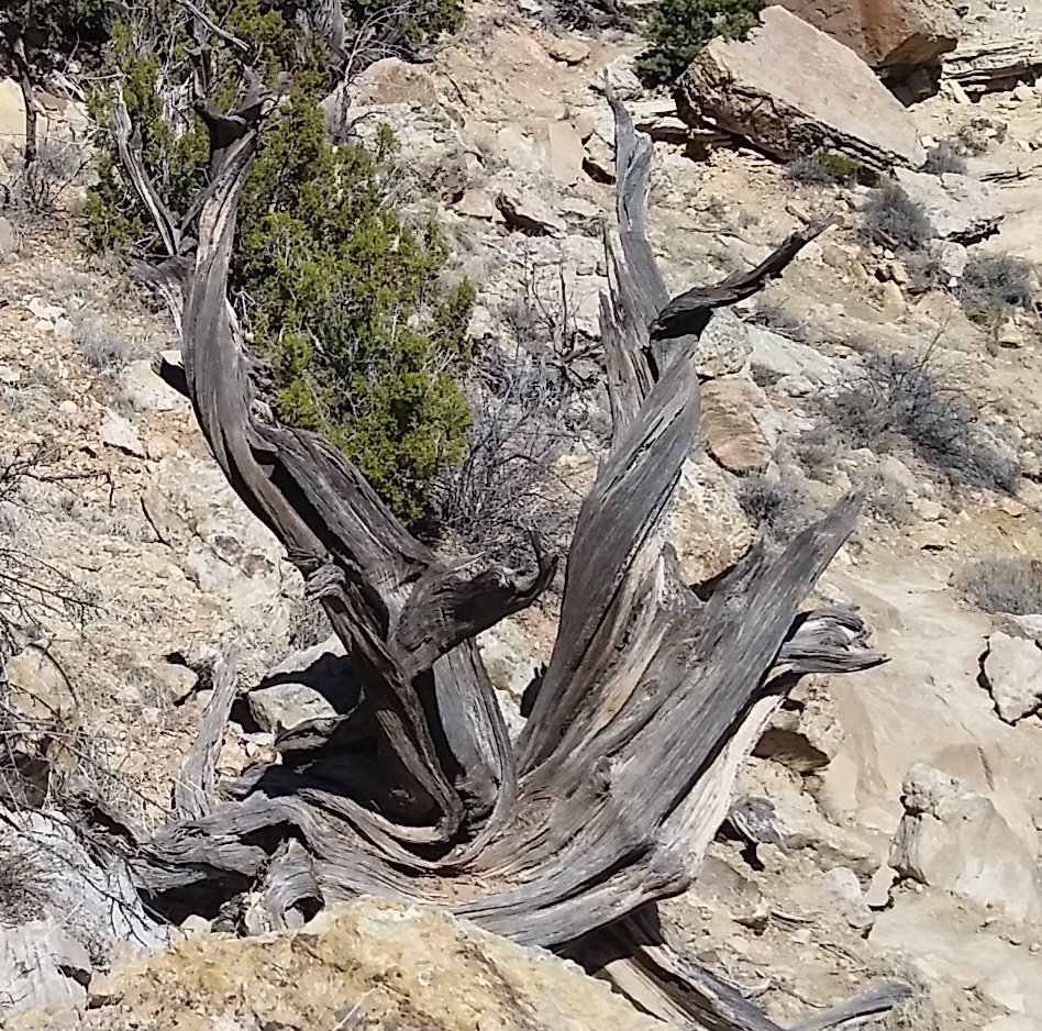
Flora for this hike: This was once a “mighty” Juniper. Now it an example of Mother Nature’s sculptures.
Thinking we’d be able to get to their track, we headed in a northerly direction, along the edge of a mesa. Having gone about .4 mile, we found ourselves at the end of the mesa with no way down into the Canada. So it was backtracking until we were able to descend and head north. We chose to follow the (lower) edge of the mesa until abreast the point where we had turned back. From there, we continued across grassland and a couple of outcrops of rock until hooking up with a two-track headed our way.
We found the first ruins about 2 miles from the end of the backtrack. I would judge this to be a medium size Pueblo ruin, maybe 20 by 50 yards. Most is rubble from the collapsed structure, but there are a few rooms evident with their walls surrounding a chamber. We looked for evidence of a kiva, but found none. From there we returned to the two-track and proceeded .6 mile to the second ruin. This one appeared to be much smaller, maybe 40 yards in length. (But inspecting the area more closely with Google Earth, there is evidence of a much larger area of rubble.) Continuing further north on the two track, using the GPS, we headed off to the west to find the third ruin. This one is very small, appearing to be no more than one or a very few rooms.
Then heading back to the truck, we stopped in some shade (and out of the wind) for our mid-hike break. We followed our outbound track until the two-track headed away from our destination, so we went “cross country” on a more direct route to the truck. This was our longest hike to date, easy enough tho’ with little change in elevation and easy ground, especailly when we were on the two-track. And if one were to start where the ASCHG track begins, the hike could be done entirely on a two-track.
Jay here: Not only was it the longest distance, it was also an impressive amount of ground covered in a short time — something like 8 miles in 3 hours and 22 minutes of actual hiking time. Factor in 15 minutes spent just looking around the first set of ruins, and you get a sense of how fast we were going. It helps to be on level ground for much of the hike but there were still some ascents to make us huff and puff. Sorry that ruins 2 and 3 were disappointing by comparison with ruin 1, but that’s the way the ruins crumble.
Statistics
Total Distance: 8.03 miles
Elevation: start 6,000 ft, maximum 6,079 ft, minimum 5,883 ft
Gross gain: 196 ft. Aggregate ascending 816 ft, descending: 817 ft
Maximum slope: 20% ascending, 27% descending, 4% average
Duration: 4:13
| GPS Track Files for Download | |
239 Downloads | |
|---|---|
247 Downloads | |
I urge you to explore our hiking tracks with Google Earth. With the virtual 3-dimensional presentation, achieved by panning and tilting the view, you can get a much better idea of the hikes and terrain than you can get from the 2-dimensional screenshot above. For assistance: Using Google Earth Track Files.
Related Posts (in the vicinity)
References
BLM Brochure: Ojito Wilderness
BLM: Public Lands – Zia Trust (PDF)
ASCHG: Las Milpas Hike
List of John: Topo map of Canada de Las Milpas


.")


