
This is a delayed posting (May 2018) of a hike at Llano Grande, Oaxaca, Mexico during our first visit to Oaxaca (Jan 2017). We joined a popular group, Hoofing it In Oaxaca who arranges hiking and other expeditions from the Oaxaca Lending Library. Llano Grande is one of the villages in the Pueblos Mancomunados, a consortium of villages offering various services for “ecotourism”. Their activities support the economy of the communities and provide for day-trip, overnite stays, and even multi-day hiking in some beautiful tropical mountains.
The Drive In
The trip begins at the Lending Library in Oaxaca City; a bus of maybe 30 people drives southeast in the valley to Tlacolula de Matamoros, then north into the Sierra Norte to the Zapotec village of Llano Grande. Once out of the valley, the road is narrow and winding, but climbing from 5,300 feet elevation to over 10,000 feet at Llano Grandd. The village has basic facilities for visitors including food services and cabanas for overnight visits.
The Hike
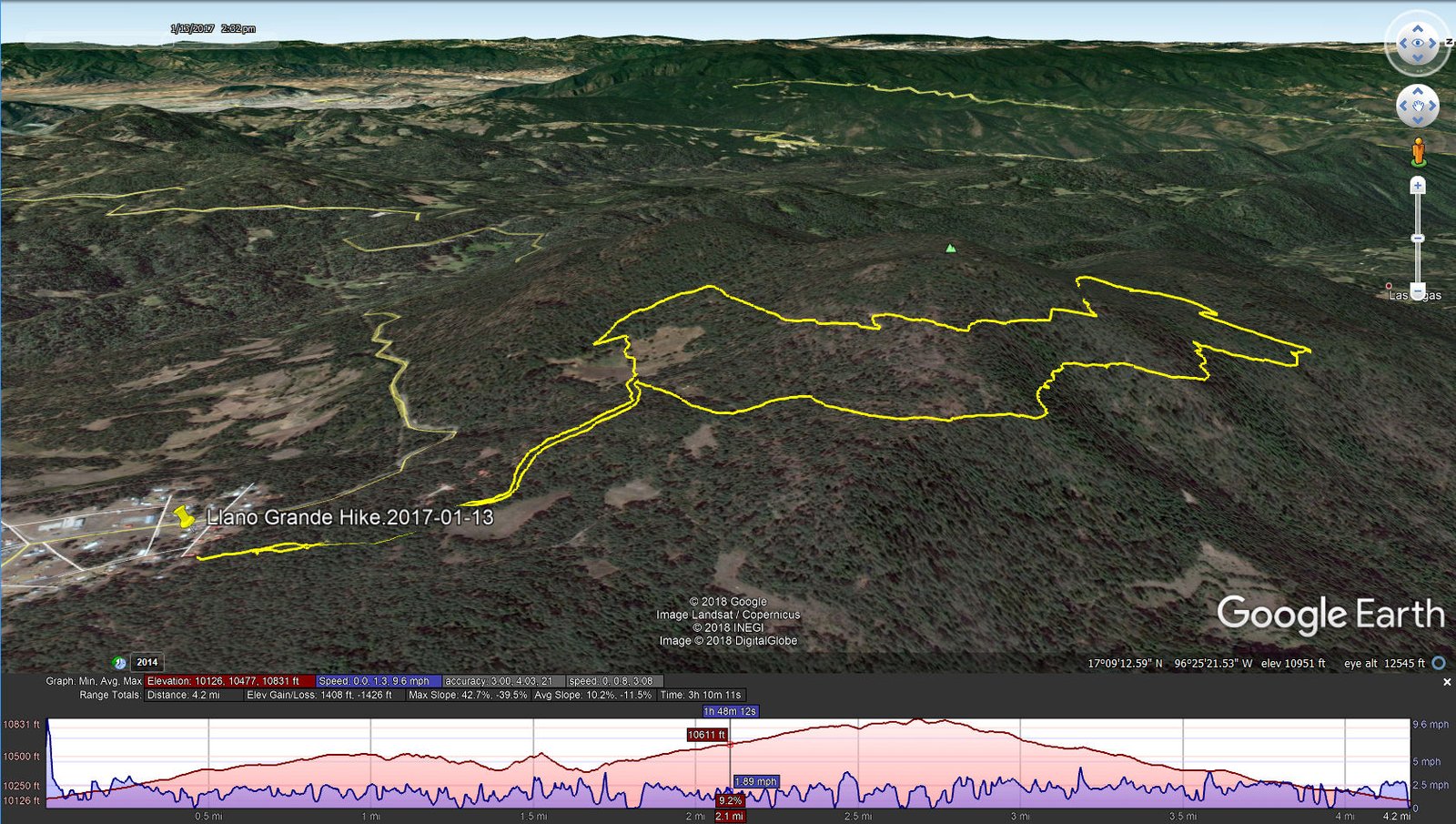
Llano Grande Hike.2017-01-13
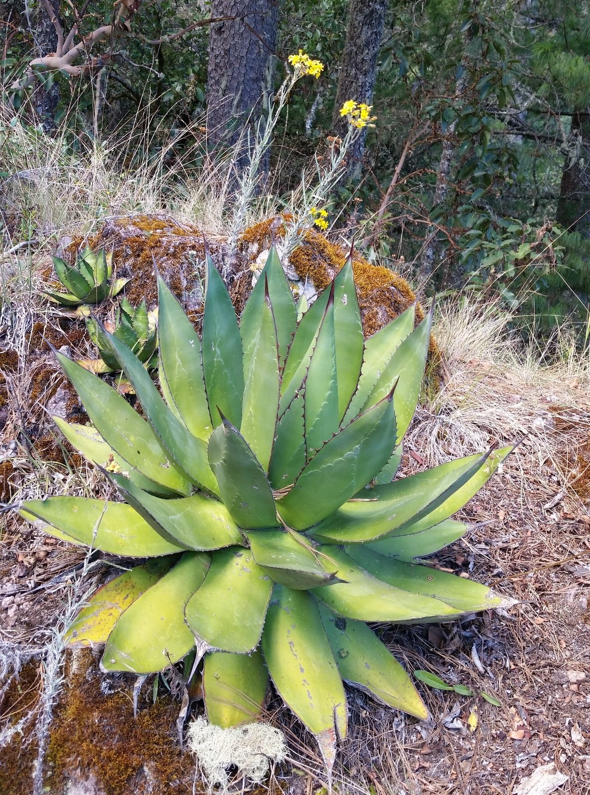
One of the -huge- agave plants
After a bit of time to stretch our legs (etc.), a guide then led us on an easy trail through this high-altitude forest on the slopes of Cerro Yatin. ‘Tho I’m not versed in such matters I would described it as a rain forest – lots of Spanish moss, fairly thick undergrowth, many flowering plants (some like we have here in NM), and >> huge agave plants (special as that is the plant used for making mezcal).
At this altitude the weather was quite pleasant – warm (not hot) and bright & sunny. The trail – smooth surface. ‘Tho a significant elevation change, no steep slopes. We enjoyed a break midway through the hike, and a pleasant light meal upon returning the the village.
Statistics
Total Distance: 4.19 miles
Elevation: start 10,126 ft, maximum 10,830 ft, minimum 10,126 ft
Gross gain: 704 ft. Aggregate ascending 1,396 ft, descending 1,414 ft
Maximum slope: 45% ascending, 39% descending, 11% average
Duration: 3:10
| GPS Track Files for Download | |
224 Downloads | |
|---|---|
182 Downloads | |
302 Downloads | |
184 Downloads | |
I urge you to explore our hiking tracks with Google Earth. With the virtual 3-dimensional presentation, achieved by panning and tilting the view, you can get a much better idea of the hikes and terrain than you can get from the 2-dimensional screenshot above. For assistance: Using Google Earth Track Files.
References
SierraNorte.org: Expediciones Sierra Norte – Pueblos Mancomunados Oaxaca
Things to do in Oaxaca: Llano Grande – Sierra Norte, Oaxaca
TripAdvisor: Pueblos Mancomunados
The Independent:
How to Have a Mexican Adventure without Destroying the Local Communities
The Sweetest Way: Los Pueblos Mancomunados: Hiking in Oaxaca State


