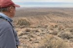
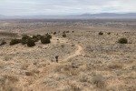
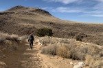
‘Tis winter, a weekday for hiking, we chose a place close to home. But this is another that we have driven past many times (like Seville NWR), sometimes wondering about hiking there.
The Drive In
On I-25 to Los Lunas, turn wests on NM 6. About 1 mile on, turn left (south) on Huning Ranch Loop SW (don’t turn at the 1st intersection for Huning Ranch Loop SW, go to the 2nd intersection). About .75 miles south on Huning Ranch, turn right on Lonestar St SW. To get to the start of our hike, turn left at the ‘T’, right again at the next intersection, and left again at the ‘T’; park in the circle. We took the trail that proceed south, down into an arroyo and then a steep climb up a very sandy trail.
The Hike
 Our hike began with a steep descent into an arroyo, then a steep climb up a very sandy trail. From there it was a steady climb on a sometimes rocky trail. And this trail is exposed with no cover, no juniper, a few cholla. The views are great, northeast to the Sandias, north to the Jemez, east across the Rio Grande valley to the Manzanos, and west across the Isleta Indian Reservation and beyond the Rio Puerco valley and Mount Taylor in the distance.
 We topped out on El Cerro de Los Lunas, discovering a tall rock cairn marking the spot. The weather this day was a bit chilly and windy, not the most common conditions for New Mexico, so we didn’t dally long. On the return, at a ‘Y’ in the trail we bore to the left which turned out to be a bit shorter route than on the way up. We found along the way enough of a juniper to shelter us from the wind, where we had our mid-hike break.
Highlight
Los Lunas Hills make for a good workout, close to Albuquerque, easy access from I-25, and offers a different vantage point for viewing the territory south of the city. And there are numerous well-used trails one can follow to further explore Los Lunas Hills.
Statistics
Total Distance: 3.47 miles
Elevation: start 5,097 ft, maximum 5,955 ft, minimum 5,057 ft
Gross gain: 898 ft. Aggregate ascending 1,026 ft, descending 5,955 ft
Maximum slope: 36% ascending, 38% descending, 10.9% average
Duration: 3:06
| GPS Track Files for Download | |
130 Downloads |
|
|---|---|
130 Downloads |
|
124 Downloads |
|
0 Downloads |
|
If you haven’t explored these hiking tracks with Google Earth, I urge you to try it. With the virtual 3-dimensional presentation, achieved by panning and tilting the view, you can get a much better idea of the hikes and terrain than you can get from the screenshot above. For some ideas, check out Using Google Earth Track Files.
References and Resources
Village of Los Lunas: Hiking Trails, download enlarged map
AllTrails: Los Lunas Hill from Huning Ranch


