Exploring again new territory, this trip the periphery of the Los Piños mountain range south of the Manzanos. I did a lot of planning to identify the roads we would use and anticipating a mixture of private, state, and federal lands, to identify land ownership.
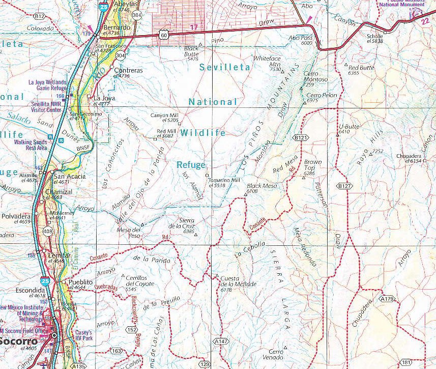
 One resource was the “New Mexico Road & Recreation Atlas” (Benchmark Maps). These maps identify roads that are more likely to be Class 3.
- Of course, GoogleEarth to get an idea of the topography and even to assess the condition of the roads (yes, GE is -that- good).
 And GoogleEarth with the Land Ownershiop overlay, giving us information with which to anticipate what kind of access we would have.
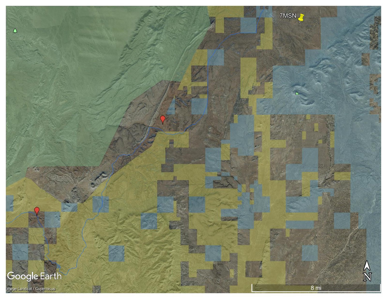
So, with printouts of these two images plus US Topo on the tablet and smartphone, we set out on this adventure.
The Drive In
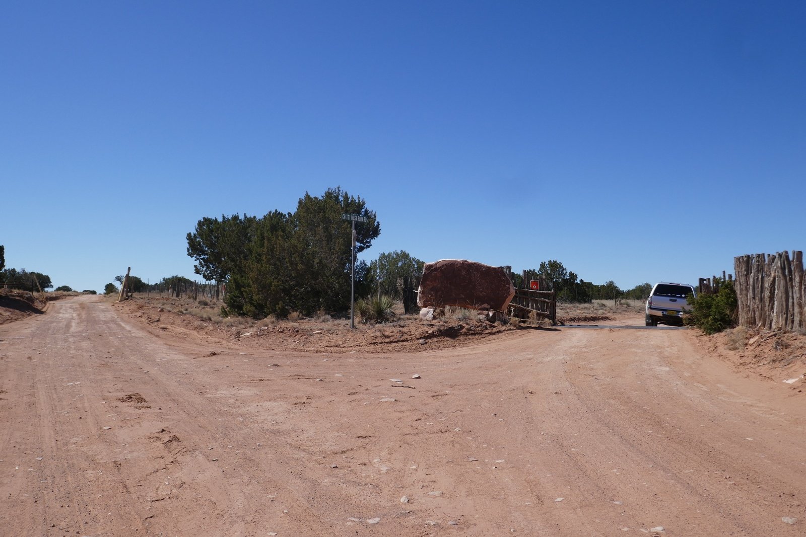
Junction, CR 127 to CR 121
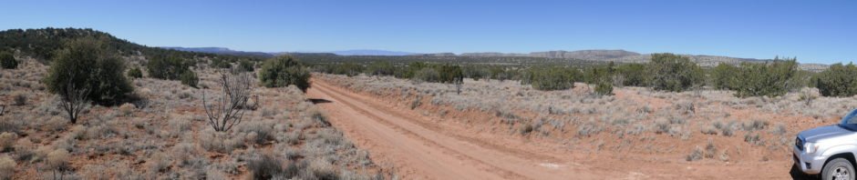
The Los Piños range runs parallel to the Rio Grande, south of US 60 on the way to Abo and Mountainair: I-25 south to Belen, NM 47 to US 60, then 3.8 miles to turn right (south) on BLM B127 (or CR 127) for 5 miles, then right on B121 (or CR 121) – Red Mesa Rd. Leaving US 60 we drive past a few buildings; after that one ranchstead and — open space — in primarily juniper “forest”. A couple of miles in we entered the Lazy JS ranch. Road conditions were as we expected (hoped for?) – graded, sanded, with only a few spots where there were ruts from traffic when it was wet.
We had in mind driving through to Escondida, but as has been our practice, when we see a spot that might make an interesting hike or walkabout, we take it.
The Hike
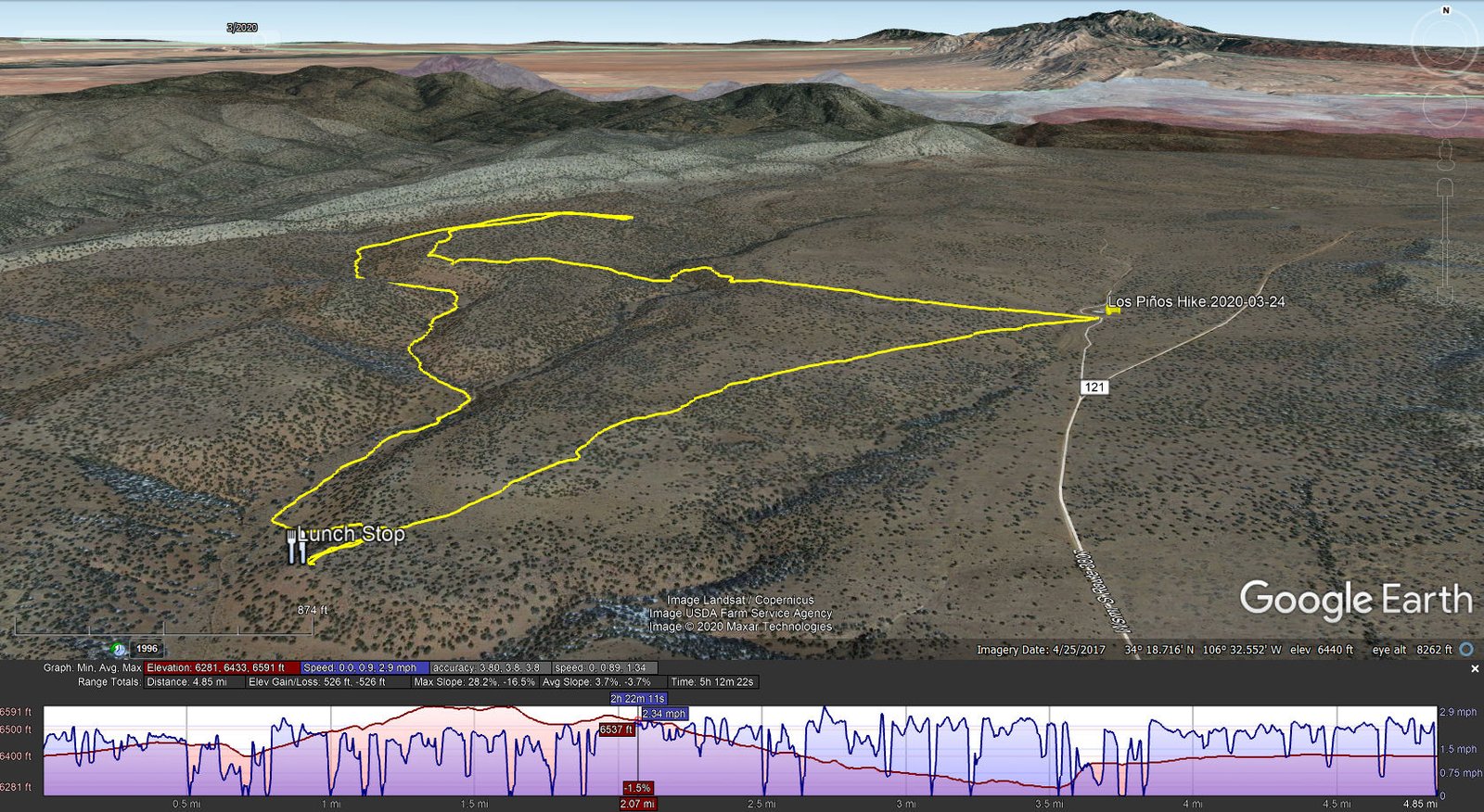
Los Piños Hike.Pat.2020-03-24
As we proceeded down CR 121, we noted that much of the land further south was private, but that there were state and BLM lands scattered along the route. We identified three places where BLM or state land adjoined the road. We decided to take one of those which would allow us to gain access to the Sevilleta NationalWildlife Refuge. Our first choice was blocked by fencing, so we returned to another opportunity where there was no fence along the road. In particular, a two-track led away from CR 121 to a dam/tank where we parked to commence our hike.
With the idea we would explore the territory, going as far as a long ridge that shows prominently on GoogleEarth, we set on a track of 260 degrees magnetic (but truth be told, we use the GPS to guide even on a bushwhacking track). ‘Twas easy walking among the sparse juniper trees, often on soil still soft from the winter freeze/melt cycles, in some places over terrain a bit rocky. We intended to get to the top of Entraniosa Draw, but a fence at the edge of this BLM land forced us to cross where the sides were still a bit steep.
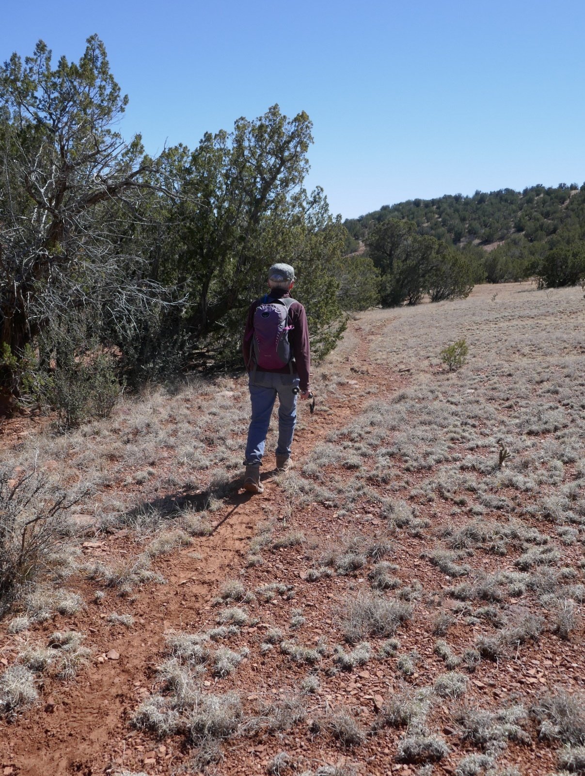
Game trails are quite nice
Out of the Draw we continued, crossing another fence and proceeded along a ridge with a steep slope to our right. Some 2 miles in we stopped for the first of two mid-hike breaks we’d planned. After consulting with US Topo, we chose to return by a route that would avoid the steep sides of Entraniosa Draw. This proved to be much easier ‘tho was a greater distance back to the truck. Here we found numerous game tracks that made it even easier.
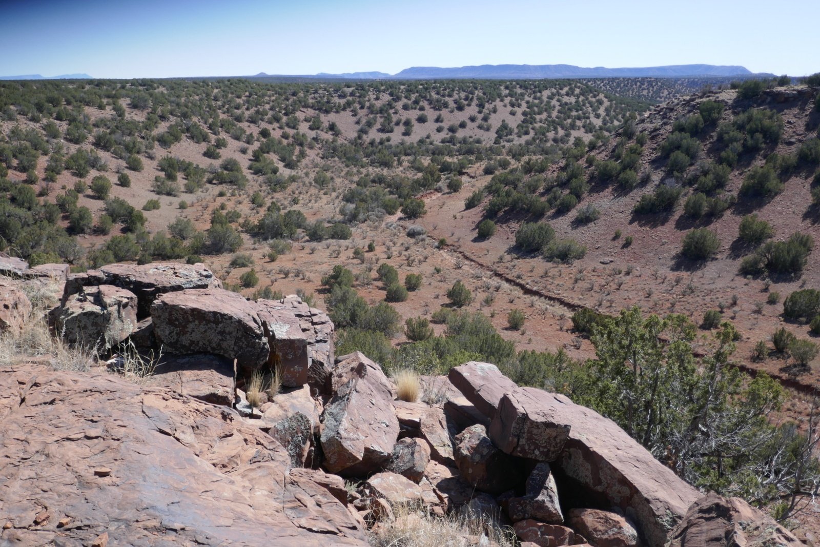
The view for lunch looking southeast down Entraniosa Draw
It being necessary to get back on ‘high ground’ we selected a relatively easy slope to climb. Having seen a promontory at the end of the ridge before climbing up, we headed there for our 2nd break, this one .. lunch. It proved to be a good choice with a great view down the lower section of Entraniosa Draw and to the horizon. The chicken ramen soup, carrots and apple slices, and PB&J were enjoyed very much.
The hike back to the truck was through the same open juniper ‘forest’, on an easy walking surface. We enjoyed another great day hiking in New Mexico’s open spaces.
Statistics
Total Distance: 4.85 miles
Elevation: start 6,402 ft, maximum 6,591 ft, minimum 6,281 ft
Gross gain: 310 ft. Aggregate ascending 526 ft, descending 526 ft
Maximum slope: 28% ascending, 17% descending, 3.7% average
Duration: 5:12
| GPS Track Files for Download | |
289 Downloads | |
|---|---|
211 Downloads | |
213 Downloads | |
174 Downloads | |