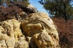
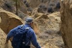
Back to the Cuba area, to explore a small mesa between Mesa de Cuba and Mesa Chijuilla. As I’ve done for other hikes recently, in the absence of a track someone has published, I began by exploring the area on Google Earth (GE), looking for interesting features (and terrain that is navigable). Then I sketched a proposed track for our hike; for this one I included an alternate, shorter track. I then loaded this sketch track into US Topo in my Android/GPS phone to use as a reference during the hike itself.
The Drive In
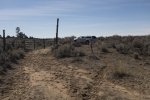
To get to our starting point for this hike, take US 550 west from Bernalillo to the southern outskirts of Cuba, left onto NM 197 for 5.5 miles, then right through an open gate onto a dirt road. At about 2 miles. At Y bear left for 1.1 miles, crossing cross Arroyo Chijuilla. Then turn a hard right up a two track for another mile or so. Choose your place to park and head east toward what I’m calling Mesa de Cuba West. We angled further northeast on another two-track, until we came to a locked gate, parked there, and embarked on our hike. (There are other two-tracks in the area, you can check them out on a Topo Map at https://www.listsofjohn.com/mapf?lat=35.9924&lon=-107.0114&z=14&t=u&l=lm&d=y).
The Hike
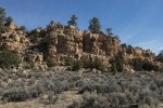
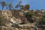
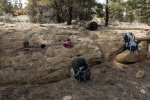
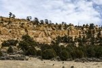
We had anticipated that our biggest challenge would be getting up onto (or down from) the mesa top. From GE and the Topo Maps, it seemed the west side would be most challenging, so we decided on a clockwise hike (based on the Sketch), starting on the west edge of the mesa. We headed north looking for a place where we might ascend. A quarter of mile on we spotted a cow/game path that appeared to head up through a break in the cliff (it happened to be the same place where my reconnoitering with GE and TOPO that suggested we could ascend). Those animals figure it out – we were able to get on top with relative ease.
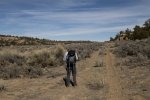
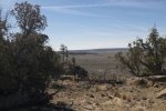
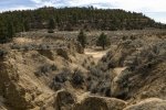
The mesa top is sparsely forested and easy going. Impressive views, like so many in these parts, are all around – the other mesas, open spaces, the Nasciementos, and at times Cabezon. We opted to take the shortened track rather than climbing up to the central ridge of the Mesa; for a future hike. We continued along the line of the alternate path in the Sketch towards the northeast corner of the mesa, finding and following a nice (old) two-track which made an easy descent into Arroyo Chiluillita where we enjoyed our mid-hike break. Then it was a 2.25 mile trek around the south end of Mesa de Cuba West back to the truck. Along the way we crossed a few sometimes deep arroyos coming down from the mesa, later picking up a two-track that made the going easier.
Jay here: Long way back is what I remember most. That and some deep sandy segments that were like walking on a beach. Which is not to say I didn’t enjoy the hike…just that there were times that I had to remind myself why we were out there.
Statistics
Total Distance: 6.54 miles
Elevation: start 6,944 ft, maximum 7,344 ft, minimum 6,944 ft
Gross gain: 400 ft. Aggregate ascending 928 ft, descending 927 ft
Maximum slope: 33% ascending, 24% descending, 4.8% average
Duration: 3:59
| GPS Track Files for Download | |
256 Downloads |
|
|---|---|
233 Downloads |
|
396 Downloads |
|
218 Downloads |
|
I urge you to explore our hiking tracks with Google Earth. With the virtual 3-dimensional presentation, achieved by panning and tilting the view, you can get a much better idea of the hikes and terrain than you can get from the 2-dimensional screenshot above. For assistance: Using Google Earth Track Files.
References
New Mexico Magazine: Badlands Walkabout
The American Southwest: San Juan Basin Badlands
Map of the San Juan Basin Badlands
Jim Caffrey Images Photo Blog: The Other Badlands
AllTrails: Mesa Chijuilla


