Our goal was to get in a hike on the first day of our return from Tucson to Albuquerque, planning to spend the night at one of our favorite BnBs, D and D’s Organic Haven in Pleasanton, near Glenwood, NM. After extensive research, we tracked down trails in the Pinaleno Mountains of the Coronado National Forest in east central Arizona. Some of the more intriguing trails were far into the Pinalenos, but reviewing road and topo maps led us to judge the road would be challenging, not for our appetite. But there were a couple of trails along the road before it started climbing the mountansides: Ladybug Trail and Noon Creek/Noon Creek Ridge Trails (also identified as Round the Mountain Trail, and Sky Islands Traverse on GoogleEarth). We chose the latter expecting that it would afford better views.
The Drive In
To get to the trailhead, drive 7 miles south on US 191 from Safford to Swift Trail Junction. Turn left on AZ 366, Swift Trail, for about 8 miles to the Noon Creek Picnic Area/Campground.
The Hike
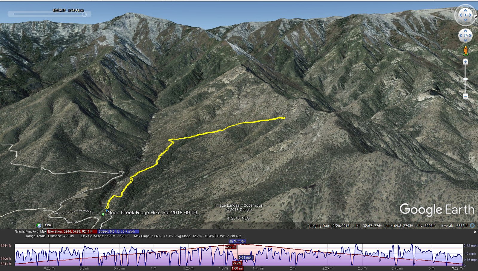
Noon Creek-Ridge Hike.Pat.2018-09-03
 The first 3/4ths of a mile or so is on the Noon Creek Trail, quite well used, easy going. Along this stretch we could hear water running in Noon Creek, but there wasn’t anyplace that afforded access. We then turned right to ascend on Round the Mountain Trail (both seem to be marked #302). Still a good trail surface, were then going uphill which continued at an even slope for as far as we went.
We set our sights on getting to the top of Noon Creek Ridge. But the trail became gradually less well traveled, occasionally quite narrow with steep drop-off or covered with brush. At 1.6 miles we encountered -very thick- brush which obstructed our further progress. and because it was a narrow section with very steep drop-off, we decided to go no further.
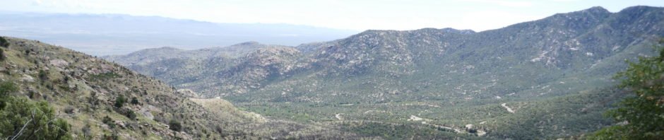
 Despite not getting to the top of the ridge, we enjoyed fabulous views across the canyon of Noon Creek, and across the plains and San Simon River to the east and beyond the White Rock and Peloncillo Mountains.
Statistics
Total Distance: 3.22 miles
Elevation: start 5,244 ft, maximum 6,244 ft, minimum 5,244 ft
Gross gain: 1,000 ft. Aggregate ascending 1,129 ft, descending 1,129 ft
Maximum slope: 32% ascending, 47% descending, 12% average
Duration: 3:04
| GPS Track Files for Download | |
230 Downloads | |
|---|---|
231 Downloads | |
I urge you to explore our hiking tracks with Google Earth. With the virtual 3-dimensional presentation, achieved by panning and tilting the view, you can get a much better idea of the hikes and terrain than you can get from the 2-dimensional screenshot above. For assistance: Using Google Earth Track Files.
References
Trails.com: Noon Creek Trail 302A
Forest Service: Noon Creek Picnic Area


