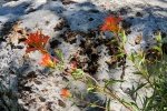
After our hike to the summit of Mount Taylor (11,300 feet), having found we aren’t acclimated to the thinner air, we returned to a higher elevation than other trails – North Crest Trail on the Sandia Mountains(starts at 10,660 ft). The trailhead is at the north end of the parking lot for the Sandia Crest House.
The Hike
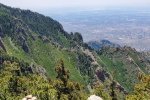
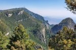
The trail begins by skirting the downhill (east) side of the radio antenna compound. A half mile along it follows along the edge of the Crest. A mile down the trail we chose a Y to the left that kept us “on the edge” and afforded us the best views of the various features on this west side of Sandia and across the Rio Grande valley: Albuquerque, the West Mesa, Tierra Grande beyond Kirtland AFB & the Sunport to the south, and the Jemez Mountains in the distance to the northwest – spectacular (tho’ limited this day by smoke in the lower atmosphere from fires in Arizona).
About 2 miles another Y presents itself: to the right to continue on the North Crest Trail to the Del Agua Cañon Overlook (and ultimately to Placitas), or to the left a less used trail to the summit of North Sandia Peak (10,447 ft); we chose the Peak (we had done the former back in 2017). This leg of the Y was a bit difficult to identify because it began with a short rock scramble, not easy to identify -the- trail. Beyond that, as it is all along the Trail, the slope to the summit was gradual and easy. We paused at the Peak for our mid-hike break, then made the return to the trailhead, hopefully having gained some acclimatization to thinner air.
Statistics
Total Distance: 4.26 miles
Elevation: start 10,660 ft, maximum 10,660 ft, minimum 10,214 ft
Gross gain: 446 ft. Aggregate ascending 1,518 ft, descending 1,524 ft
Maximum slope: 45% ascending, 54% descending, 10.9% average
Duration: 4:06
| GPS Track Files for Download | |
205 Downloads |
|
|---|---|
110 Downloads |
|
I urge you to explore our hiking tracks with Google Earth. With the virtual 3-dimensional presentation, achieved by panning and tilting the view, you can get a much better idea of the hikes and terrain than you can get from the 2-dimensional screenshot above. For assistance: Using Google Earth Track Files.
References and Resources:
AllTrails: North Sandia Peak Trail
North Crest Trail
SummitPost: North Sandia Peak
ondafringe: Day Hike: North Crest Trail to Del Agua Canyon Overlook
Visit Albuquerque: Some of the Best Hiking Trails in & Near Albuquerque


