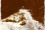
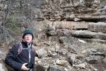
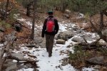
Got a late start today, so chose a trail close to Albuquerque, plus rain and snow yesterday would have made unpaved roads too difficult. We’ve avoided these trails up South 14 out of Tijeras because they are used so much by mountain bikers. But today, with the muddy and in many places slushy snow on the trail, the bikers were not out.
The Hike

Otero Canyon.Jay.2017-01-02 – In the Manzanita Mountains; the south end of Manzano Mountains can be seen on the horizon.
Temperature was cool (low 40s) but no wind on the trail, and with moderate cold weather clothing we were quite comfortable. As mentioned, mud, slush, and some soft ice were the order of the day. The trail goes up Otero Canyon, the climbs to the ridge north of the canyon, and returns to the parking area. Surface is almost entirely soil, tho’ if one sticks to the canyon bottom it is rock covered (which we did in sections to avoid the often very muddy trail proper). There are no steep sections (great for the bikers?) thanks to good switchbacks climbing out 0f the canyon.
This makes for a really good hike for the less athletic (or enthusiastic), when the mountain bikers aren’t out in force.
Jay here: The mud, ice and snow made for an intimidating hike experience. I kept thinking that we would reach some point on the trail that was just impassable due to the depth of the mud or danger of ice. In that respect it was another example of pushing beyond one’s comfort zone. When we got back to the trailhead it took us 10 minutes to scrape the mud off the bottom and sides of our boots. Next time there’s the prospect of mud, we’re bringing shoes to change into.
Statistics
Total Distance: 5.06 miles
Elevation: 6,820 start, 7,357 maximum, 5794 minimum
Gross gain: 537 ft. Aggregate ascending 1,015 ft, descending: 1,015 ft
Maximum slope: 28% ascending, 32% descending, 6% average
Duration: 3:05
| GPS Track Files for Download | |
221 Downloads |
|
|---|---|
130 Downloads |
|
If you haven’t explored these hiking tracks with Google Earth, I urge you to try it. With the virtual 3-dimensional presentation, achieved by panning and tilting the view, you can get a much better idea of the hikes and terrain than you can get from the screenshot above. For some ideas, check out Using Google Earth Track Files.
References
ASCHG: Otero Canyon West Loop
Cibola National Forest: Otero Trailhead
MTB Project: Otero Canyon – Great photos are posted here.


