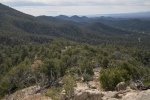
With just a short day for hiking, we remained close to Santa Fe, and continued our exploration of the Dale Ball Trails; it is quite nice having many nice trails so close. Embarked on one new to us – the Picachco Peak trail.
The Drive In
The trail begins at the Cerro Gordo Trailhead: proceed up Upper Canyon Rd, turn left on Cerro Gordo Rd for the parking lot. Cross Upper Canyon Rd for the start of the trail.
The Hike
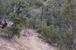
The start of the trail passes through private property so stay on it. It is a well used trail and is easy .. to follow and to tread upon.Some 700 feet into the hike the trail takes to the top of a high berm, what appears to be the downhill edge of an acequia. Along the way we encountered a sign that explained some history of this “Hydropower Ditch”. The trail then turns into an arroyo and begins the climb towards Picacho Peak. It is a reasonably steady climb, rising the 1,210 feet in 2 miles; up the arroyo, over a ridge and across another arroyo, then up a ridgeline to the peak.
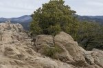
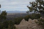
The trail is in good condition throughout; only a few sections that are steeper over large rocks. A couple of places where the trail topped a ridge, the views across Santa Fe to the Jemez Mountains were great (‘tho haze restricted the scenic-ness of the views on this day). This should be a great trail for winter hiking (avoiding recent snowfall), but is quite exposed and I expect it would be hot in the summertime.
Jay here: This was my second time on this trail, but the first time all the way to the peak. It’s pronounced pea-ka-cho, by the way, and it’s really a gem for it to be so close to Santa Fe. There are many more variations to the trail within the Dale Ball system, so you can make it a more lengthy and challenging hike if you so desire. I was fine with the length just the way it was.
Statistics
Total Distance: 3.88 miles
Elevation: start 7,318 ft, maximum 8,528 ft, minimum 7,318 ft
Gross gain: 1,210 ft. Aggregate ascending 1,865 ft, descending 1,876 ft
Maximum slope: 62% ascending, 59% descending, 15.7% average
Duration: 3:14
| GPS Track Files for Download | |
165 Downloads |
|
|---|---|
161 Downloads |
|
I urge you to explore our hiking tracks with Google Earth. With the virtual 3-dimensional presentation, achieved by panning and tilting the view, you can get a much better idea of the hikes and terrain than you can get from the 2-dimensional screenshot above. For assistance: Using Google Earth Track Files.
References and Resources
Santa Fe County: Foothill Trails (pdf)
AllTrails: Pichaco Peak Trail
SkyAboveUs: Great Hikes: Picacho Peak, Sante Fe, New Mexico
Inn on the Alameda: The Dale Ball Trails: Picacho Peak


