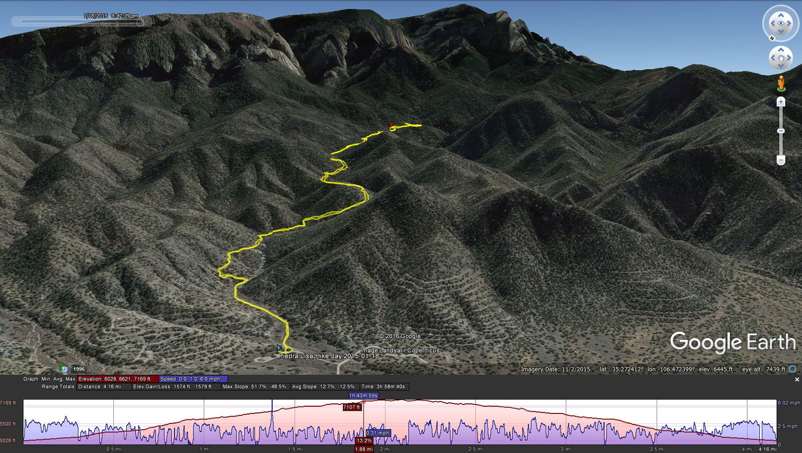
Piedra Lisa North Hike.Jay.2015-01-18
Statistics
Total Distance: 4.13 miles
Elevation: start 6,021 ft, maximum 7,161 ft, minimum 6,021 ft
Gross gain: 1,140 ft. Aggregate ascending 1,559 ft, descending 1,566 ft
Maximum slope: 48% ascending, 50% descending, 12% average
Duration: 3:59
| GPS Track Files for Download | |
321 Downloads | |
|---|---|
157 Downloads | |
If you haven’t explored these hiking tracks with Google Earth, I urge you to try it. With the virtual 3-dimensional presentation, achieved by panning and tilting the view, you can get a much better idea of the hikes and terrain than you can get from the screenshot above. For some ideas, check out Using Google Earth Track Files.


