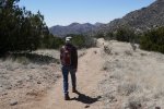
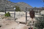
For this hike, Pat & I sought a trail a bit easier than last week’s hike on Three Gun Springs. We’ve hiked the Pino Trail more than once in the past – it was likely the first -real- hike we took after moving to Albuquerque in 2010. The image to the right is a screenshot with placemarks identifying the turnaround point on hikes that year.
The Hike
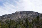
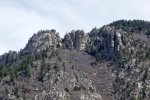
‘Twas our recollection that Pino is a gentle, continuous slope so we could get -some- elevation gain without much strain. And the views of the northern Sandias above us and Albuquerque and the Rio Grand valley below us would reward our effort. So it was.
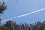
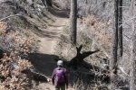
This day’s hike was most pleasant – a comfortable temperature (started with 3 layers, shed to 2 midway outbound), no wind, bright blue sky with some filmy clouds at times. Folks we met on the way up reported encountering snow near the top – we weren’t expecting to go that far so no problem for us. We did go far enough to find small patches of snow in heavily shaded spots, some on the trail, but none making the trail even muddy. We stopped for our mid-hike break at a wide, sandy area, perfect to brew some coffee, and enjoy a peanut butter and jelly sandwich, carrots, and a bit of tequila.
Statistics
Total Distance: 5.38 miles
Elevation: start 6,453 ft, maximum 7,730 ft, minimum 6,453 ft
Gross gain: 1,277 ft. Aggregate ascending 1,454 ft, descending 1,462 ft
Maximum slope: 26% ascending, 24% descending, 9.4% average
Duration: 5:02
| GPS Track Files for Download | |
161 Downloads |
|
|---|---|
113 Downloads |
|
I urge you to explore our hiking tracks with Google Earth. With the virtual 3-dimensional presentation, achieved by panning and tilting the view, you can get a much better idea of the hikes and terrain than you can get from the 2-dimensional screenshot above. For assistance: Using Google Earth Track Files.
References
USDA Forest Service: Pino Trail 140
Sandia Mountain Hiking Guide: Pino Trail
ASCHG: Pino Trail to Crest Trail Hike
ondafringe: Day Hike: Pino Trail~Sandia Mountains
AllTrails: Pino Trail


