‘Tis winter and there is still snow in the mountains, so we turned south for dry roads and hiking, plus March is a better time of year to visit places that are as open as the Quebradas Back Country Byway – it will be hot in the summer. Through research I identified a place of interest not far from the entrance to the Byway: Ojo de Amado and Bursum Springs, the Gonzales Mine, and an arch somewhere nearby.
The Drive In
Getting off of I-25 at Escondida, then through the village, over the the railroad tracks and Rio Grande, then left at the sign to the Quebradas Back Country Byway. We continued on this dirt/gravel road (“New Mexico pavement”, by our categorization a Class 3 road) for about 3 miles, then a turnoff to the right where we parked.
The Hike
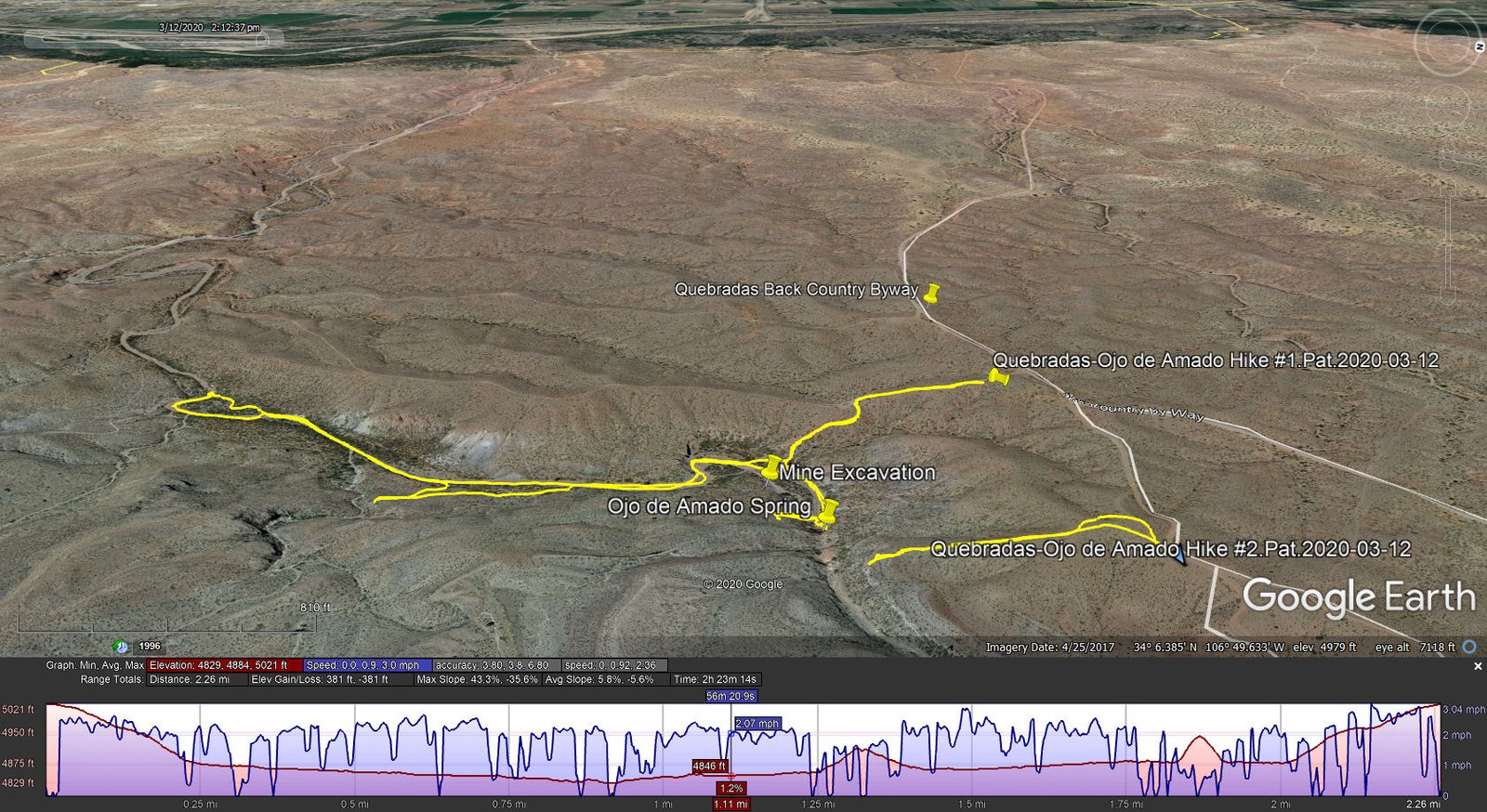
Quebradas-Ojo de Amado Hikes.Pat.2020-03-12
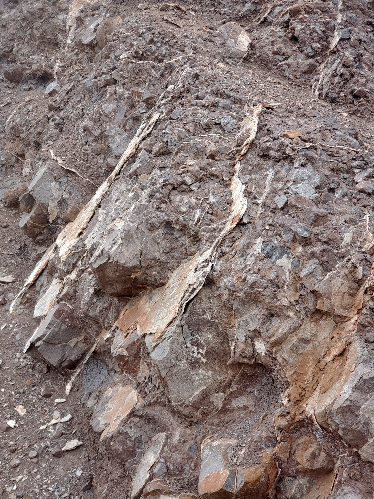
The face of the excavations of the Gonzales Mine,
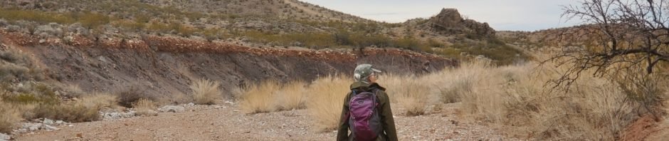
The hike commenced downhill into Cañon de los Piños on a two-track (for us, a Class 4 road). Reaching the bottom we identified the excavation in the south side of the cañon that we took to be the Gonzales Mine. The formation had quite interesting features, layers of some flaky material separating gray rock material. We could imagine students from the nearby New Mexico Institute of Mining & Technology making field trips to get acquainted with this geology. I had read that there was a rock arch nearby, so we walked down the cañon floor for a half mile or so. On the way back up the cañon we took a brief look into a side cañon – possibly it would be up there out of our sight.
Ojo de Amado.
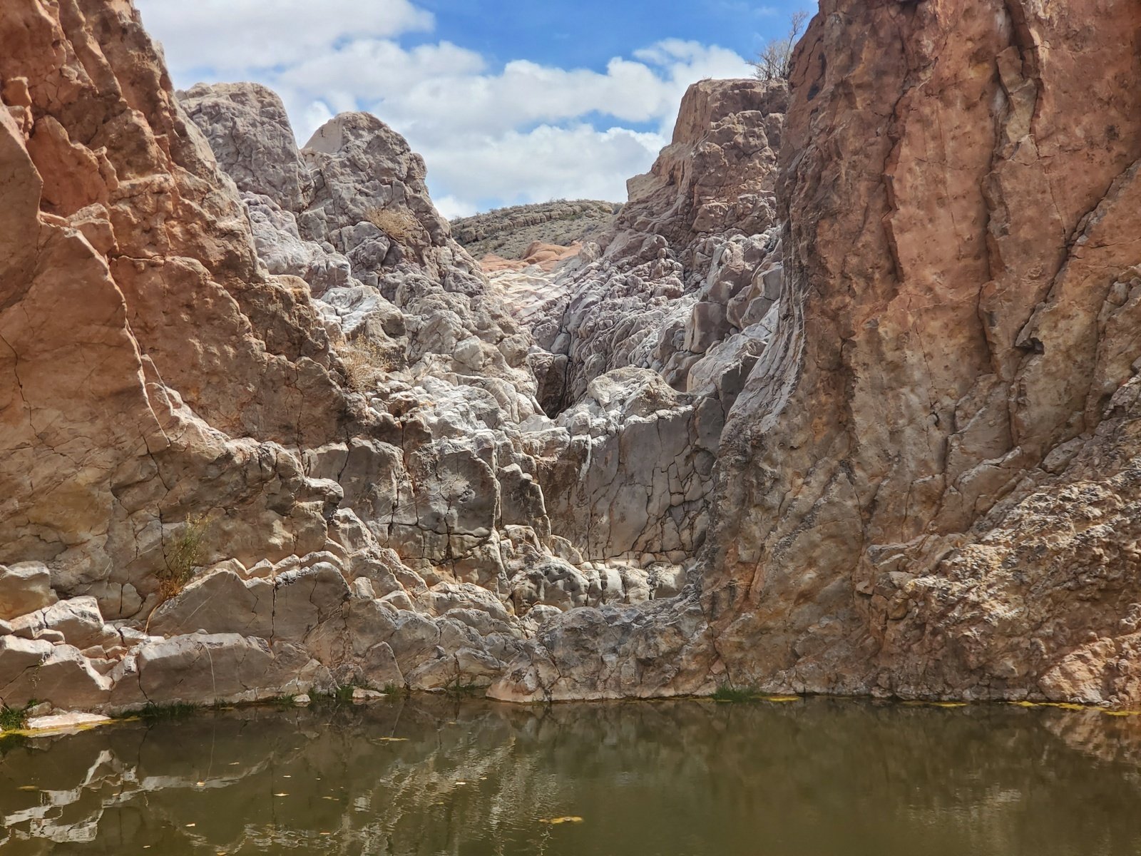
The next point of interest was a (dry) waterfall that we saw on our way down into the canyon – the Ojo de Amado and the Bursum Spring. The rock face for the waterfall was most interesting. Curious about what was above the waterfall, we searched for a means to get above it. We saw indications of a path up the west hillside, but chose not to pursue it further and returned to the truck.
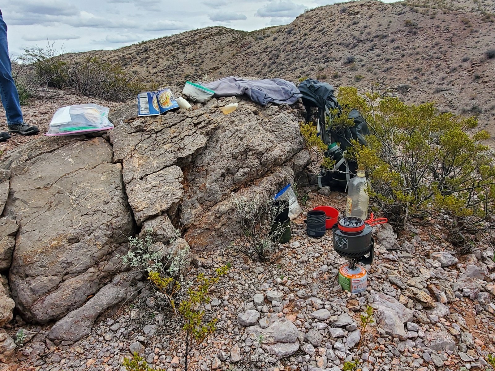
Our “kitchen” for coffee & chocolate, as well as carrots, apples, and PB&J sandwiches.
Still curious about what was above Ojo de Amado, back on the Byway we drove a bit further, parked along a small two-track, and walked to the edge where we could see down into the cañon. It satisfied our curiosity – there was another pond above Ojo de Amado, which we presume is Bursum Spring. With the great scenery across this backcountry, we set up the “kitchen” for our afternoon repast, then returned to the truck and home.
Statistics
Hike #1:
Total Distance: 2.26 miles
Elevation: start 4,875 ft, maximum 5,021 ft, minimum 4,829 ft Gross gain: 193 ft
Aggregate ups & downs: ascending 381 ft, descending 381 ft
Maximum slope: 43% ascending, 36% descending, 5.7% average
Duration: 2:23
Hike #2:
Total Distance: 0.5 miles
Elevation: start 5,082 ft, maximum 5,085 ft, minimum 4,954 ft Gross gain: 131
Aggregate ups & downs: ascending 173 ft, descending 174 ft
Maximum slope: 51% ascending, 39% descending, 13.2% average
Duration: 1:03
| GPS Track Files for Download | |
322 Downloads | |
|---|---|
267 Downloads | |
211 Downloads | |
184 Downloads | |
I urge you to explore our hiking tracks with Google Earth. With the virtual 3-dimensional presentation, achieved by panning and tilting the view, you can get a much better idea of the hikes and terrain than you can get from the 2-dimensional screenshot above. For assistance: Using Google Earth Track Files.
References and Resources
BLM: Quebradas Backcountry Byway
NM Bureau of Geology & Mineral Resources:
A Geologic Guide to the Qebradas Back Country Byway
Quebradas Guide 20120 (PDF)
New Mexico True: Quebradas Backcoutry Scenic Byway
Recreation.gov: Quebradas Backcountry Byway
Dog of the Desert: Gonzales Mine from the Quebradas Byway
Southern New Mexico Explorer: Arroyo del Tajo – Quebradas Backcountry Byway
Southwest Armchair Traveler: #Hiking #NewMexico – Bursum Springs, Quebradas
Geocaching: Singing Rock

. We hoped to find a rock arch; we didn't do so but may have identified the location (for another visit).")


