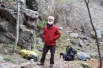
This was my first backpacking trip since high school – one overnight on the crest of the Manzano Mountains. And with Marlin who has backpacking experience – great help with logistics and confidence. (Updated later – in 2019.)
The Hike Up
We began at the Red Canyon Campground, going up the Spruce Spring Trail. The trail is well used, with dirt and some rock, and presents a steady climb with switchbacks to get from 8,000 ft to 9,200 ft elevation in 4.23 miles. The trail is generally in a ponderosa pine forest, with occasional openings providing views across the Salinas Valley to the east. Near the top the trail passes near the Spruce Spring which offers a source of water for those on a longer trek than ours.
The trail tops out where in intersects the Manzano Crest Trail, which runs the length of the Manzano Mountains. And here is a nice, large meadow, open space great for setting up a simple campsite for the night. As a nice touch there is also a built-up rock fireplace, great for making a small fire to stave off the cool temperatures of the evening. We enjoyed a very nice stew that Marlin had prepared and frozen in advance – what a treat – thanks, Marlin.
The Hike Down
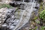
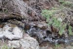
‘Twas a chilly morning, but after a warm breakfast and breaking camp, we set out southbound on the Manzano Crest Trail. We faced a bit of a climb up on the shoulder of Gallo Peak (topped out at 9,751 ft, Gallo is just over 10,000 ft) before descending to the intersection with the Red Canyon Trail. The trail was a bit difficult to find at first, but on track like Spruce Spring, it was easy going, a steady descent with a few switchbacks. About half way down we came upon running water, small waterfalls, and later a larger waterfall to add some interest to the hike. ‘Twas an easy descent back to the Campground.
Statistics
Up via Spruce Spring Trail
Total Distance: 4.29 miles
Elevation: start 8,042 ft, maximum 9,201 ft, minimum 8,008 ft
Gross gain: 1,159 ft Aggregate ascending 2,323 ft, descending 1,162 ft
Maximum slope: 49% ascending, 48% descending, 14% average
Duration: 3:03
Down via Manzano Crest and Red Canyon Trails
Total Distance: 3.87 miles
Elevation: start 9,342 ft, maximum 9,747 ft, minimum 7,931 ft
Gross gain: 1,411 ft Aggregate ascending 781 ft, descending 2,191 ft
Maximum slope: 43% ascending, 43% descending, 12% average
Duration: 3:05
| GPS Track Files for Download | |
294 Downloads |
|
|---|---|
100 Downloads |
|
I urge you to explore our hiking tracks with Google Earth. With the virtual 3-dimensional presentation, achieved by panning and tilting the view, you can get a much better idea of the hikes and terrain than you can get from the 2-dimensional screenshot above. For assistance: Using Google Earth Track Files.
References
USDA Forest Service: Manzano Mountain Trails (pdf map)
Spruce Spring Trail
ASCHG: Spruce Spring – Red Canyon Loop Hike
ondafringe: Day Hike: Spruce Spring/Cest/Red Can;yon Trails Loop~Manzano Mountains
ExploreNM: Red Canyon/Spruce Spring Loop
AllTrails: Best Trails in Manzano Mountains State Park
Spruce Spring Trail to Red Canyon Trail Loop
SummitPost: Manzano Mountains
Stav Is Lost: Hike Gallo Peak via Spruce Spring and Red Canyon Loop


