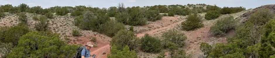
I met Jay in our original hiking grounds – Placitas and the northern foothills to the Sandia Mountains. We revisited an old friend, the Strip Mine Trail, one of the very first hikes that we did together back in 2012, -13, and -14, even before I started this BLOG, Hiking in New Mexico. But we haven’t hiked this trail since then.
The Drive In
We met at the Strip Mine Trailhead located just off of NM 165, 0.8 miles east of the Placitas Cafe (also Blades’ Bistro). The parking area is 300 yards off of the highway on a very rocky road.
The Hike
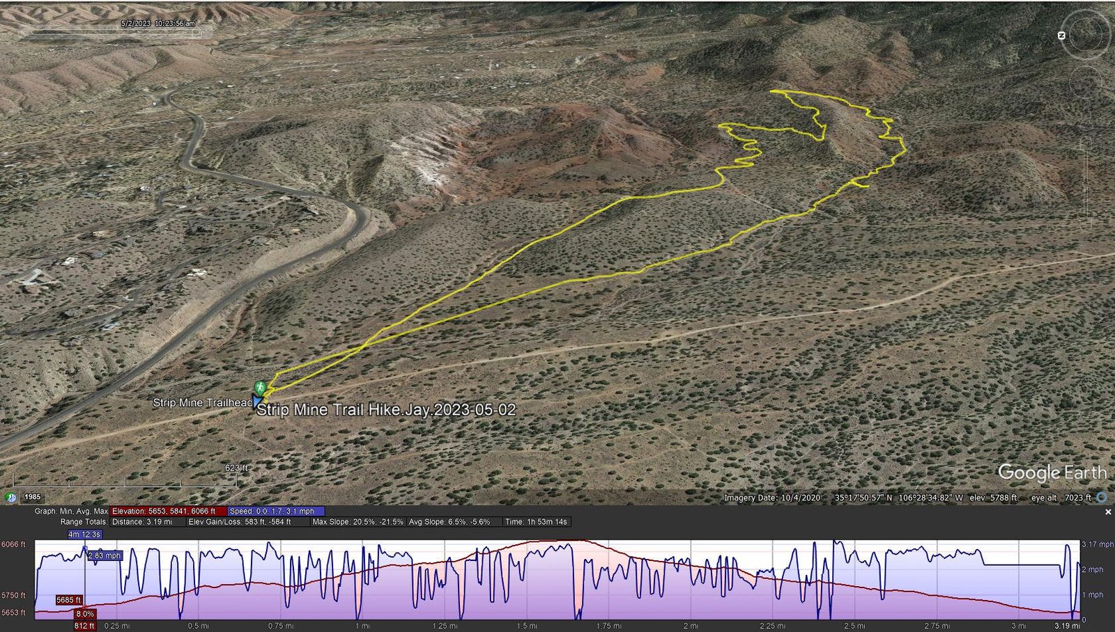
Strip Mine Trail Hike.Jay.2023-05-02
Notes about the Google Earth screenshot: the graph at the bottom shows elevation of the track (pink area) and speed (the blue line).
From the parking lot, we crossed the road to take up the trail that goes in a southeast direction. The terrain is in some stretches rocky, in other stretches sandy soil. These trails are used extensively by mountain bikers, well worn and easy to follow.There are many trails in the area (see Trailforks link below), and as on the Dale Ball Trails hikes, Jay is my guide.
For our hike, we started with an incline for 3/4th of a mile, dips down through an arroyo, the climbs again up some switchbacks onto a ridge to the high point for our hike. From there it’s a general descent along another arroyo, then out onto open terrain back to the parking area.
Statistics
Total Distance: 3.19 miles
Elevation: start 5,660 ft, maximum 6,066 ft, minimum 5,653 ft
Gross gain: 406 ft. Aggregate ascending 583 ft, descending 584 ft
Maximum slope: 21% ascending, 22% descending, 6.3% average
Duration: 1:53
| GPS Track Files for Download | |
203 Downloads | |
|---|---|
172 Downloads | |
If you haven’t explored these hiking tracks with Google Earth, I urge you to try it. With the virtual 3-dimensional presentation, achieved by panning and tilting the view, you can get a much better idea of the hikes and terrain than you can get from the screenshot above. For some ideas, check out Using Google Earth Track Files.
Related Posts
Strip Mine Hike – 01/19/2014
Strip Mine Hike – 12/02/2012
Hikes in the Placitas area
Facebook: Placitas Area Trail Association
AllTrails: Stripmine and Chalkdust Trails Loop
ondafdringe: Day Hike: Strip Mine Trail …
GaiaGPS: Strip Mine Trailhead via FR 445
Hiking Project: Placitas Stripmine Loop
TrailForks: Placitas Mountain Biking Trails