Introduction
‘Twas to be a hot day at 5000 feet elevation in Albuquerque. So we went “to the mountain”, high up on the east side of the Sandia Mountains. The Survey Trail, used in the winter for cross country skiing, makes for a very nice hike in the summer. It starts at 10,275 feet elevation where it is cool (58 degrees when we started) and stays close to that elevation throughout.
The Hike
The trail begins at the Ellis Trail parking area; just south of the upper parking area a trail heads west and joins with Survey. Survey then proceeds northwest for a quarter of a mile where it crosses the Crest Highway (Route 536) . It then heads north; the condition indicates moderate use-not trampled yet easy to follow. The 10k Trail crosses Survey at about 2.5 miles.
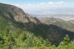
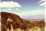
We continued on to the end of the Survey, then turned left onto the Osha Loop Trail, then left onto the Sandia Crest Trail, where we had the only scenic views on this hike – a vista from the north slopes of Sandia Peak clockwise, north to the Rio Grande valley and Jemez Mountains. We continued southward to the intersection with the 10K Trail, then the Survey to return to our car.
Highlight
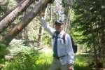
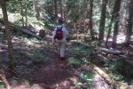
The trail goes through forest for its whole length, so we were nearly always in shade. It is well maintained – many trees have fallen across the trail over the years, but even those fallen recently had been cut and the trail cleared. The trail surface is the softest and quietest we’ve seen – instead of gravel and rocks that we find on many other trails, Survey is covered with years of organic matter fallen from the trees.
Statistics
Total Distance: 6.14 miles
Elevation: 10,274 start, 10,439 maximum, 9,838 minimum
Gross gain: 436. Aggregate ascending 1,420 ft, descending 1,420 ft
Maximum slope: 47% ascending, 36% descending, 7.8% average
Duration: 3:40
| GPS Track Files for Download | |
149 Downloads |
|
|---|---|
219 Downloads |
|
If you haven’t explored these hiking tracks with Google Earth, I urge you to try it. With the virtual 3-dimensional presentation, achieved by panning and tilting the view, you can get a much better idea of the hikes and terrain than you can get from the screenshot above. For some ideas, check out Using Google Earth Track Files.


