Vince set us on this site for a hike, expecting to see petroglyphs, an arch, and maybe ruins. He had been stymied on past trips by the road – it crosses the Rio Puerco and tributaries 2 or 3 times. Crossings are made in a steep descent from the surrounding terrain into the river bed itself – the road must be completely dry or one -will- get stuck. For this trip, the crossings were uneventful.
The Drive In
The road in, NM 279, goes west from US 550 at milepost 41. Paved initially, it turns to dirt and does some winding and intersections on which one might go astray (See Guadalupe Ruin & Tapia Canyon for more specific directions and great interactive map).
The drive itself is quite interesting, scenic with the many volcano chimneys in view, you will pass through or near (nearly abandoned) settlements, and you will drive by Guadalupe Mesa on top of which are Pueblo ruins, identified as the easternmost outlier from Chaco Canyon. About a half mile past the Guadalupe Ruins, turn west on a two-track; park at the end of the two-track just short of a fence, about a half mile from the road.
The Hike
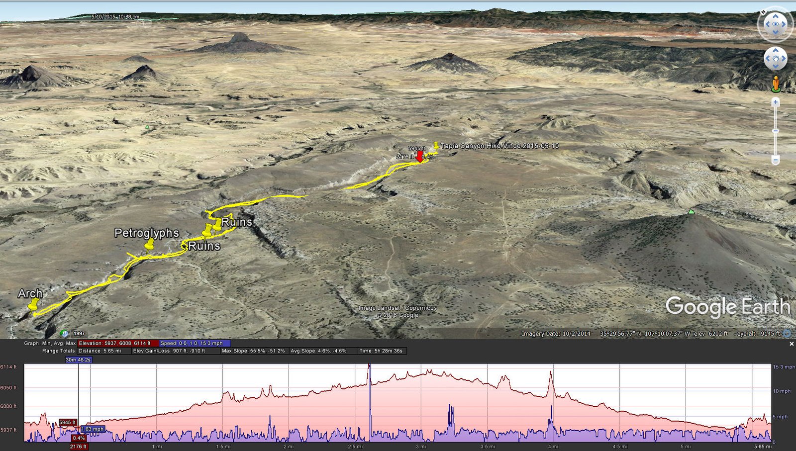
Tapia Canyon Hike.Vince.2015-05-10
To begin the hike, look for a break in the embankment to descend into the stream bed; we backtracked maybe 100 yards and found an easy path down. The hike itself follows the bottom of Tapia Canyon, mostly a sandy surface but with sections of rockiness and of grass clumps and small trees. The canyon ranges from 75 to 120 yards in width, the walls over 100 ft high throughout. On the lookout for petroglyphs, we discovered our first set on the left canyon wall, under a bit of an overhang. We were impressed with the span of images, although they did not stand out from the background.
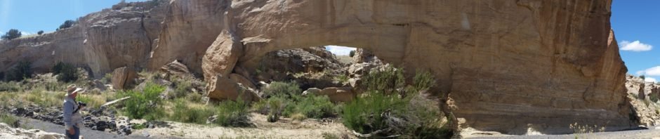
Continuing up the canyon, on the alert for more petroglyphs (courtesy ondafringe), .. we found them on a 30′ tall mound against the right hand wall of the canyon. And this is an amazing collection of very prominent petroglyphs as you will see in the photos below. A bit further up the canyon we came to the arch, and a large one it is.
The day was a bit warm, and the hiking surface challenging, so this became our turn-back point. After our mid-hike coffee and snacks, we headed back down the canyon. Although we had planned to ascend out of the canyon to visit the Tower Ruins, our stamina was running out so we returned to the car and home. I should note that the Canyon and Ruins are closed to visitors four times a year for Native American Traditional Activities each year.
Statistics
Total Distance: 5.65 miles
Elevation: start 5,957 ft, maximum 6,114 ft, minimum 5,937 ft
Gross gain: 177 ft. Aggregate ascending 907 ft, descending: 910 ft
Maximum slope: 56% ascending, 51% descending, 5% average
Duration: 5:28
| GPS Track Files for Download | |
414 Downloads | |
|---|---|
452 Downloads | |
331 Downloads | |
560 Downloads | |
If you haven’t explored these hiking tracks with Google Earth, I urge you to try it. With the virtual 3-dimensional presentation, achieved by panning and tilting the view, you can get a much better idea of the hikes and terrain than you can get from the screenshot above. For some ideas, check out Using Google Earth Track Files.
References and Resources:
ondafringe: Day Hike: Tapia Canyon and Tower Ruin
CargoVANConversions: Guadalupe Ruin & Tapia Canyon
Doug Scott Art: Canon Tapia
Dog of the Desert (great video): Petroglyphs of Tapia Canyon, New Mexico – YouTube


