Today we headed to the Volcanoes for a other “Urban” hike, places close to the city offering quite easy hiking conditions. From our upstairs window we look out at the Volcanoes each morning so they constantly beckon us.
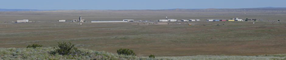
The Drive In
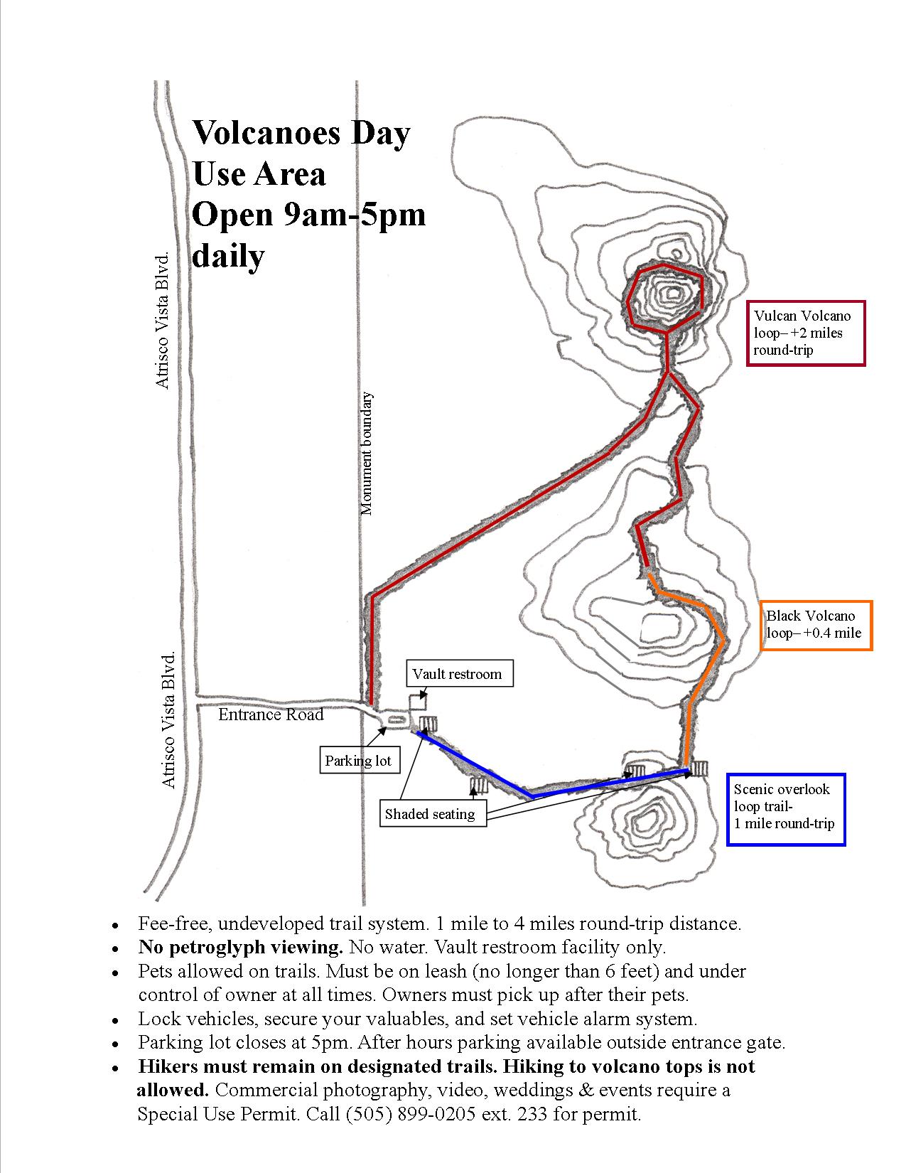
The Volcanoes is part of the Petroglyph National Monument, having evolved from a ranch 50+ years ago, then becoming part of Albuquerque’s Open Spaces in the ’70s and becoming part of the Monument in the ’90s. There is ample parking at the trailhead (open from 9:00 to 5:00 daily; at other times park at the entrance gate).
The Hike
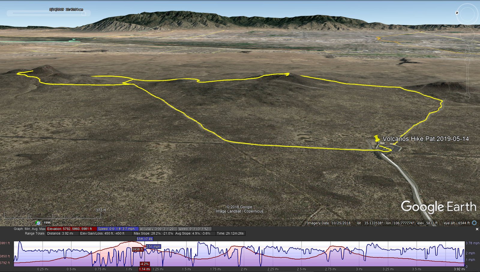
Volcanoes Hike.Pat.2019-05-14
The trails range from groomed gravel or sand, some sections of hard clay, and rocky stretches as one ascends onto the slopes of the cones. As you can see from the photos, there are no trees or even shrubs; hike early or late, or plan on a day of full sun. Check the references below for trail maps and descriptions, especially the geologic history. We made two trips around Vulcan to extend our hike, having set out to do 4 miles.
Highlights
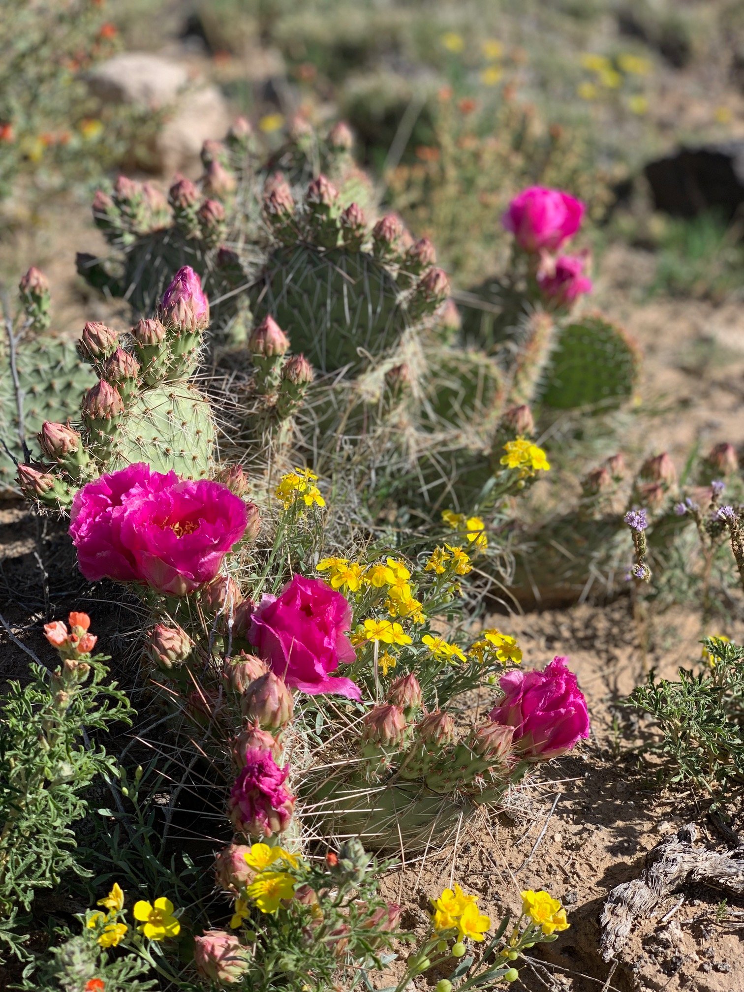
The Volcanos were a veritable flower garden – so many flowers, so many different plants.
We’ve enjoyed a lot of precipitation this winter and spring, and the flowering plants are showing the results. I lost count of the number of flowering plants that we saw, but it’s somewhere above a dozen. In many places there would be a field of 10 or 20 yards, nearly covered with yellow. In other instances we found 3, 4, even 5 different flowers mixed in together – one of Mother Nature’s bouquets. Even the grasses presented pretty pictures, glimmering in the morning sun as they waved in light breeze.
Then there are the views away from the volcanoes. The air was hazy on this day, a product of unusual high humidity I think (as noted this has been a year with lots of moisture – snow during the winter and rain this spring). Consequently details of the mountains weren’t discernible (Sandias to the east, Jemez to the north, Mount Taylor to the west, and Ladrone to the south) and the view of the City was hazy as well. Nonetheless, to be able to see such great distances in all directions is a treat.
One more feature: from the top of Vulcan one has a clean view of the Double Eagle II airport. We watched (and heard) planes in the traffic pattern, practicing landings (touch and go’s). And on this day one of the pilots is someone we are acquainted with, maybe making her first solo flight.
Statistics
Total Distance: 3.92 miles
Elevation: start 5,793 ft, maximum 5,981 ft, minimum 5,792 ft
Gross gain: 189 ft. Aggregate ascending 450 ft, descending 450 ft
Maximum slope: 28% ascending, 21% descending, 4.9% average
Duration: 2:12
| GPS Track Files for Download | |
212 Downloads | |
|---|---|
483 Downloads | |
I urge you to explore our hiking tracks with Google Earth. With the virtual 3-dimensional presentation, achieved by panning and tilting the view, you can get a much better idea of the hikes and terrain than you can get from the 2-dimensional screenshot above. For assistance: Using Google Earth Track Files.
References
National Park Service:
Petroglyph National Monument – The Volcanoes
Volcanoes Day Use Area
Map of the Trails (PDF)
A Landscape of Symbols
NM Museum of Natural History & Science: Albuquerque Volcanoes
AllTrails: The Volcanoes Trail
ASCHG: Los Volcanos Hike
ProTrails: Albuquerque Volcanoes – The Three Sisters – 2.0 miles
Wikipedia: Albuquerque volcanic field
Living Nomad Style: Petroglyphs National Monument Volcanoes Trail


