Having explored most of the canyons of of FR 144 and the lower portion of NM 126 above the Fish Hatchery, we set out to explore hiking off of FR 376. A couple of opportunities came to light by casting about via Google Earth and the topographic maps.
The Drive In
We chose to enter FR 376 from it’s north end, some 3 miles up NM 126 from La Cueva, and check out Trail Canyon, some 6 miles on FR 376 from NM 4.
The Hike
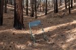
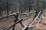
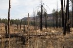
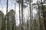
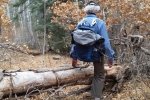
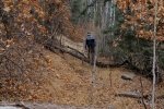
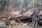
Our hike began where the Rio Cebolla crosses FR 376; Fenton Lake is upstream on the Rio Cebolla initially following a two-track. After crossing a fenced area (along the edge of private land), we found ourselves in an area of heavy downfall, the result of a fire sometime since 2014; the going was difficult, climbing over down tree trunks etc. Our track angled off to the left (from Rio Cebolla) to head up Trail Canyon. Here we were passing through generally forested territory (no trail, only occasional game trails) with some downfall.
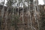
The change in elevation was gradual; rock cliffs were interspersed with steep slopes to the canyon walls. As we neared the head of the canyon, it became narrower and the downfall more prevalent. We had set our sights on topping out at the canyon’s head, but having gone as far as we wished, we stopped for our mid-hike break at 3.5 miles. We hoped to find an alternative route to return to the truck, but each option we looked at seemed to involve a very steep descent back into the canyon or a large increase in distance. Thus, we returned on the outbound track, except for scirting the downfall in the burn area.
An added attraction to choosing to hike along FR 376, one can return to Albuqerque by proceeding south down the Guadalupe Canyon and the Rio Cebolla, a nice valley with a burbling stream that flows year round. At the placename Porter, the Rio Cebolla is joined by the Rio de las Vacas, becoming the Rio Guadalupe. FR 376 also leads to the Gilman Tunnels which are themselves interesting, but the canyon (also referred as the Guadalupe Box) is a surprise and it is stunning. (The road, FR 376, becomes NM 485 south of the Tunnels.)
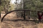
Jay here: This hike was remarkable for both its length and distance. While the ascent was not particularly difficult, large portions of the canyon were filled with the kind of underbrush that gives you constant whiplash. The downed tree trunks section was also daunting. Getting to the head of the canyon surprised me as I truly thought we were going to be unable to reach that endpoint when I saw how the canyon narrowed more and more. A challenging hike for sure.
Statistics
Total Distance: 6.92 miles
Elevation: start 7,489 ft, maximum 8,365 ft, minimum 7,489 ft
Gross gain: 876 ft. Aggregate ascending 1,393 ft, descending 1,389 ft
Maximum slope: 33% ascending, 32% descending, 6.6% average
Duration: 4:45
| GPS Track Files for Download | |
132 Downloads |
|
|---|---|
226 Downloads |
|
176 Downloads |
|
120 Downloads |
|
149 Downloads |
|
260 Downloads |
|
I urge you to explore our hiking tracks with Google Earth. With the virtual 3-dimensional presentation, achieved by panning and tilting the view, you can get a much better idea of the hikes and terrain than you can get from the 2-dimensional screenshot above. For assistance: Using Google Earth Track Files.
References
WikipediA: New Mexico State Road 485
Only in Your State:
Most People Have No Idea These Unique Tunnels in New Mexico Exist
dangerousroads: Gilman Tunnels


