Our first day of our 5-day camping and hiking trip to Pagosa Springs. We had reserved 6 nights in the East Fork Campground maintained by the Forest Service. Site #4 was a nice back-in site for the R-Pod – level spot, picnic table and fire pit, an area providing full sunlight for a good part of the day for the solar panels to keep the R-Pods batteries charged, pit toilets, and water was available – a hand-pump at the far end of the campground (near site #26). Tho’ the campground is a loop and we were near the entrance, it was still a quiet site.
The Hike
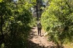
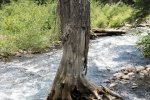
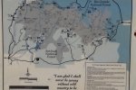
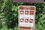
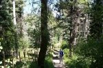
With advice from a ranger at the Visitor’s Center in Pagosa Springs and a map he provided, we chose the Turkey Creek hike for starters. The trail head was not far from the campground and from the description would be a good introduction to hiking at this higher elevation. Initially the well-marked trail proceeded downhill, until we crossed Turkey Creek. The trail then ran parallel to the creek which was visible at times in the steep canyon to the right.
About 2.4 miles into the hike the canyon floor opened up presenting a large open, flat area obviously used frequently for camping. We had our mid-hike break at the far edge of a large open area, finding some shade (the sun made it feel hot) and breeze (to get away from the flys and mosquitoes). Tho’ a review of GoogleEarth suggests this would be a great trail for a longer hike and other attractions nearby, we headed back taking a side-trip to get closer to Turkey Creek and explore the camping area.
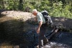
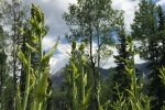
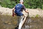
Jay here: This was our first hike in the Pogosa Springs area so we chose something at lower elevation (for us…we typically are hiking in the 7200′ to 8800′ elevation range). It was a good choice and had some pleasant streams to cross uneventfully. We kept running into to a plant that we thought looked like mutant corn stalks, and not surprisingly we looked it up to learn that it was called corn lily and that farmers find it to be an invasive nuisance. We followed the rushing waters of Turkey Creek for part of the hike and enjoyed the sound of the clear rushing waters,
Statistics
Total Distance: 6.00 miles
Elevation: start 8,301 ft, maximum 8,656 ft, minimum 8,144 ft
Gross gain: 500 ft. Aggregate ascending 1,126 ft, descending 1,126 ft
Maximum slope: 33% ascending, 28% descending, 6% average
Duration: 3:56
| GPS Track Files for Download | |
246 Downloads |
|
|---|---|
100 Downloads |
|
I urge you to explore our hiking tracks with Google Earth. With the virtual 3-dimensional presentation, achieved by panning and tilting the view, you can get a much better idea of the hikes and terrain than you can get from the 2-dimensional screenshot above. For assistance: Using Google Earth Track Files.
References
The Adventure Guide-Pagosa.com:
Hiking Trails in the San Juan National Forest – Pagosa Springs Area
Pagosa.com: A Walk in the Woods: Hiking Trails in Pagosa Springs
Outdoor Recreation Information Center – Colorado:
Pagosa Springs Region Day Hiking Trails Index


