Our 2nd day camping in our R-Pod in Jemez Falls Campground. Having been curious about the trail to the top of South Mountain in Valles Caldera, we set out to hike from the Cabin District down to the starting point for the climb up South Mountain.
The Drive In
We start this hike at the south end of the Cabin District. From NM 4, go north to the Visitor’s Center where we pick up our pass that is required to go further into the Caldera. Drop the cable barring further entry, and drive west to where the road turns north; turn left and park about 100 yards where a barrier prevents vehicle traffic from going further.
The Hike
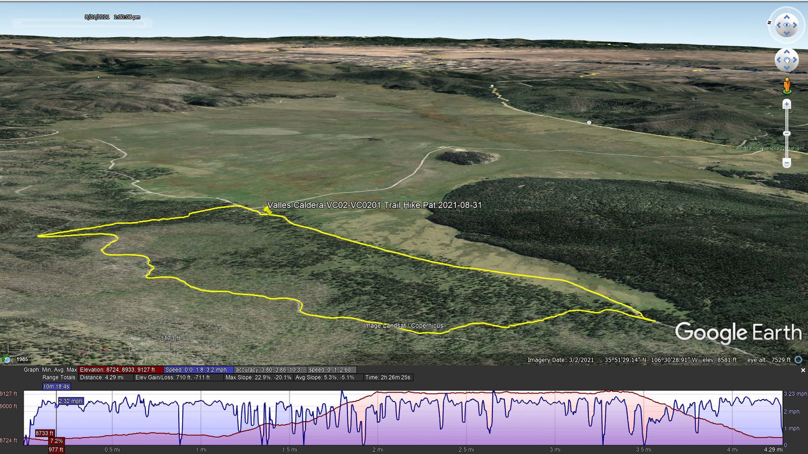
Valles Caldera-VC02-VC0201 Trail Hike.Pat.2021-08-31
The track going southwest from parking is a well used two-track – easy going – no elevation gain for the first mile, then slight for another .2 miles. The track is along the southwest slope of South Mountain; using GPS tracks for hikes up the mountain, we found the trailhead – ready for a hike in the future.
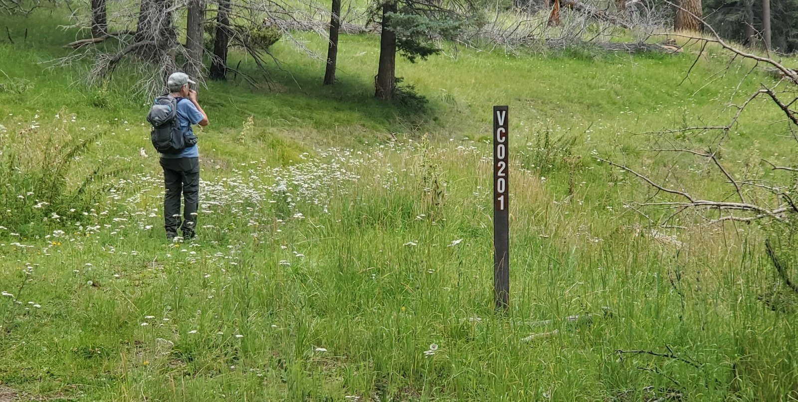 We also noticed a sign “inviting” us to head back to parking via VC0201 – why not? We had done this on a previous hike (VC02 South Mountain Hike – 05/27/2019), so – let’s do it.
 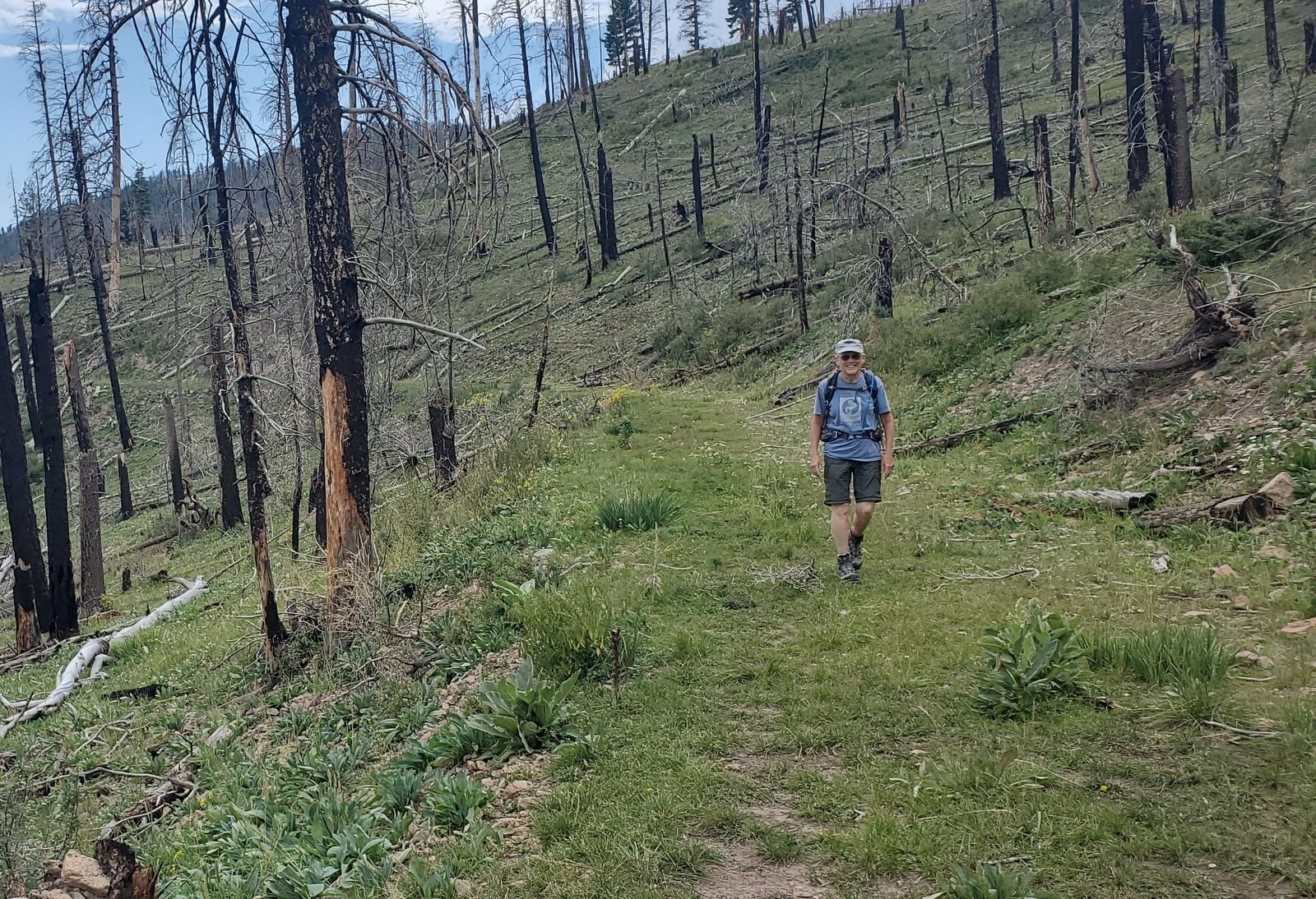 Due to recent monsoon rains, the grasses and flowers were in thick and “full green”, so pleasant compared to other times of year. VC0201 is an old two track, ascending up some 400 feet, then running parallel to the topo lines. It passes through sections of healthy forest, other sections of forest that were burned back in 1987.
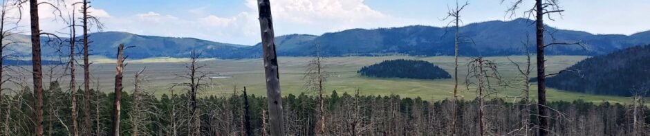
 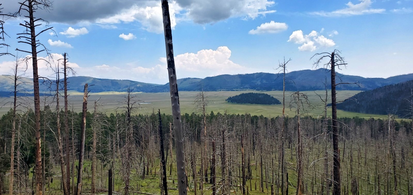 The elevation and the openness (except for the burned trunks still standing) afforded a great view across Valles Caldera.
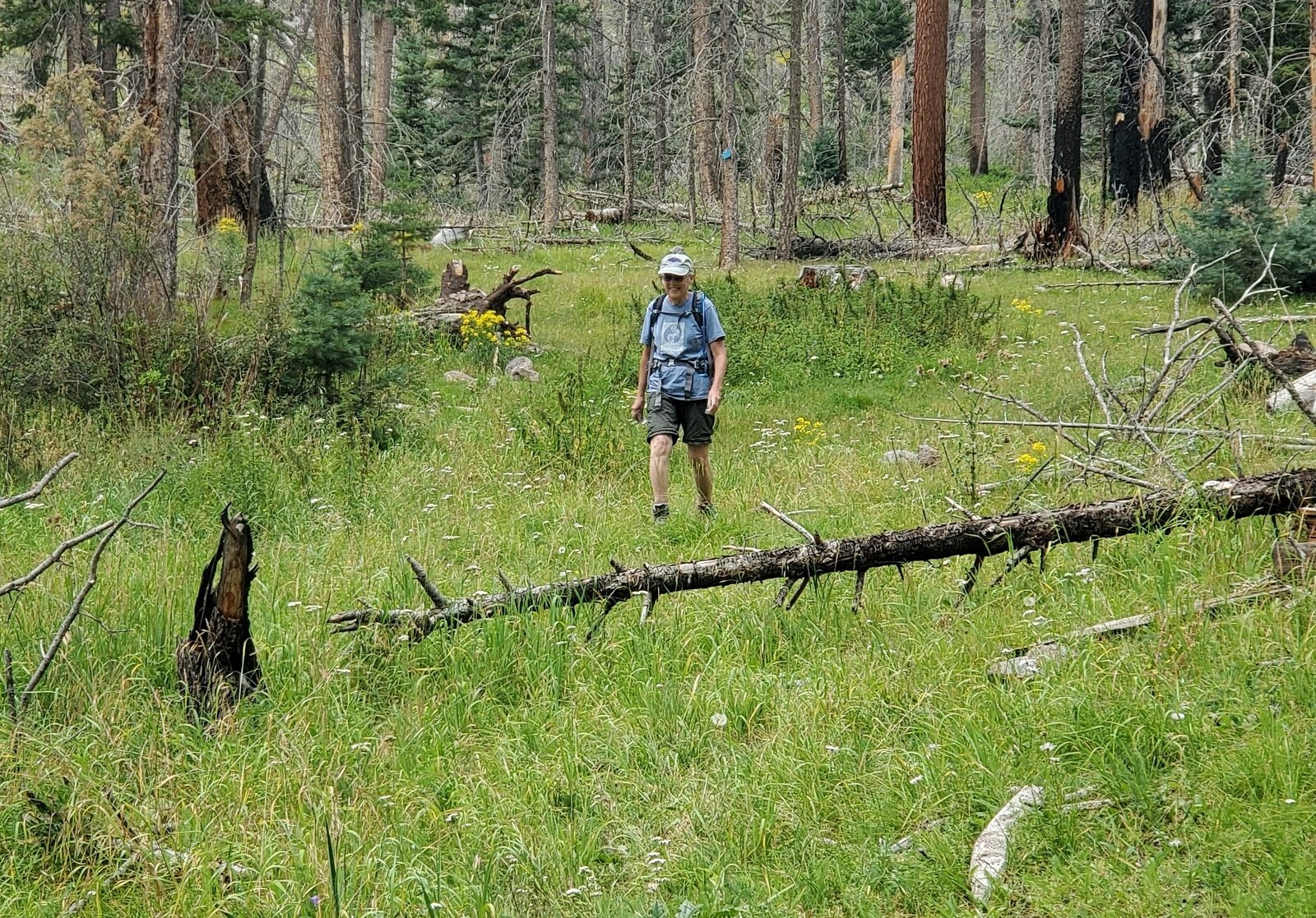 The tracks published by other showed a descent back to the Cabin District some 2.0 miles from the start of VC0201, running downslope parallel to La Jara creek. Reaching the creek, we didn’t see a trail in evidence, but did see blue blazes on many tree trunks. So we figured – that must be the track. With no trail, we were bushwhacking, although it was easy going since the forest was quite open – the only impediments were the many downed tree trunks.
Post hike note: we set out on VC0201 with the idea we would retrace our earlier hike. Later, checking the GPS track for that hike, I found that we had turned off of VC0201 within .25 miles of it’s starting point. We had followed what appeared to be an old two-track that had made for a shorter hike, 3.06 miles. VC0201 proved to be a quite a bit longer, more than we anticipated, but we were pleased to have done the 4.29 miles.
Statistics
Total Distance: 4.29 miles
Elevation: start 8,747 ft, maximum 9,127 ft, minimum 8,724 ft
Gross gain: 403 ft. Aggregate ascending 710 ft, descending 701 ft
Maximum slope: 23% ascending, 20% descending, 5.2% average
Duration: 2:26
| GPS Track Files for Download | |
167 Downloads | |
|---|---|
290 Downloads | |
If you haven’t explored these hiking tracks with Google Earth, I urge you to try it. With the virtual 3-dimensional presentation, achieved by panning and tilting the view, you can get a much better idea of the hikes and terrain than you can get from the screenshot above. For some ideas, check out Using Google Earth Track Files.
Related Posts
VC02 South Mountain Hike – 05/27/2019
References and Resources
NPS Valles Caldera: Moderate Hikes
AllTrails: South Mountain Trail (VC 02)
Los Alamos Woods Wanderer: New South Mountain Hike


