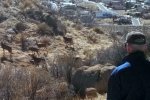
This trail is not well documented, although it is used extensively as the latter part of loop hikes, such as up Embudo Canyon or other hikes that go to the top of the Sandias.
The Hike
For us, it was basically and out-and-back hike, -up- Whitewash, then back down a slightly less strenuous down a shallow ravine. The -up- part of this hike was for us quite taxing – a quite steep slope on rough, rocky ground. Looking back on it – check that one off of our list.
Statistics
Total Distance: 3.23 miles
Elevation: start 5,987 ft, maximum 7,223 ft, minimum 5,987 ft
Gross gain: 1,236 ft. Aggregate ascending 1,405 ft, descending 1,403 ft
Maximum slope: 39% ascending, 45% descending, 15.6% average
Duration: 3:04
| GPS Track Files for Download | |
138 Downloads |
|
|---|---|
305 Downloads |
|
I urge you to explore our hiking tracks with Google Earth. With the virtual 3-dimensional presentation, achieved by panning and tilting the view, you can get a much better idea of the hikes and terrain than you can get from the 2-dimensional screenshot above. For assistance: Using Google Earth Track Files.
References
Hiking Project: Whitewash Trail
ondafringe: Day Hike: Whitewash/Oso Pass/3 Gun Spring/Off-Trail …


