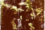
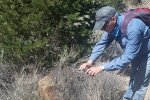
 This hike is an old standby for Jay and me, having made this loop a few times in the past.
The Hike
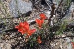
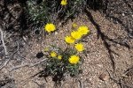
The weather was perfect – sunny, cool, no wind ’til late in the hike. There was a nice flow of water along the bottom of the canyon, such nice sounds to accompany our hike. Spring is in the offing – cottonwoods are leafed out, grass along the bottom of the canyon is vibrant, and flowers are a’bloom. The GoogleEarth screenshot above, a view to the south, gives you an idea of the location of these trails – on the north end of the Sandia Mountains. The Northeast Heights of Albuquerque are in view over the top of Rincon Ridge. And the green ‘meander’ beyond Albuquerque is the Rio Grande River. Beyond the Sandias, the horizon in the center of the view, are the Manzano Mountains. Our track, the yellow line, was a counter-clockwise loop: up the Del Agua trail then down the north end of the Piedra Lisa trail.
A bit of explanation about the bar across the bottom of the screenshot above. The red line (and pink area) depicts the elevation of our track, left to right/start to finish. The jagged blue line depicts our speed in miles per hour. (As you can see we kept up a steady and rapid pace during the last quarter of the hike – keeping up with Jay gave me a strenuous workout.)
Statistics
Total Distance: 4.3 miles
Elevation: start 5,949 ft, maximum 7,035 ft, minimum 5,949 ft
Gross gain: 1,086 ft. Aggregate ascending 1,509 ft, descending 1,509ft
Maximum slope: 51% ascending, 43% descending, 11.7% average
Duration: 2:53
| GPS Track Files for Download | |
121 Downloads | |
|---|---|
83 Downloads | |


