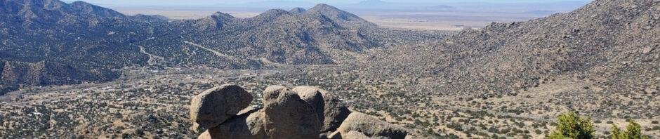
The trails in Tijeras Canyon, like Hawk Watch, are favorites – close to home, just challenging enough to keep our physical condition, and nice scenery too. Because it is so close to the city (but not -in- the city), I’m placing this and others in Tijeras Canyon in the Category ‘Suburban’ hikes.
Today, as I will sometimes do, I did this hike solo. On other occasions, Pat & I will take a morning and do a -suburban- hike to stretch our legs (and whole body) as is the case for the 2nd hike in this BLOG post. Thru these we get more exercise than we get for our -urban’ hikes, like our walks in the Bosque.
The Drive In
The reach the trailhead, go east on NM 333 from Tramway Blvd for about 3.25 miles, then turn left onto Monticello Drive. Proceed uphill .5 miles, turn left onto Alegre Dr (there has been a sign pointing to the trailhead), then take the 2nd street to the right (another sign) onto Tres Pistolas Trail; continue to the parking lot for the Tres Pistolas Trailhead. Hike up the Tres Postolas Trail (also labeled Three Gun Springs Trail, No. 194) for about .5 miles; a few feet beyond the gate into the Sandia Mountain Wilderness, turn right and downhill onto the Hawk Watch Trail (No. 215). Enjoy this downhill stretch – from here Hawk Watch goes -uphill-.
The Hikes
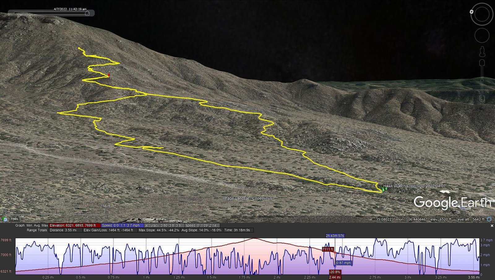
Hawk Watch Loop.Solo.2022-04-07
Notes about the Google Earth screenshot: the graph at the bottom shows elevation of the track (pink area) and speed (the blue line).
The 1st hike, solo: I went out to hike Hawk Watch, but at the trailhead chose to explore other routes. Rather than proceeding up the main trail, from the parking area I angled off to the right (east) on what appeared to be a trail. I soon found myself in a wash, following tracks that gave me the idea it was a trail. And so it was; about 1/3 mile on, I turned onto a trail to the right anticipating that it would ultimately take me up to the Hawk Trail. So it did; the trail proceeded up hill (200′ in half a mile) and intersected with Hawk Watch. I continued from there 1.3 miles until the slope of the trail became very steep (and slippery on a sand/gravel surface) where I became uncomfortable and decided I had come far enough.
On the way down, I began looking for an alternate trail on which I might return to parking. From a higher vantage point, I had seen trails on ridges south of Hawk Watch that held promise for such an alternate route. Returning 8/10th of a mile I came across a trail to the left, so I took it. Along the way I maintained my bearings, choosing trails at a couple of intersections that seemed promising, and they did lead me right back to the Tacoma.
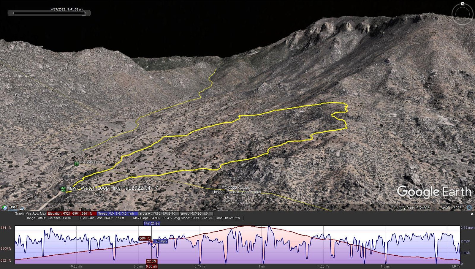
Hawk Watch Loop Hike.Pat.2022-04-17
Notes about the Google Earth screenshot: the graph at the bottom shows elevation of the track (pink area) and speed (the blue line).
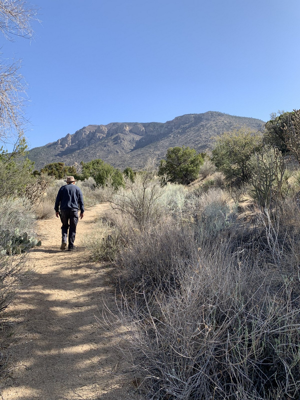 The 2nd hike, with Pat: This hike was appealing to us for one of our daily “walks”, or hikes. It offers a nice distance (that is, time spent on the hike) and some elevation gain which we need in preparation for hikes later this year, like Mount Taylor in May. So, it served our purposes nicely, and as a bonus provides great views of the Three Gun Springs canyon, the side of South Sandia Mountain, and even out across the plains to the southwest. A great “suburban” hike.
Statistics
The 1st Hike (solo):
Total Distance: 3.55 miles
Elevation: start 6,321 ft, maximum 7,699 ft, minimum 6,321 ft
Gross gain: 1,378 ft. Aggregate ascending 1,464 ft, descending 1,464 ft
Maximum slope: 45% ascending, 44% descending, 14% average
Duration: 3:18
The 2nd Hike (w/ Pat):
Total Distance: 1.8 miles
Elevation: start 6,321 ft, maximum 6,844 ft, minimum 6,321 ft
Gross gain: 514 ft. Aggregate ascending 560 ft, descending 571 ft
Maximum slope: 35% ascending, 32% descending, 11% average
Duration: 1:07
| GPS Track Files for Download | |
178 Downloads | |
|---|---|
369 Downloads | |
265 Downloads | |
259 Downloads | |
If you haven’t explored these hiking tracks with Google Earth, I urge you to try it. With the virtual 3-dimensional presentation, achieved by panning and tilting the view, you can get a much better idea of the hikes and terrain than you can get from the screenshot above. For some ideas, check out Using Google Earth Track Files.
Related Posts
Hawk Watch Trail Hike – 10/27/2019
Hawk Watch Hike – 03/16/2014
Hawk Watch Hike – 04/27/2013
Hawk Watch Hike – 02/15/2011
All Tijeras Canyon and Vicinity Hikes
References and Resources
HawkWatch International: Manzano Mountains, NM
ASCHG: Hawk Watch Hike
SummitPost: Hawk Watch Trail
City of Albuquerque: Foothills Trail Map – Copper (.pdf)
And check other Related Posts


